My 1983 Appalachian Trail Hike in Photos
I wrote a ton in words in my journal as I hiked the Appalachian Trail. I also shot a ton of Kodachrome slides in that pre-digital age. I've scanned all my old AT slides and posted them with short text blurbs connecting them to their parts of the story. I'd never tried to connect all these slides with all these words before. It helped me remember details of that long-ago hike in new ways. These pages are a chronological visual journal of the hike. Probably one of the oldest thru-hikes on the Internet to get one.
More pics from my 1983 Appalachian Trail hike. Table of Contents is here.
Little Hump Mountain, NC / TN - Whitetop Laurel Creek Gorge, VA

Still in Chapter 6 of my Appalachian Trail book, and still June 2, 1983. Still in the Roan Highlands along the North Carolina-Tennessee border.
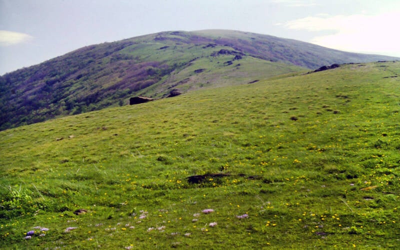
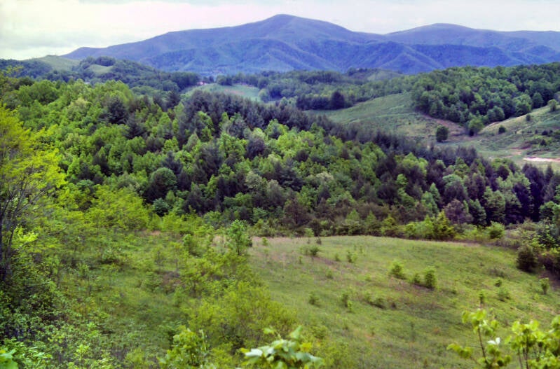
After rolling along the ridge crest over Round Bald and Jane Bald, both of which topped out at just over 5800 feet, the Appalachian Trail maintained those lofty heights as it crossed a spur ridge of Grassy Ridge Bald north of the actual summit.
The AT descended a few hundred feet. I had come to the end of Roan Mountain, but the Roan Highlands were far from finished.
There were plenty of views along the way. On both days of my Roan Highlands traverse, I spent more time enjoying the immense panoramas and taking pictures than I spent hiking seriously. I just could not rush through a place like this.
My weather experience for Beauty Spot and the Roan Highlands more than made up for the slightly disappointing day on Big Bald.


And not far down the road in southwestern Virginia I saw some amazing blooming rhododendron displays at somewhat lower elevations than the Roan Highlands. Which is a story for Chapter 7, and we're still in Chapter 6 of my book here.
Still June 2, 1983.
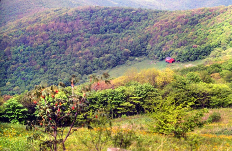
The rolling meadow continued over several spurs of Yellow Mountain at still lofty elevations of around 5300 feet before the AT finally left the open fields behind and plunged steeply down a wooded slope into Low Gap. I probably would have spent the night there in the Roan Highlands Shelter, but some campers had trashed the shelter and fouled its water supply.


I drifted back onto the trail at 6:00, eventually pitching my tent in a field of high grass in Yellow Mountain Gap in the evening twilight. Acquiring water for camp involved an adventure with a barbed wire fence but I eventually emerged relatively intact.
This old barn not far from my campsite was soon to become one of the favorite AT shelters, but there was nothing about it in the guidebook at the time.
I slept the sleep of the dead that night, so exhausted I did not wake even for a moment until 6:30 in the morning. The sky had completely clouded over during the night and hung low and threatening above my tent. I crawled back inside my sleeping bag. Moments later, I heard the first drops of rain spattering off the tent fly.
June 3, 1983.
I awoke again at 8:00 and went outside to make breakfast. The sun was shining and not a cloud was in sight. The outside of my tent was dry. While cleaning up breakfast, I looked overhead. Black and depressing clouds filled the sky. I packed up my gear as fast as possible but did not hit the trail until 9:30. It was a mile-and-a-half from my campsite in Yellow Mountain Gap to Little Hump Mountain, the next bald summit of the highlands on the Appalachian Trail.
Along the way, I crossed another open, grassy spur of Yellow Mountain. The sun was shining, and the clouds were breaking up. Strange morning.
The weather remained mostly sunny for the rest of the day.
Still Chapter 6 of my book, still June 3, 1983.


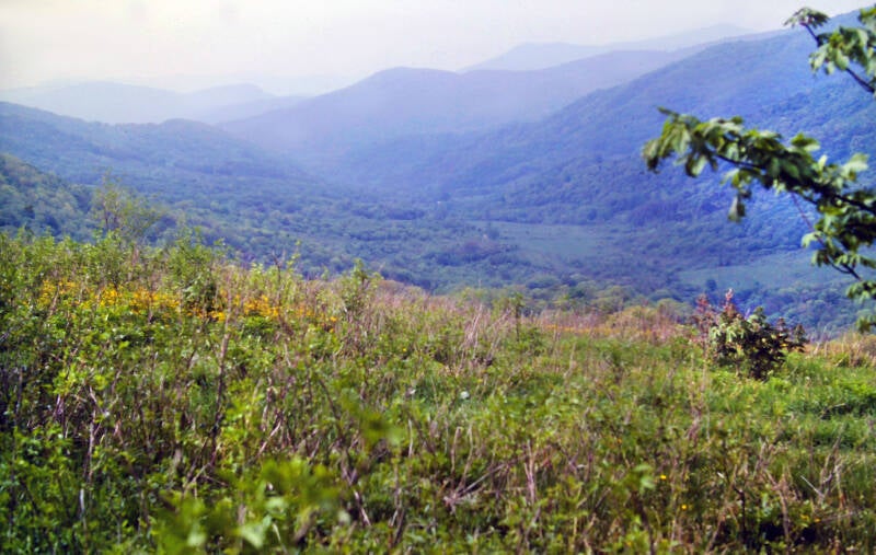
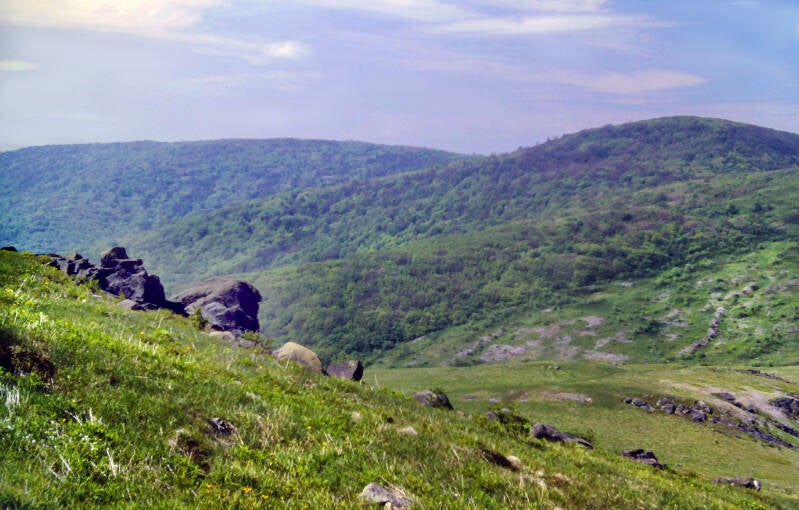
There were unbroken vistas from the trail all along the southwest slope of Little Hump Mountain to its summit.
Looking back across the Roan Highlands to Roan Mountain.
Still Chapter 6. Still June 3, 1983.


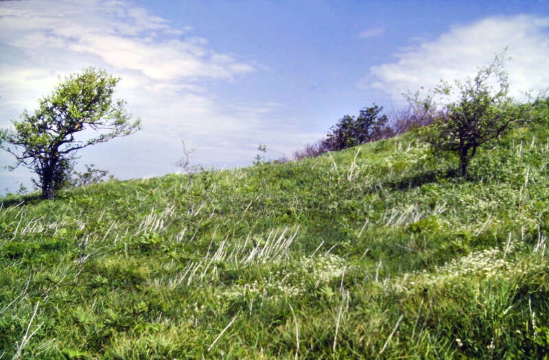
As I approached the summit, Little Hump was grassy and scrubby and sometimes rocky in places.
Along the ridgeline of Little Hump Mountain. Walking across this pastoral landscape, it was easy to forget you were still above 5000 feet in elevation.
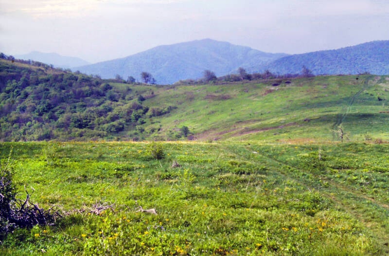

Up ahead was Hump Mountain, another stiff but rewarding climb.
Still Chapter 6. Still June 3, 1983.
The east side of Little Hump Mountain, as I descended into Bradley Gap, was somewhat more overgrown, but still had frequent viewpoints overlooking the trail ahead to the summit of Hump Mountain.

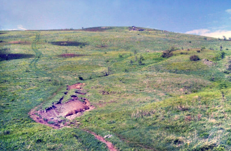
The climb up Hump was a bear, but views from every inch of the trail lightened the load.
Of all of the mountains I had seen thus far on the hike, Hump was now my favorite. Roan had been my previous choice, so it had obviously been a very scenic past couple of days. The fourteen miles of trail between Little Rock Knob and Hump Mountain traversed one of the most superb stretches of scenery I have ever encountered.
Still Chapter 6. Still June 3, 1983.

I named chapter 6, Hump and Groan, after those two wonderful peaks. Groan was the nickname northbound Appalachian Trail hikers had given Roan Mountain due to the long, steep climb to its ridge crest.
Ther trail up Hump Mountain was flanked by big splashes of bluets.


Like Round Bald, Jane Bald, and Little Hump, this summit had 360-degree views, but Hump Mountain was much higher, and the panorama extended for miles in every direction.
Still Chapter 6. Still June 3, 1983.
An intricate series of cross chains groped eastward towards the Blue Ridge's long eastern fork, while to the north loomed Virginia and Mount Rogers, its highest peak.

The grassy Highlands rolled southward to Roan Mountain's lofty, forested plateau. Some miles away to the west in Tennessee ran Iron Mountain -- the long, lower range which parallels this western fork of the Blue Ridge. I would be hiking its flat, wooded crest soon.
The weather on June 3 held fair through the entire hike.


Looking back towards Little Hump Mountain.
And further back towards Roan Mountain.

Clouds were starting to move in, the first signs of a less placid night ahead.
Still in Chapter 6 of my book, and still June 3, 1983.
Still on Hump Mountain.


I sat on top of Hump Mountain for almost an hour, drinking in views.
Still in Chapter 6 of my book, and still June 3, 1983. Still on Hump Mountain.
The climb down was long and very steep. The east slope of Hump was densely forested from a point just below the summit and beyond.


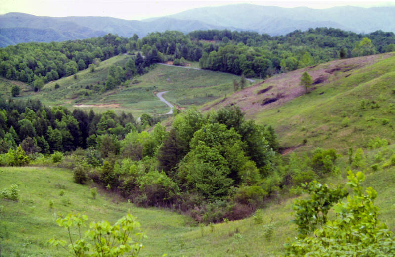
The Appalachian Trail broke out into the clear one last time, one mile later, at a place called Doll Flats. From this large, level meadow were great views southward into North Carolina, and, to the west, one last excellent farewell look at Hump Mountain's summit.
From Doll Flats, the Appalachian Trail descended north off of the state line ridge into Tennessee, and I said good-bye to North Carolina as well. Two states down.
The trail route, for most of the distance to Don Nelan Shelter, either passed through private lands or followed rural lanes. It crossed a state highway and climbed steeply through high pastures baking under a relentless sun.
There were great views back towards Roan and Hump Mountains from the tops of several of the fields, but I could not appreciate them fully. I ran out of water and my tissues were dehydrating rapidly along those shadeless stretches.
I dragged myself into the shelter at 4:00. Not fifteen minutes after I arrived, a drenching thunderstorm struck and hung around for about a half-hour.
Still in Chapter 6, and still June 3, 1983.
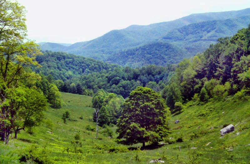
The next day, Appalachian Trail came out of the woods at the top of an old field, where I enjoyed my only views of June 4, 1983. The eastern Tennessee countryside through which I was now traveling was much like the landscape I described a couple of days ago in the views from Little Rock Knob: a rolling country of mountains and farm valleys. The terrain is less rugged and the mountains a little lower than the lofty state line ridge I had followed since the Smokies, but it is far from gentle and flat.

Nesar the end of the day I passed Laurel Falls, a wide, forty-foot-high cascade emptying into a deep, rock-walled pool. The trail then followed another old, abandoned railroad bed past numerous smaller cascades and rapids in Laurel Fork Gorge. I slept June 4 in Laurel Fork Shelter, which clings to one of the walls of the gorge. A small but loud raccoon made sure I did not get much unbroken sleep.
West of the Blue Ridge, the mountains were a big change from those I had traversed previously on this trip. These were like long folds in the land stretching for miles. Their ridge crests tend to be heavily wooded, with nothing resembling a summit peak to break up their flat-topped profiles -- just an occasional wind or water gap cutting through.
This was going to take some getting used to after all of the majestic scenery, but the rhododendron was finally in bloom at these lower elevations, and fiery azaleas like these also brightened the mood.
Still in Chapter 6, and now June 5, 1983.


June 5, 1983, a couple of days into this quiet stretch, the Appalachian Trail cut through the hearts of two beach/picnic areas along the shore of Watauga Lake. Hundreds of happy people were playing and relaxing in the sun with friends and loved ones. I felt completely out of place.
Soon, I was on the long, level crest of Iron Mountain, Tennessee. From that point, although the hiking was fairly easy, the woods continued to be very buggy, and the heat and humidity of the day were slow to abate as the afternoon wore on. The Appalachian Trail followed the ridge with no major climbs or descents.


At around 5:00, after 16 miles of hiking, there was an excellent viewpoint of Watauga Lake and the surrounding valley from a rock outcrop just behind Vanderventer Shelter. I sat on that ledge for a half-hour enjoying the view, chasing away flies, and making sensible excuses to myself about why I could not be awesome today. Then, I stood up, put on my pack, and began walking another seven miles to Iron Mountain Shelter. June 5, 1983.
My last night in Tennessee was a stormy one, and I awoke to fog and drizzle. I left the shelter at 7:40 on June 7 and walked the ten miles of the Appalachian Trail to Damascus, Virginia in less than four hours. It was easy trail, and I was feeling strong and confident. Just as they had yesterday, the miles passed pleasantly and uneventfully. Before I knew it, I came upon a sign marking the boundary of the Jefferson National Forest. Three states were now completed, and I was entering Virginia. The trail gradually descended along the ridge into the green valley where Damascus lay nestled among the mountains. Chapter 6 was ending, Chapter 7 lay ahead.


Chapter 7 of my book, which you can read here. Leaving my first Virginia trail town the next afternoon with a full pack of supplies was, as usual, no fun, but the AT out of Damascus was excellently graded and maintained. Rhododendron and mountain laurel along the trail were just beginning to bloom. Although my heart was not in the effort, I managed to grind out seven miles before coming upon a lovely site in the gorge of Whitetop Laurel Creek which I simply could not pass by.
June 8, 1983.
June 9, 1983. After a climb to the long, wooded crest of Straights Mountain, the Appalachian Trail returned to Whitetop Laurel Creek gorge, joined an old railroad grade known as the Virginia Creeper, and followed the creek through green forests and masses of flowering rhododendron.

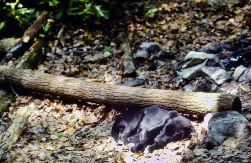
That was where I had my encounter with this fearsome beast, which you can also read about here. Also part of the June 9 entry.
I'm still not done. More AT pics here.