My 1983 Appalachian Trail Hike in Photos
I wrote a ton in words in my journal as I hiked the Appalachian Trail. I also shot a ton of Kodachrome slides in that pre-digital age. I've scanned all my old AT slides and posted them with short text blurbs connecting them to their parts of the story. I'd never tried to connect all these slides with all these words before. It helped me remember details of that long-ago hike in new ways. These pages are a chronological visual journal of the hike. Probably one of the oldest thru-hikes on the Internet to get one.
More pics from my 1983 Appalachian Trail hike. Table of Contents is here.
Start of Nantahala Range, NC - Thunderhead, NC / TN

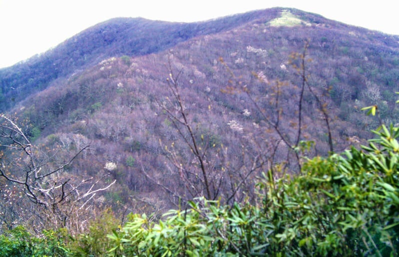
In Carter Gap, the Appalachian Trail left the Blue Ridge, which it had been following from the beginning of the hike, and swung around the bases of a couple of mountains to the beginning of the Nantahalas, an east-west cross range which it would follow westward towards the Great Smoky Mountains.
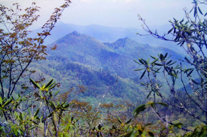
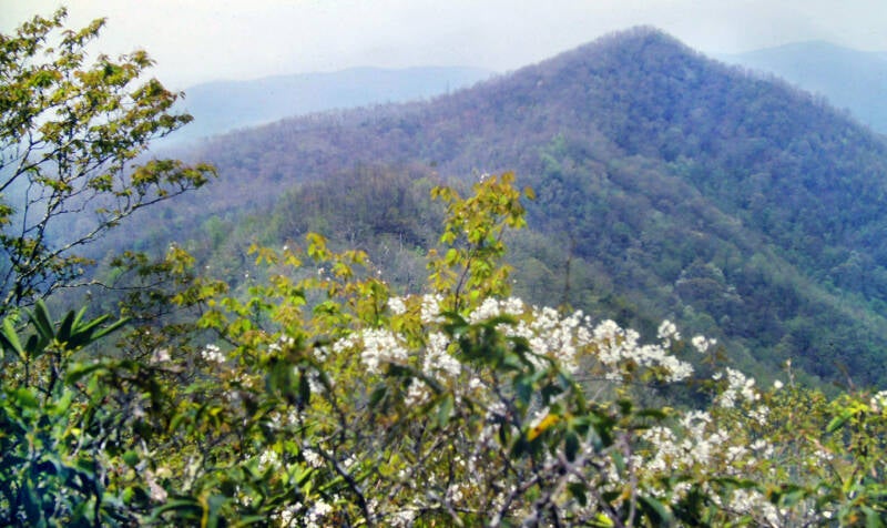
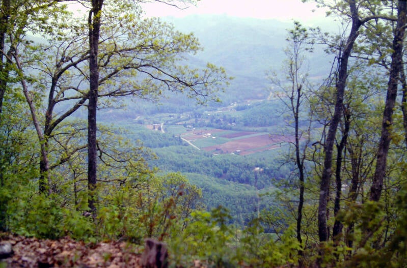
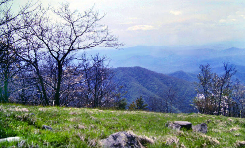
When I reached ridgeline in the Nantahalas, the crest was narrow and the trees small, allowing constant partial views into the adjacent valleys. A great viewpoint of the surrounding mountains with haze-shrouded valleys had been cut out of the forest at the end of a short side trail along the crest of this ridge.
Still May 10, 1983. Nearing the end of Chapter 1 of my story.

The next day, May 11, I was intending to skip the long hitchhike into Franklin, North Carolina despite my dwindling food supplies. In Winding Stair Gap, in a parking area by the side of the (in 1983) new US Highway 64, an older couple stopped and offered me a ride. What could I say? No?
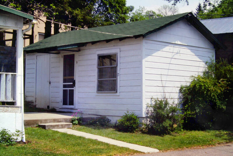
After gulping down a large meal at the local burger place, I ran into Dave. We wound up sharing a cabin in Henry's Motel for $7.00 each. A local resident told us about this motel owned by an older lady who was partial to hikers.
Franklin became the end of Chapter 1 of my story. Henry's Motel was an older place, but was obviously still tended with care, as indicated by little touches like the flowers planted in front of the door to our cabin above.
When we hitched back to the Appalachian Trail in Winding Stair Gap on May 12, 1983, we stopped briefly at the northbound side of the gap for pictures. I told Dave to point pompously to the trailhead, clearly marked with white AT blaze, like a guy who thinks he's a master trailblazer because he can read a blaze. Dave was not a very pompous guy, so this is what he came up with.
We are now in Chapter 2 of my Appalachian Trail story.


My pose was slightly more on point, but I have to say that neither of us found our character. Still had most of the gut I started the trail with, as you can see. Which makes sense because May 12 was only Day 11 or Day 10 of the hike, depending on whether you date back to when I started the feeder trail or when I reached the Appalachian Trail's southern terminus on Springer Mountain.
Note the 70s / early 80s era short gym shorts, riding up a bit high on my right side. Also, the pocket watch looped around my backpack's waist belt because I hate having a watch on my wrist. Cool socks...
Back to the hike. By the time we had hitched a ride back to the Appalachian Trail and begun hiking, it was 1:30 in the afternoon. A big thunderstorm had rocked Franklin late last night, and the threat of more rain persisted throughout today. Thus, we were determined to stay in a shelter tonight. Our problem was that the next two AT shelters were, respectively, four miles and sixteen miles up the trail.
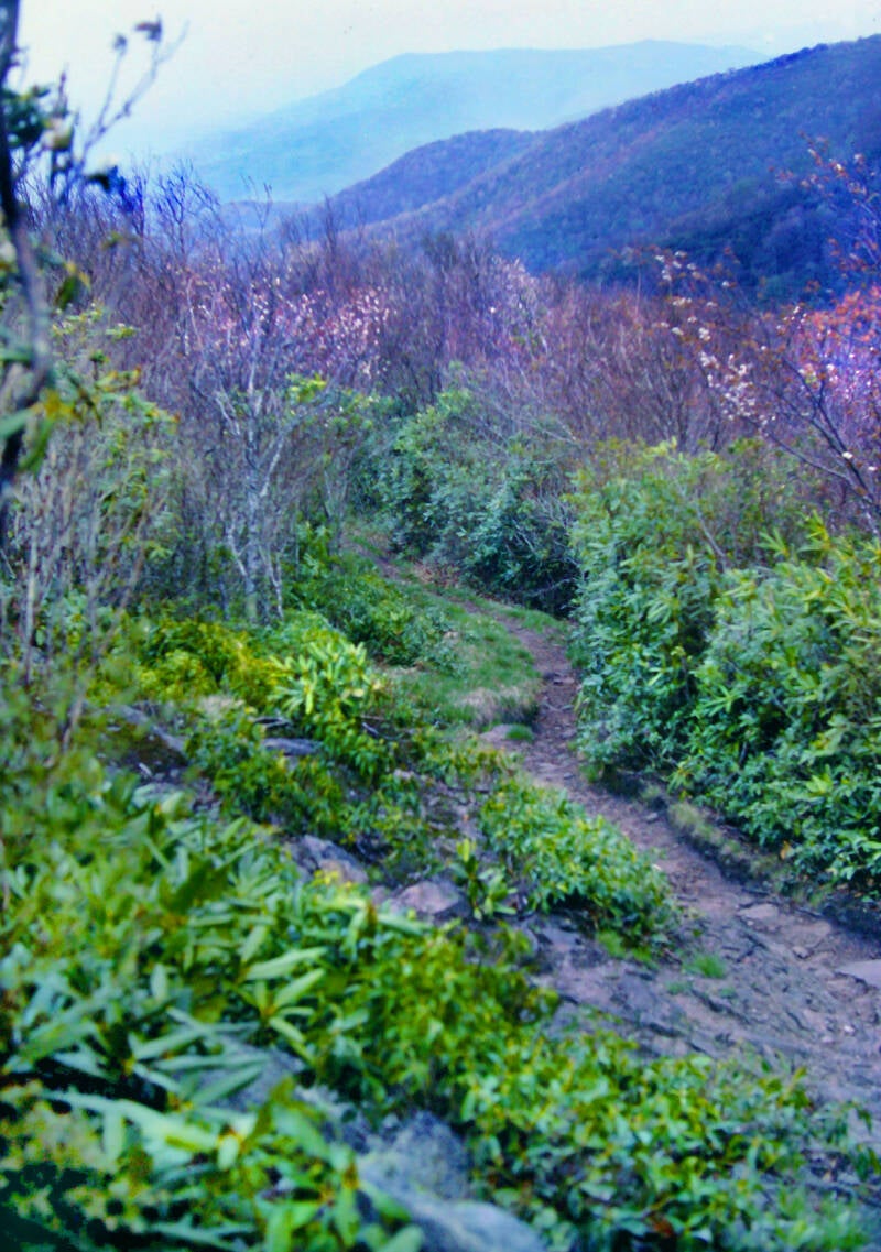
I walked non-stop for ten miles. The first six were on a stretch of pleasant, but uneventful, connecting trail. Along the way, I wandered a while along the wooded crest of a 5000-footer called Silers Bald before descending to cross a narrow strip of state road in Wayah Gap. This mountain pass marked the onset of a long climb up to the summit of Wayah Bald which was the grueling climax of the ten-mile grind. Along the crest, the AT joined a paved road which had also ascended from Wayah Gap.
The road led to a parking area near the summit, next to an observation tower which featured a set of latrines -- a rare find in these primitively accoutered southern forests of the Appalachian Trail -- and a sweep of mountain panorama from the Blue Ridge to the Smokies. I sat down at the top of the tower, absorbing the views and attempting to remember why a sixteen-mile afternoon had seemed like such a great idea a few hours earlier.
I resumed hiking after but a ten-minute rest, once I had discovered that my battered feet throbbed much more painfully when I was off of them. I had abused them so thoroughly recently that they became desensitized while walking. As I went along, the pain faded to a dull ache, but I knew it would return once I had stopped for the night.
The final six miles of today's hike were nothing more than a hazy blur of fatigue.


Still May 12, 1983. Still Chapter 2.
Early evening May 13, we arrived at the A. Rufus Morgan Shelter on the Appalachian Trail. The shelter, located less than a mile south of town, allowed us to hang out parts of two days at the center without tapping our meager cash reserves for a night's lodging.
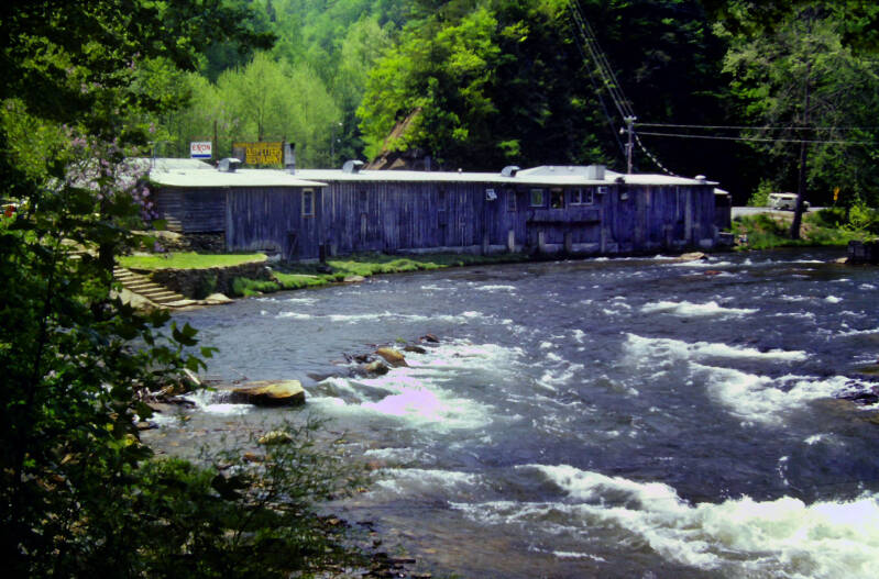
Heading north from Springer Mountain, Wesser, North Carolina is the first trail town through which the Appalachian Trail actually passes. The swirling rapids and scenic gorge form one of the most famous whitewater rafting centers in the southeast. Directly upon the AT's river crossing is the Nantahala Outdoor Center -- in fact, the trail passes over the stream on the small, wooden bridge along the driveway connecting their parking lot to US 19. They are major recreational outfitters whose facilities include a restaurant, a motel, and a large store featuring backpacking and rafting supplies.
This is the Nantahala Outdoor Center in Wesser, North Carolina. This pic is from the morning of May 14, 1983. This corner of town is a narrow strip along the floor of the deep, heavily wooded, steep-walled gorge which the Nantahala River has gouged through the mountains. A line of railroad tracks and a sparse string of buildings are squeezed between the north bank of the river and the adjacent cliffs, and a two-lane thread of road fronts a few more buildings on the south side.

Dave and I strolled around Wesser the evening of May 13, absorbing the sights and sounds of the town for a while. It was a lively interlude from the relentless stillness of the forest. Exuberant rafters were milling around, laughing and shouting, riding their post-adventure highs. Trail towns are always an eagerly anticipated blast of excitement for thru-hikers, but Wesser was something special for us that night.
I stayed about an hour. Accumulated fatigue and an impending fair-sized walk back to the shelter pulled me away while the evening was still young. Clouds were also thickening once again. A pint of chocolate ice cream and an icy coke for my dessert helped ease the pain of separation. I raced back to the shelter in order to relax and enjoy them before turning in. Another big thunderstorm exploded just moments after my arrival. I kicked back on my sleeping bag, enjoying the fruits of my trip to the snack bar as I took in nature's light show.
We visited Wesser again the next morning, May 14, for some food shopping and a restaurant meal, both at the Nantahala Outdoor Center.
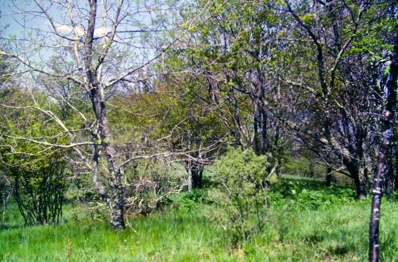
We somewhat reluctantly headed out of Wesser at 1:00 p.m. on May 14. After crossing the railroad tracks, the Appalachian Trail began a major ascent, rising more than 3000 feet from the gorge. It was the biggest climb yet on the AT. Nevertheless, the trail was well laid out, and we were starting to come into true hiking form, so it was no big deal. The ascent passed through vibrant jungles of rhododendron and hardwoods carpeted with moss and ferns and hung with vines and creepers.


There were some good peephole views through the dense foliage as we climbed.
Still Chapter 2.
After attaining the ridge crest of the Nantahala Range, the Appalachian Trail followed that crest westward paralleling the Nantahala River gorge, still climbing. Several viewpoints looked almost straight down a few thousand feet into the gorge. West of Wesser it had widened a bit, with a few more buildings visible, but it was still quite narrow.
We arrived at the shelter at 5:00, at the end of a short seven-and-a-half-mile hike. Sleeping was difficult that night. It remained quite warm, and I sweated considerably even though I left my sleeping bag unzipped. May 14, 1983.
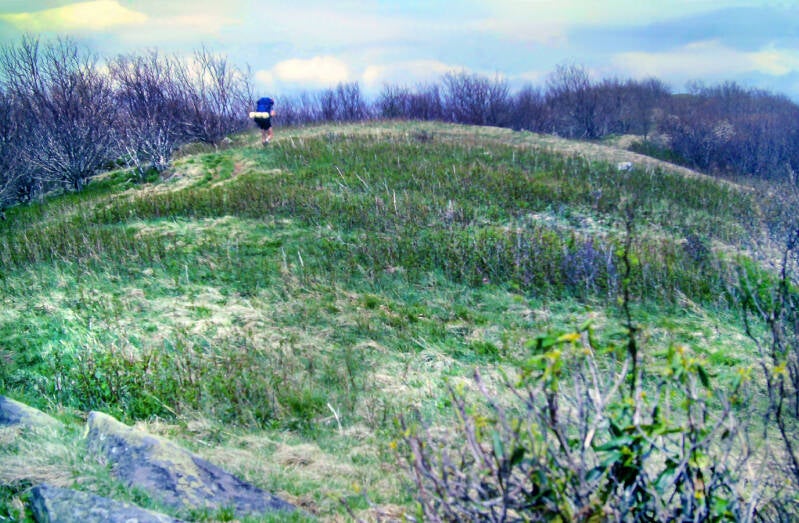
I awoke May 15 morning at 6:00, before dawn broke over the forest, and was on the trail at 7:20. A steep climb from the shelter brought us to the summit of Cheoah Bald, which was surrounded by a sprawling open meadow but on that day was wreathed in dark clouds.


A hazy sun emerged on the ensuing descent, which was steep and muddy. When that was over, the AT traversed a group of very rugged knobs in the muggy sunshine.
Meanwhile, the uncomfortable heat of the previous night and the morning quickly faded, although the thick haze and humidity remained.
The stretch of Appalachian Trail between Wesser and Fontana Village is reputed to be one of the most difficult sections of the entire trail, and it lived up to every bit of its reputation May 15, 1983. The grueling 6.3 miles I walked to Stekoah Gap chewed up almost three-and-a-half hours.

After the rugged knobs the AT descended to a road crossing at Stekoah Gap, where I caught up to Dave. We relaxed for a while in a roadside field. We did not linger long. The sun had disappeared, and a cold steel wind began lashing stinging splinters of mist across the meadow. The warmest night of this adventure had been followed by the coldest and most blustery day. We were forced to move on in order to warm up.
It was still fairly early in the afternoon on May 15, 1983, when we stumbled into Cable Gap Shelter after 14.7 miles, but we decided to stop for the night. Cold rain and killer climbs had quelled our enthusiasm for any additional miles today.
At Cable Gap, Dave and I have caught up to, with the exception of one guy in Georgia, the only thru-hikers that we had met thus far on the AT. They are known in the registers as Ron and Sonny the Wonder Dog. Ron is a dark-haired, heavily bearded man who looks to be in his thirties. Sonny is a large, black mixed breed resembling a Doberman whose ears and tail have not been trimmed.
Ron broke out some good salami, and Dave turned us on to several joints of good pot. We all got very high and giggly. When thru-hikers get together, we love to share stories, and, God knows, we all have some good ones. We spun tales all night as the rain pattered down on the shelter's tin roof.


Ron and Sonny were presently traveling with another dog -- a little white mongrel stray who followed them out of Wesser. He later stayed in Fontana Village. I am told that there are abandoned dogs in these mountains who work a stretch of trail between two towns, latching onto and mooching off of hikers as they pass between the towns, and then catching someone going the other way.
May 16, 1983, Chapter 2 of the book.
When you spend the night beneath a tin roof, unless you are stone deaf, you know that it rained. It poured all night. The onslaught continued unabated in the morning. The rain eventually began to slacken, finally tapering off by midmorning. We had a late start to Fontana, but it was only a seven-mile hike.
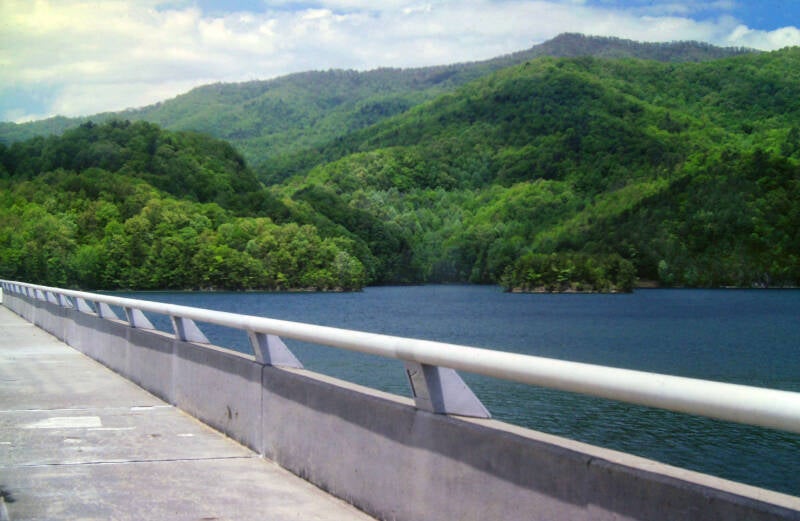
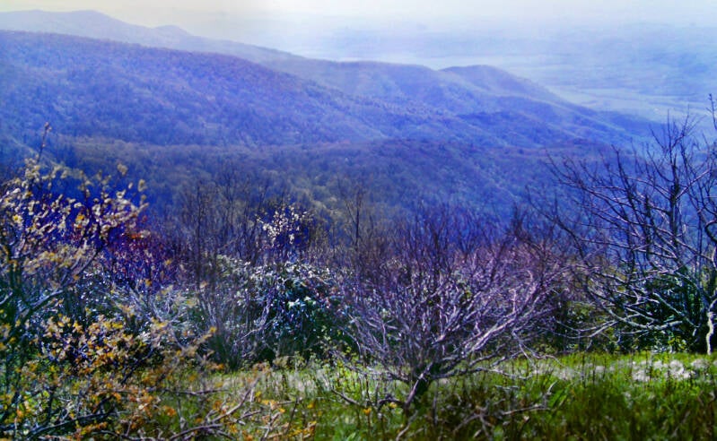
The sun began to break out as we climbed the Yellow Creek Range. The trail was not overly difficult, and the afternoon turned out to be a pleasant one. At one point along the ridge crest, I got a great picture (--->) of Fontana Dam and the huge lake it has formed, with the Great Smokies rising like blue-gray giants as a backdrop. Their summits were wreathed in clouds, but what else is new? That is how the mountain range got its name. Everywhere else I looked, the sun was brightly shining. An omen whose significance escaped me completely at the time; the next chapter of my book - the Great Smokies chapter - would come to be called "The Dark Lands".

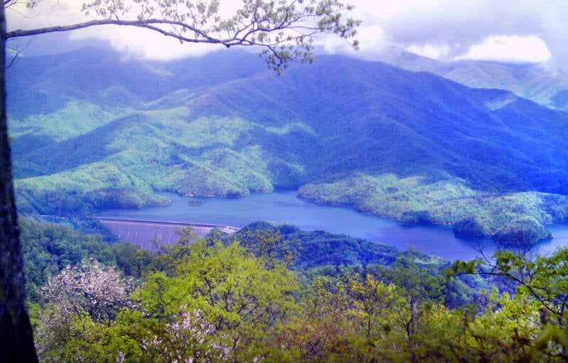
Here's a slightly different look at that awesome view. This one gives you an even better look at the Great Smoky Mountains living up to their name. And a bit more of Fontana Lake.
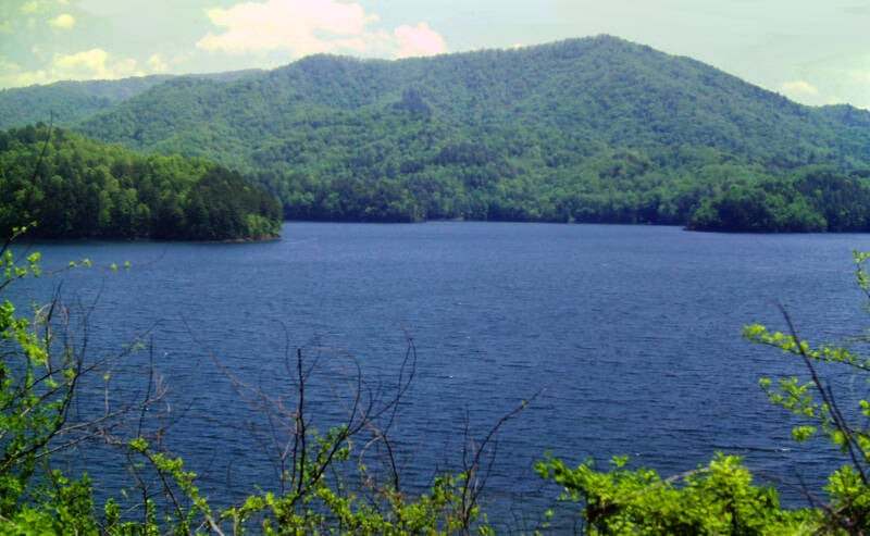
A long descent, with increasingly close looks at Fontana Lake, brought us to North Carolina 28, the small, two-lane highway connecting Fontana Dam with the village.
We dropped our gear off at the Fontana Dam Shelter headed into the village for mail and resupply.
Dave and I happened to run into a National Park Service Ranger in Fontana Village. She gave us the necessary thru-hiker permits, which allowed us to use the shelters and campsites in the Great Smokies, so we were all set to enter the park the next day. Which brings both May 16, 1983 and Chapter 2 to an end.
May 17, 1983. Chapter 3. A beautiful day to start our Great Smoky adventure. A rare beautiful day, as it turned out. Dave, Ron and I went back to Fontana Village for some items we had forgotten the previous night. It was three miles each way to Fontana from the shelter, and we wound up walking nine-and-a-half of them total both days. Not the best place for hitchhiking.
At the shelter, I loaded my pack and followed the AT over paved T.V.A. roads for a quarter mile to the dam.
On the far side of the dam loomed the Great Smoky Mountains towering above us, and this was just a lesser side ridge to the main state line ridge beyond.

Behind me were the Yellow Creek Mountains, the Nantahala Range and, for the moment, Dave.
Fontana Dam is a cool place. There are a great many mountains that have less impressive views.
Still May 17, 1983. Chapter 3.
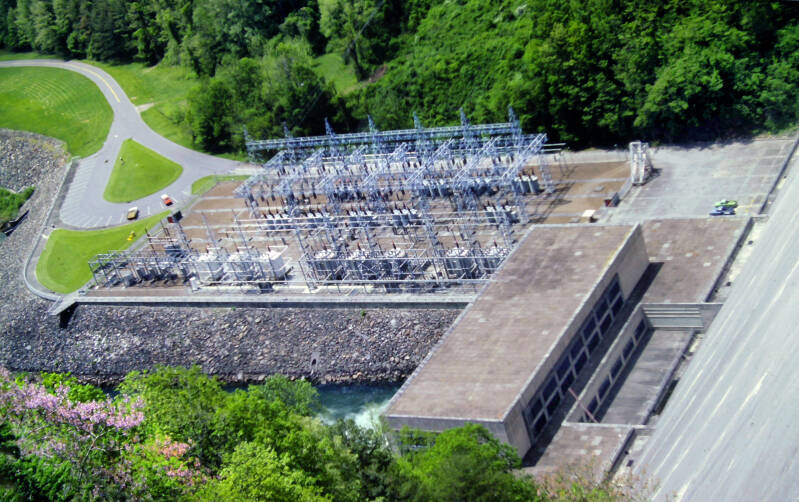
Looking over the downstream side of the concrete dam, there was a dizzying drop of almost five hundred feet to a massive hydroelectric plant and the river below.
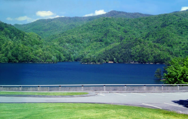
According to the National Park Service, Fontana Dam is the tallest concrete dam (480 feet) east of the Rocky Mountains. This height allows the dam to generate plenty of hydroelectric power. Fontana Lake, formed by the dam, has a shoreline of about 240 miles.

The massive amounts of water and electricity available at the dam allowed the U.S. government to generously offer free hot showers at the dam's visitor center. Last I heard they still do this to this day. The U.S. government has my sincere gratitude for this thoughtful gesture. An especially nice touch was a mirror in the shower stall. I enjoyed my first shave since the Walasiyi Inn in Georgia right in the stall.
Yon grizzled backpacker in front of the Visitor Center here appears to be rummaging around in his pack for his loofah. We will wish him good luck and move on.
One last look at the impressive height of Fontana Dam. This is a view from the dam of the Little Tennessee River just downstream from the dam.
By the time Dave and I trod the concrete footway across the long dam, it was 1:15. On the far side of Fontana Lake, the Appalachian Trail followed paved roads along the shore for a half-mile before turning into the woods.
Still May 17, 1983. Chapter 3.

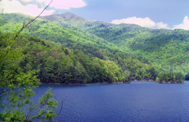
This began the long, grueling climb up a spur ridge of the Smokies. There were occasional views of Fontana Lake below.
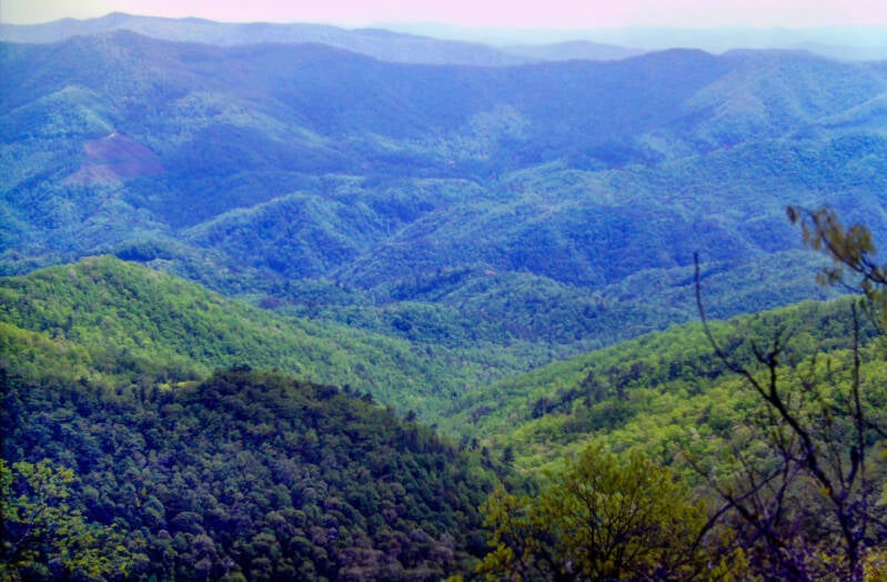
As we climbed higher there were excellent views across western North Carolina's long intricate strands of interconnected mountain ranges.
Still May 17, 1983. Chapter 3.

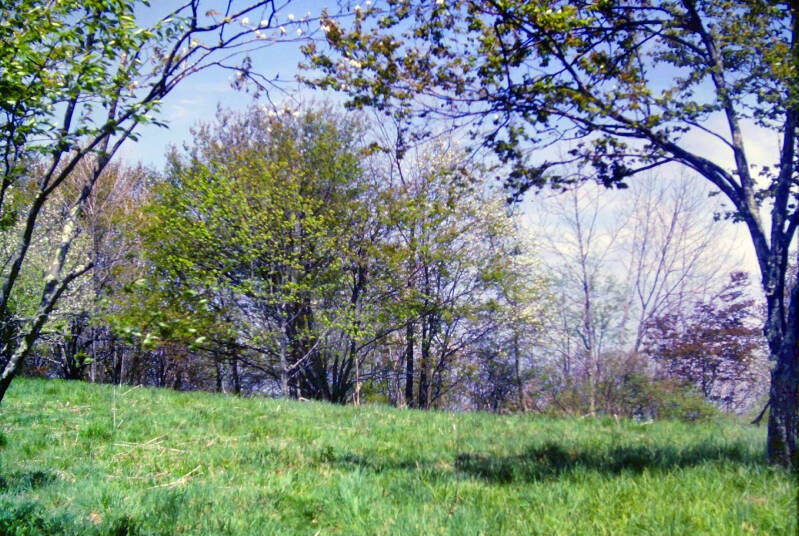
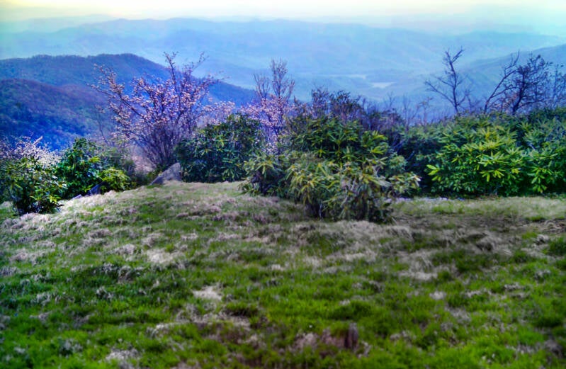
We had not yet climbed back into early Spring. All the trees down here were fully decked out in summertime leaves, although the colors were still the brighter, lighter greens of late Spring.
In mid-May there was still plenty of early Spring ahead in the higher elevations of the Great Smoky Mountains.
When we finally reached the end of the long initial climb at the fire tower on the top of Shuckstack Mountain, there was an incredible 360-degree view of western North Carolina's mountain ranges to the east and the North Carolina/Tennessee state line ridge crest of the Smokies to the west.


The panorama included the best view yet of Fontana Lake a couple thousand feet below. A day earlier, the Yellow Creek Range seemed plenty high standing atop it, looking down hundreds of feet at the dam and lake, but that's its ridgeline far below.
Two hikers we met at the fire tower who were on their way down into Fontana told us of a severe rat problem at Mollies Ridge Shelter, where we intended to stay tonight. We decided to stop at Birch Spring Shelter and make today a short day. Russell Field Shelter, the next one past Mollies Ridge, was eight miles away, and it was already 4:00.
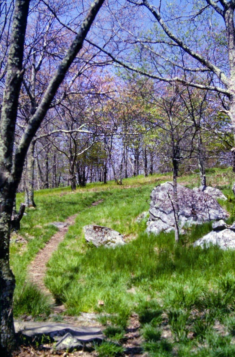
The ridge crest tended to be covered with lush grass, even beneath the trees. This turned out to be a very common feature in the Smokies.
Still May 17, 1983. Chapter 3.
We had been climbing along an eastern spur of the Smokies since the dam and had not yet attained the main crest.


At 8:15 in the morning on May 18, we started out to cover the remaining two miles along the spur ridge to the state line ridge at Doe Knob. The hike was relatively easy; we had already done the bulk of the climb on Tuesday.
It was a spectacular day. Birds were singing, and bees were buzzing over the lush green grass.
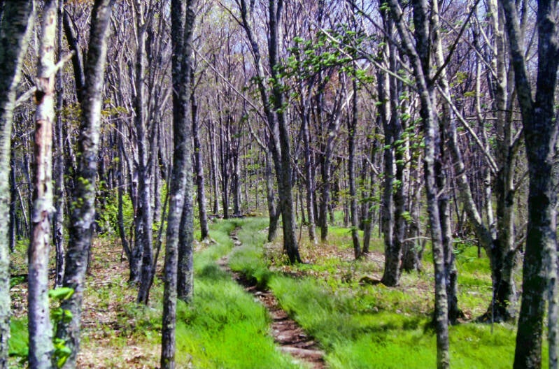
Climbing into the Smokies from the Little Tennessee River valley had taken us back in time several weeks.
At these altitudes, early Spring was in the air in mid-May. Trees were budding or growing out their first tiny leaves.

Although we couldn't know it at the time, Dave and I were enjoying the last few hours of fair weather for us in the Smokies. From Doe Knob, a long, fairly steep descent into Ekaneetlee Gap, followed by a lot of ups and downs along a rolling stretch of ridge crest brought us to Russell Field Shelter.
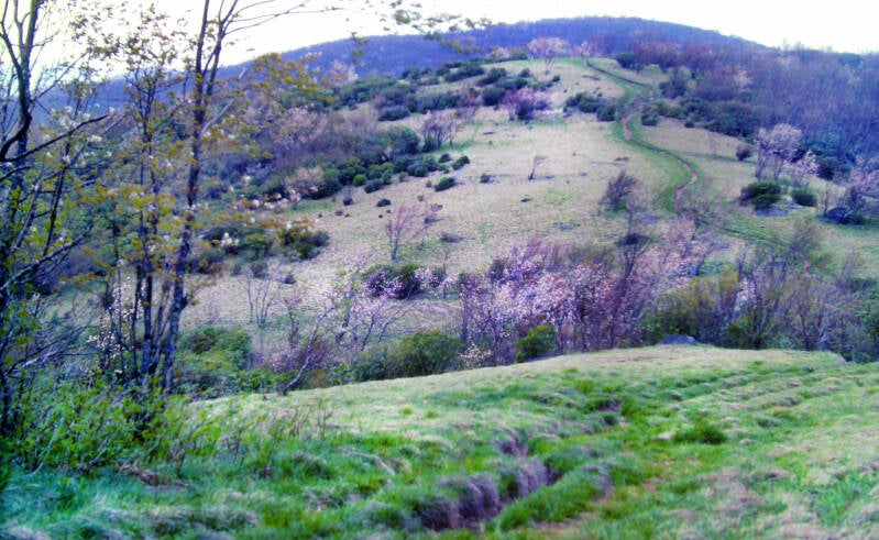
Russell Field was a beautiful spot. The shelter was situated in a grassy, park-like wooded area, where many of the trees were thick with tiny, bright buds.
Still May 18, 1983. Chapter 3.
Years ago, before these mountains became a national park, folks used to farm their ridge crests.
The old farm fields had now been reclaimed by the patient forest, but trees covering them grow less densely and-the woods were airier than the surrounding forests.
Dave and I spent forty minutes in Russell Field, walking around and just relaxing.
Still May 18, 1983. Chapter 3.
Most AT shelters had wooden walls with an external firepit for cooking. Russell Field Shelter was a typical Great Smokies shelter in 1983. It had an indoor fireplace with a large chimney featuring the same intricate stone construction as the three outside walls. Like most other AT shelters, the Smokies shelters had an open front side and a shiny corrugated tin roof. In the Smokies that open front was covered ground to ceiling by a thick bear fence with a door in the middle.

Even where the forests were more densely wooded, the ground was often grassy. This time of the year, even these thicker forests were sunny.
A short while later, we hit the nicest spot I had seen up to that point in the Smokies -- a grassy little rolling meadow atop a knob called Little Bald. The sun was shining, and the air remained pleasantly cool. It never did get hot all day.


I took a few photographs of the views from Little Bald, although the air was becoming rather hazy. We didn't know it then, but our blue-sky, soft breezes Great Smokies idyll was drawing to a close.
Still May 18, 1983. Chapter 3.
It was glorious while it lasted. Although we had not planned it, Dave and I wound up having lunch there and staying for about an hour.

After lunch, we had a long, steep climb up Thunderhead, an impressive mountain which loomed above the entire southwestern section of the Great Smokies. Clearly visible from Little Bald, the view of that impending long, steep climb took a bit of the idyllic edge off this lunch break.
There were good views along this portion of the climb, looking towards Thunderhead and its lower west peak Rockytop, famed in song.


A side trail, up from the North Carolina side, joins the Appalachian Trail just in time for this colorful display of trees in full bud on May 18, 1983. We are still in Chapter 3.
The ridge crest was one open grassy field after another.

There were constant great views info the valleys far below on either side.
The trail descends a short distance into a grassy little sag before resuming the long climb up Rockytop. A side trail coming up from Tennessee joins the AT near that big, vaguely car-shaped boulder just ahead.
Still May 18, 1983. Chapter 3.

The haze was growing thicker, especially noticeable looking down into the valleys, where the air itself was thicker. Hiking the ridgeline of the Smokies, you are at altitudes at which the air is thinner than most of us experience on a daily basis.
The wind was picking up as well. It was obvious a storm was coming in.
The huge grassy fields we followed along the ridge crest since Little Bald began to diminish as we climbed. We were nearing the two peaks of Thunderhead, but we still had a ways to climb.
There were plenty of views along rocky stretches of the climb where grass and scrubby rhododendron took over from the trees.
A hazy sun was still with us as we neared the high stretch of ridge crest connecting Rockytop and Thunderhead's main summit.

There were far-ranging views as we neared that summit ridge.
Almost there.
Still May 18, 1983. Chapter 3.

There were good views on Thunderhead, especially from the lower west peak aptly named Rockytop.
I enjoyed the views and shot some good pictures up there, but darker clouds were quickly moving in, and we had no time to linger.

The valleys below were disappearing into that gathering haze. Still May 18, 1983. Chapter 3.
I took a long last look and started down. A scattering of fat raindrops began to fall on us as we made our way down the other side. Soon, the sun was gone, the wind was wailing, and the temperature was plummeting.

I'm not done. More AT pics here.