My 1983 Appalachian Trail Hike in Photos
I wrote a ton in words in my journal as I hiked the Appalachian Trail. I also shot a ton of Kodachrome slides in that pre-digital age. I've scanned all my old AT slides and posted them with short text blurbs connecting them to their parts of the story. I'd never tried to connect all these slides with all these words before. It helped me remember details of that long-ago hike in new ways. These pages are a chronological visual journal of the hike. Probably one of the oldest thru-hikes on the Internet to get one.
More pics from my 1983 Appalachian Trail hike. Table of Contents is here.
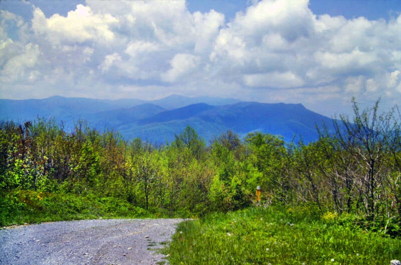
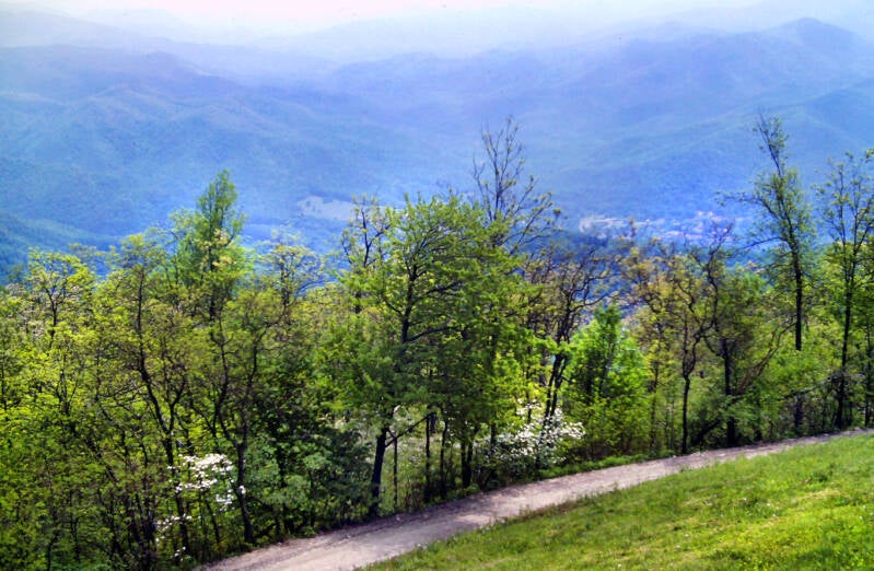
Thunderhead, NC / TN - Camp Creek Bald, NC / TN
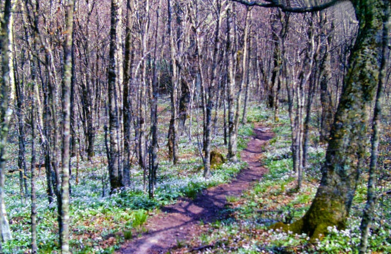
This brief golden hour breakout over a grassy ridge crest carpeted with white and violet flowers was the sun's farewell to us for the next several days. The storm was coming. We flew over the last four miles to Derrick Knob Shelter.
Immediately upon my arrival, I threw on my long pants, chamois shirt, and wool sweater. The balmy afternoon had given way to a rather tempestuous night. The Dark Lands lay ahead.
Still May 18, 1983. Chapter 3.
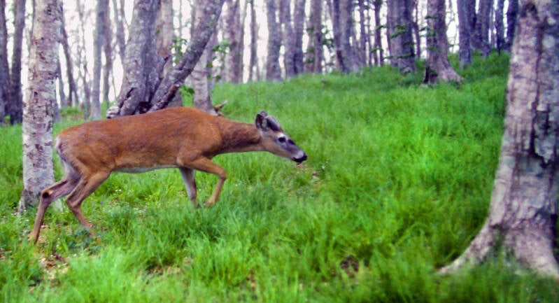
Derrick Knob shelter was in an excellent spot, similar in appearance to Russell Field. About a dozen small deer were wandering around nibbling the grass and the lower leaves, and they let me approach surprisingly close. It is pretty amazing how brave the deer are in the national parks, where no hunting is allowed. As I followed the side trail down to the spring to get water for my dinner, one walked past me on the trail, even closer than this one did, close enough for me to touch.
A solid mass of water was falling from the clouds when I awoke May 19, 1983. A howling wind was lashing the rain sideways at times. We waited until noon before starting our hike, but the rain and the wind and the cold hung on strong all day.
The trail was covered with a rich clay soil which the deluge had transformed into a sea of mud, bottomless and clinging on the flats and thin and tractionless on the slopes. Walking them was like walking on ice.
A half-mile climb felt like a mile with my feet slipping back a half-step downhill for each step I climbed. I was more exhausted after May 19's seven miles than I was after the previous day's fifteen. Worst of all, I was running low on food and those seven miles I eked out this day put me well behind schedule.

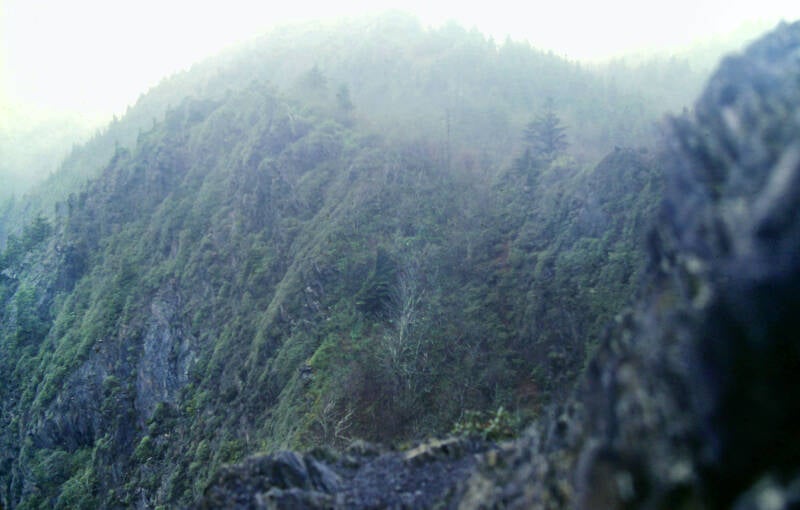
There were some extremely tough stretches on the trail, most especially the open summit of Silers Bald and the crest of a narrow, knife-edge ridge traversed by the AT soon afterwards. Both would have been scenic and not terribly difficult on a more clement day, but May 19 was far from clement.
Still Chapter 3.
Days like these have their own warped charm and personality, and they make for more interesting stories afterwards than the nice days, but a wee dram of this sort of thing goes a long way towards satisfying one's appetite for adventure.
I heard that the weather was supposed to be much better over the next couple of days. If we could make it 20.6 miles tomorrow to Pecks Corner Shelter, our supply problems would be workable.
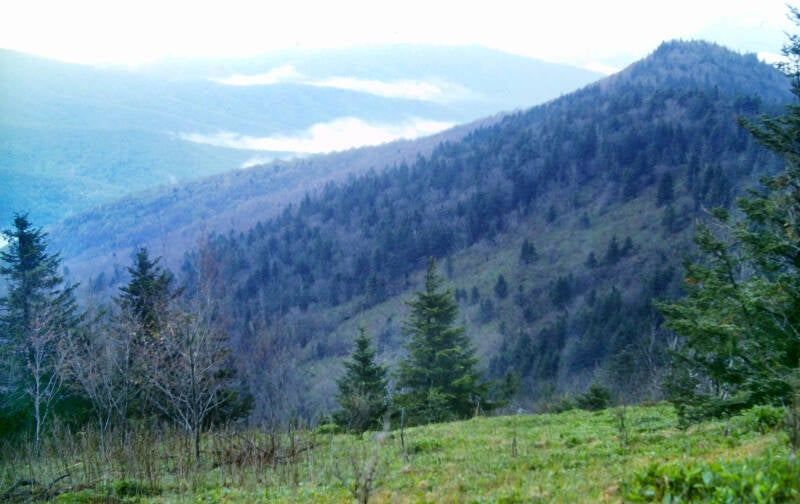
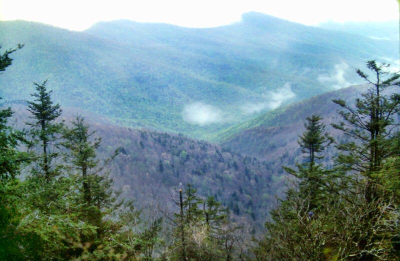
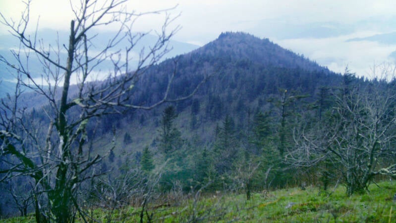
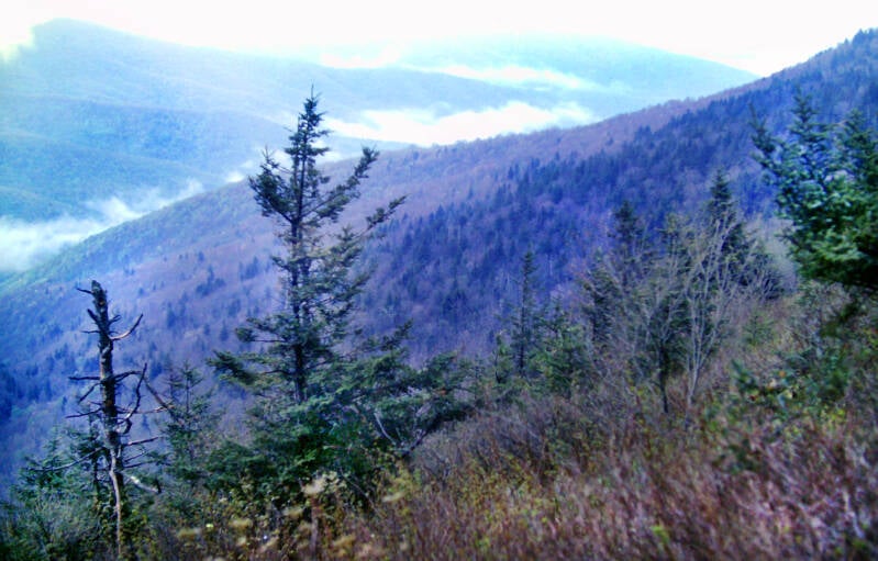
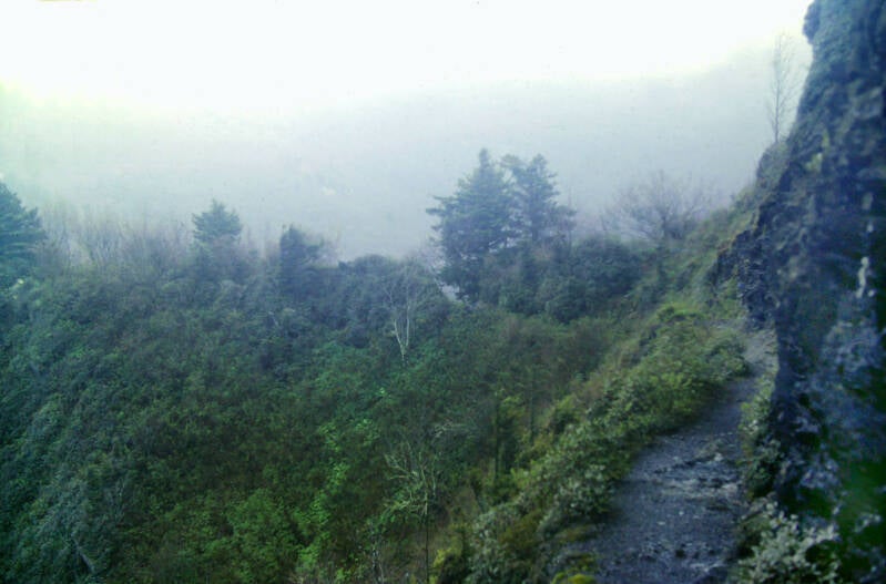
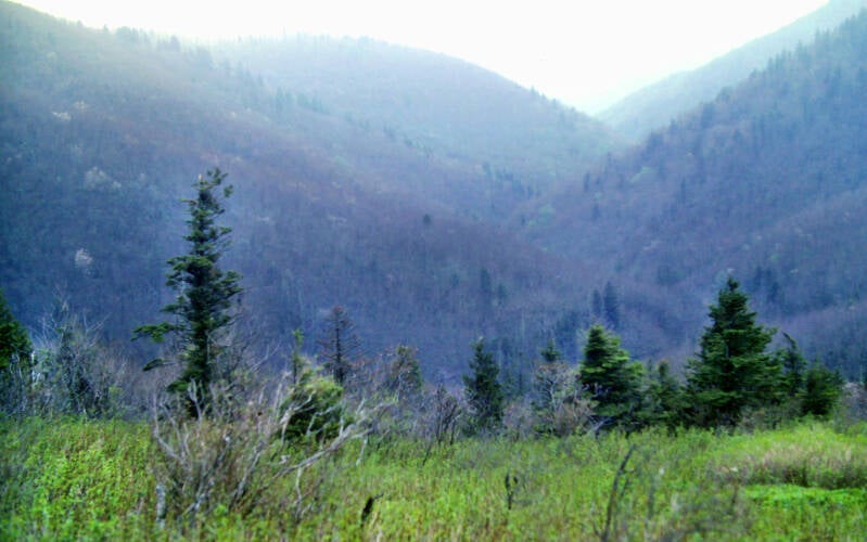
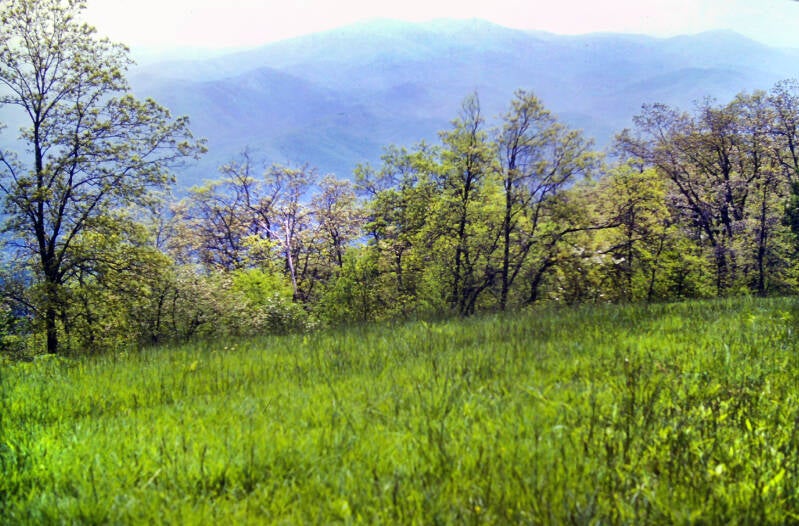
May 20, 1983 started off well. It was an overcast morning, but gradually clearing. I made the initial three-mile climb to Clingmans Dome, the highest point on the Appalachian Trail, in good shape -- in about ninety minutes. The summit had an observation tower, but it was completely engulfed by a cloud. There were views into the mists elsewhere along the ridge crest.
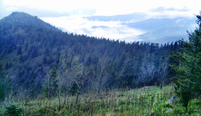
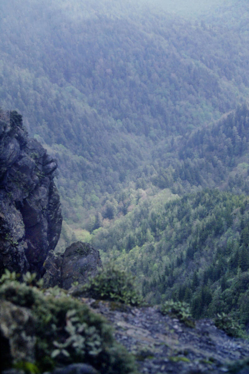
The trail past Clingmans was extremely swampy from yesterday's rain -- and steep and broken by constant washouts as well. It was a lot of work to keep my shoes and socks -- still damp from yesterday -- from becoming completely water-logged. On a more pleasant note, I did get some good shots from Mount Buckley, a minor summit of Clingmans Dome, of the distant peaks and valleys as the clouds finally started to lift.
The prospective halfway point of our ambitious twenty-mile hike was Newfound Gap, the deep slash in the mountain range where US 441 and Tennessee 71 share the only road which crosses it. The weather continued to improve as we approached Indian Gap, with Newfound Gap less than two miles ahead. We were making excellent time and had not yet even stopped to rest. The twenty-mile day we needed seemed in the bag. As we climbed out of Indian Gap, the clouds began to return. When we were still a half-mile from Newfound Gap, the sky fell.
The three-mile climb from Newfound Gap to Ice Water Spring Shelter was endless misery. There was no wind, but rain was falling in sheets -- heavier than the previous day. The already-saturated slopes instantly sprouted scores of cascading streams. I soon abandoned completely my effort to avoid puddles -- the world was one big puddle.


Within five minutes, my feet were swimming around inside of my boots. All of my toes felt arthritic, and my right calf was cramping up as tightly as a miser's fist. Even though it was just 3:00 when I arrived at Ice Water Spring, I knew I was finished. The next AT shelter, the one we had hoped to reach, was eight miles away. Now, Dave and I needed food very badly, and it was still twenty-eight miles to Davenport Gap.
Still May 20, 1983. Still Chapter 3.
Just to make a wonderful day perfect, a skunk dropped by the shelter that night and swaggered around as if he owned the place for the an hour.
When I awoke May 21 morning, a bleak cold rain was pouring down upon the mountains. I was extremely thankful for my wool sweater. I thought about mailing it home from Fontana Village when I realized that I had not yet worn the thing, but decided to hold onto it for the high elevations of the Smokies. Good thing.

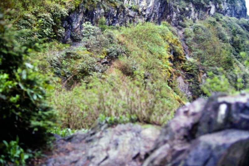
I did not start hiking until 10:00. I was waiting for a break in the weather in order to get a good look at the famous stretch of narrow trail which clings precariously to the cliffs on Charlies Bunion. It was about a half-mile from the shelter. Although the sky never did actually clear, the rain did stop, and the clouds lifted a bit off of the ridge.
Not the nicest day, but this at least made it possible to see the exciting drop beneath the muddy loose dirt of the trail.
Hello, down there...
Still May 21, 1983. Still Chapter 3.
If that sounds like complaining, I'm not. The National Park Service had recently rerouted the Appalachian Trail around the safe, boring side of the Bunion. If I was looking for safe and boring, I could have remained in Connecticut and kept my job pumping gas. I took the old trail around the Tennessee side. It was not as scary as other backpackers had led me to believe that it would be, but it was impressive.
The clouds had lifted just enough to give me nice views into Tennessee and a good look at the precipitous drop a few inches away.
Still May 21, 1983. Still Chapter 3.
The weather continued to improve as I hiked the Bunion, but I did not trust it. I kept my chamois shirt, long pants, and rain pants on my body and the rain cover on my backpack. For the entire day, the weather alternated between deteriorating and improving conditions.
For all its excitement, Charlies Bunion is a rather short stretch of trail, and I was soon looking back from the other side.
That was easily the high point of May 21, 1983. A few drops of rain finally fell upon me later as I rested at Bradleys View, a spot at about the halfway point of the day's hike with fine views eastward into North Carolina. Affordable waterproof cameras still being years off, I shot no pics there.
After I left Bradleys View, the weather improved steadily. I was finally compelled to stop three miles later in Copper Gap and strip down to my shorts and tee shirt. While I was there, I ate a pitiful lunch from my dwindling supplies.
I staggered into Tri-Corner Knob Shelter at 4:30 p.m., tired and discouraged after a 12.3-mile day. Still Chapter 3.
May 22, 1983. Morning limped in with the moisture-sodden air and grim perpetual twilight I had now come to associate with the Smokies. I had slept badly. The drumming of the rain on the tin roof of the shelter haunted my dreams. I just felt that if I did not make those 14.7 miles to Davenport Gap Shelter today, I would be forced to quit, and my fragile dream of Katahdin would flicker out. The rain finally ended that morning at 9:30, and I was off. Shreds of mist coiled in the gloom beneath the trees like cobras preparing to strike. The trees and the underbrush were still dripping wet from the rain. I would have probably been more comfortable had I worn my rain pants over my shorts, but they would have slowed me down. Today, I needed speed.
As I climbed Mount Guyot, the weather further deteriorated. By the time I was about halfway up, a steady, soaking drizzle had set in. I would have traded my right arm for one brief glimpse of sun. The endless dreariness was eating away at my brain, and my dream of Katahdin was washing away in waves of frigid rain and fatigue like a sandcastle battered by a merciless surf. The stage seemed set for the final act of my Great Smoky Mountains tragedy.
My shorts and socks became saturated, but I just kept chugging up that mountain, swearing occasionally at the top of my lungs. The rain grew harder, the wind was blasting, and I was shaking from hypothermia by the time I made it to the top. I was terribly alone, bone-weary, soul-weary, and half out of my head -- but I kept going.


Cosby Knob Shelter, where I was stopping for lunch, was 7.7 miles from my starting point. Thanks in part to seeing an extremely annoying guy I had met catching up to me at one point, I drove my worn-out underfed hulk for three hours fifteen minutes with one quick call-of-nature stop along the way. I arrived at Davenport Gap Shelter at 4:00, having covered another seven miles in two-and-a-half hours. I was less than a mile from the end of the Great Smoky Mountains. That evening I walked to the small grocery in Davenport Gap and back. Chapter 3 was over. The Dark Lands were behind me. May 22, 1983.
May 23, 1983. Chapter 4 of my story. Another morning dawned gray and dismal, shedding a chill misting rain as we made ready to set out. The sun broke out from the clouds once again just as we left the shelter -- all in all, a nice little symbolic flourish for our impending departure from the Great Smokies.
Our first break of the day was a ten-minute rest almost six miles from the shelter. Our second stop came two-and-a-half miles later on the top of Snowbird Mountain, at the end of a fast 2860-foot climb from the Big Pigeon River.
My first climb in the Bald Mountains, the state line range just northeast of the Smokies, was long and steep. Nevertheless, the bright, crisp morning was like rocket fuel to two sunshine-starved backpackers fresh from the sensory-deprivation tanks.

The entire summit area of Snowbird's west peak was a sloping deep green lawn, recently mown, freckled with blazing yellow dandelions and bright white milkweed.
Still May 23, 1983 and Chapter 4.
A dirt service road came up from the valley below. Over the trees we could see the Great Smokies, including a large stretch where towering clouds were raining all over some other set of miserable wretches. For the moment that was all behind us. Backpackers tend to live almost completely in the present moment. And this moment was glorious.
At the highest point the service road ended at an F.A.A. tower resembling a N.A.S.A. space capsule. I was told the setup was a navigation aid for pilots.
Still May 23, 1983 and Chapter 4.
The views from the peak were among the finest thus far on the Appalachian Trail. I spent about a half-hour taking photographs and relaxing in the brilliant sunshine.
Looking at many of these Snowbird pics with the eye of someone who has hiked a lot more miles that the 24-year-old 3 weeks into his big hike, it's hard to miss the growing risk of evening thunderstorms in these clouds.
The next few miles of trail from Snowbird's summit was a cakewalk after the morning's long climb. Spring was in the air.
Still May 23, 1983 and Chapter 4.
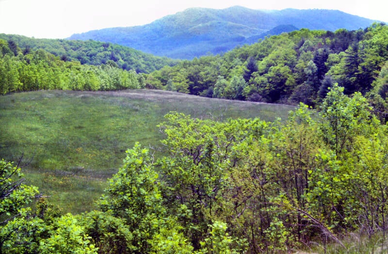
The Appalachian Trail followed a grassy old woods road along the flattish crest of the mountain, down into a shallow sag and up past Wildcat Top -- the east summit of Snowbird. From there, it was all downhill to Deep Gap, where I took the side trail to Groundhog Creek Shelter. I lunched in simple elegance at the picnic table just in front of the shelter, with more than ten miles already under my belt. Today was truly the antithesis to the last days in the Smokies.


The first few miles of the afternoon were a long climb from Deep Gap up to a high saddle on Harmon Den Mountain followed by a shorter descent into Brown Gap. The trail was graded very nicely and this portion breezed past. From that point onward, it got rough. Little mother climbs abounded.
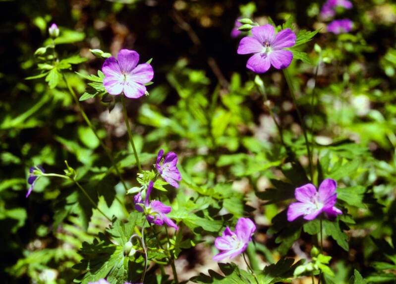
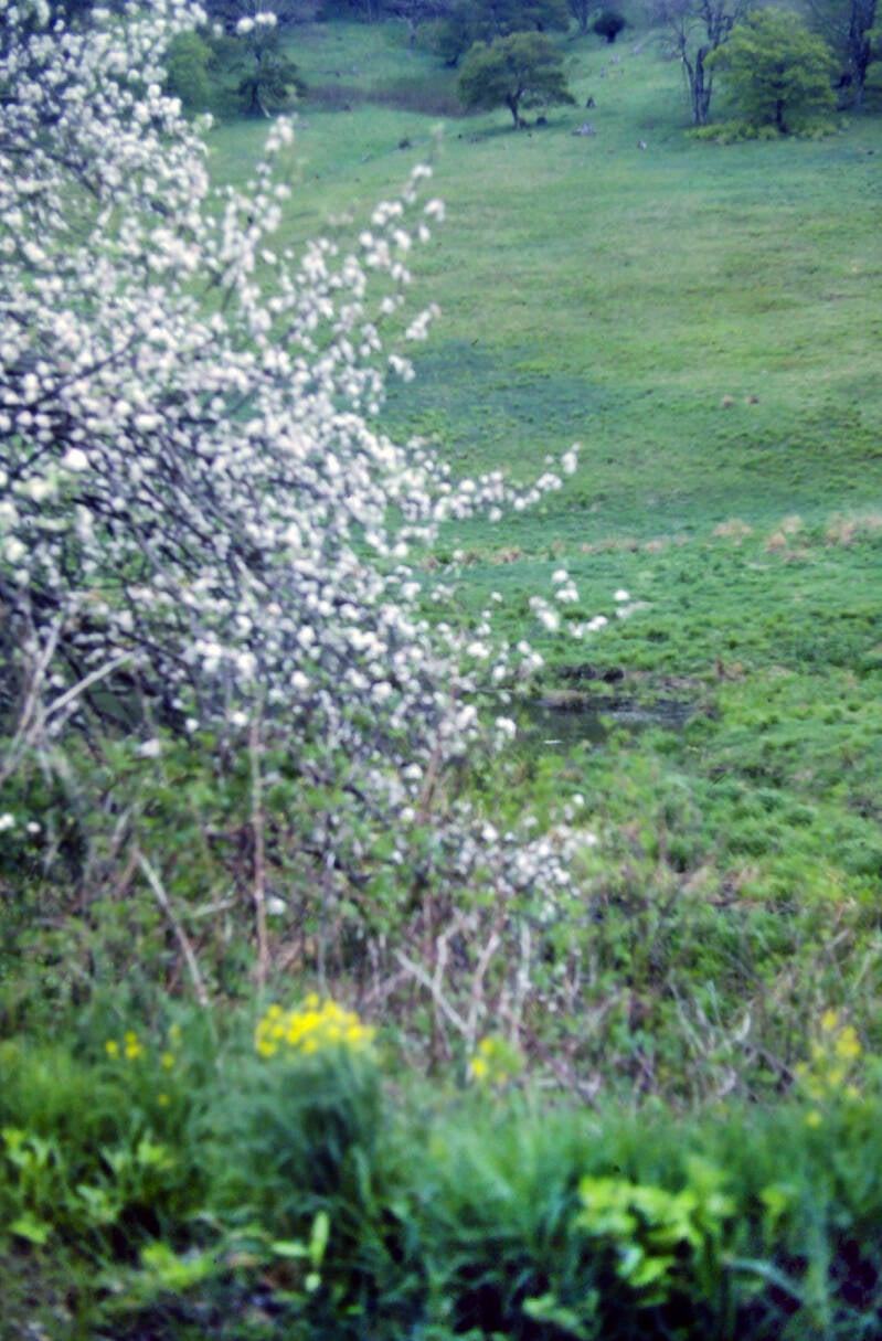
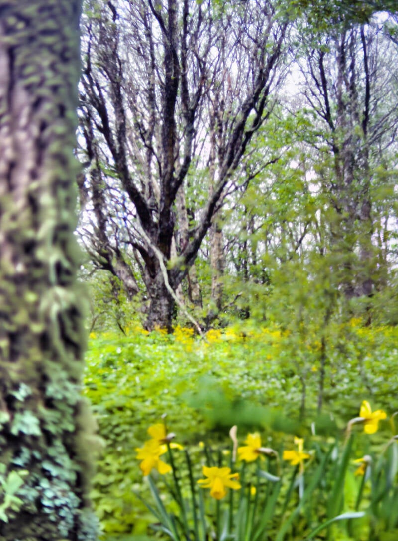
The scenery was good, though. The trail sides and occasional meadows teemed with a profusion of violets, lilies, and daffodils being attended to by huge, lumbering bumblebees.
The Appalachian Trail finally leveled out near the crest of Max Patch Mountain, soon coming out upon the gravel Max Patch Road, which it would follow for the next four miles. We were nearing the end of a 21-mile day.
Still May 23, 1983 and Chapter 4.


When we reached the beginning of this roadwalk, Dave and I had covered more than half of our projected afternoon mileage, and the sun was still high in the sky.
At first, the road passed large, impressive estates and horse farms.
Gradually they gave way to smaller homes perched upon small, less prosperous mountain farms. Despite the obvious poverty, it was still pretty country, with great views and an interesting glimpse of a vanishing way of life. But that darkening sky became more and more of a distraction as the thunderheads moved in.

Before we made it very far, ugly, boiling black clouds were beginning to obliterate the sunshine. We were very tired, having already walked more than sixteen miles today, but we chugged grimly down that road as fast as we could move, racing the storm to the shelter.
That road seemed endless. The angry sky kept growing darker, and thunder began to rumble in the distance. Still the roadwalk stretched onward.
Eventually, it began to sprinkle. The sprinkle became a drizzle, and the drizzle became rain. Finally, I was forced to stop in order to put my camera in my backpack and cover the pack with its rain shield. While I was thus occupied, the sky shattered into a million fragments which began cascading down upon me.
As I was belatedly struggling into my rain suit, I seem to remember gibbering completely incoherent sounds. It seemed just too much to have a wonderful day fall to pieces after nineteen grueling miles -- with but two remaining. As it was, I had barely battled through the Smokies with soul and body intact. On the Appalachian Trail, time slows down and expands; one lives almost entirely in the present moment. And this moment just absolutely sucked. The AT finally turned off of that fateful road and plunged into the woods. I plodded the final wretched mile up Walnut Mountain to the shelter.
I almost snapped when I saw the place. Were the universe to receive an enema, Walnut Mountain Shelter is the exact spot where it would be administered. I knew before I arrived that the place had been built in 1938, but its forty-five years must have been very hard ones, because it looked ancient. The floorboards tilted in every conceivable direction and seemed on the brink of collapse. Wind and rain were blasting in through numerous gaping holes in the walls, and the roof made an excellent sieve. Home, sweet home.
Then, a strange thing happened. I was right in the middle of a ranting tirade when I suddenly burst out laughing. Soon, Dave and I were literally rolling around on the floor, giggling hysterically about how wretched our lives had become. We spent the remainder of the night making sick, twisted jokes and cracking ourselves and each other up. We were in more of a state of delirium than actual mirth, but fun is fun wherever you can find it. Especially on a night such as this, May 23, 1983, at a place whose new nickname became the title of my Chapter 5: "Heartbreak Hotel."
A sign next to the-shelter read, "TOILET" with an arrow pointing out a path leading off into the woods. This became the butt of numerous jokes (pardon the pun). We speculated that its destination was probably a naked toilet sitting out in the open forest.
Still May 23, 1983. Still Chapter 4.
The next morning, May 24, Dave was required to pay it a visit, and -- surprise! -- we had been virtually correct. It had no roof and just a three-foot-tall partition around three sides. The commode sat above a shallow pit of irregular shape which extended slightly past the sides of the unit. It was a cold, damp, blustery morning; Dave was treated to an invigorating gale blowing in through the edges of the hole and funneling up through the bottom of the toilet. He had all of the luck when it came to these matters.


I awoke cold and clammy the morning of May 24 and lay in my sleeping bag fascinated, watching tiny wisps of cloud swirl in through the gaping holes in the wall above my head, drift leisurely across the ceiling, and slip out of the open side. It had rained sporadically throughout the night. At least I had water.
It was mid-morning when we started out, and the sun was just starting to peek through the clouds and fog.
I'm thinking if you had a field down here and you wanted to keep it as a field, you'd better mow it or graze it rather often in the Springtime.


Everything was intensely green.
The morning mists eventually gave way to a fairly pleasant day.
Still May 24, 1983. Still Chapter 4.
The morning mists eventually gave way to a fairly pleasant day. I began the hike with five non-stop miles over Walnut Mountain, up Bluff Mountain, and down the other side.

Near Bluff's summit, the sky darkened, the wind kicked up, and I began to hear thunder. That almost blew my good mood, but the sun quickly emerged from behind a passing wisp of-cloud, the stray gust of wind died out, and the thunder turned out to be the sonic boom of a military jet.
Still May 24, 1983 and Chapter 4.
Near Garenflo Gap, on the far side of Bluff Mountain, I found a sunny little meadow and decided to take my first break. Having filled my canteen at a stream crossing, I lay out for twenty minutes, chugging Tang and devouring the last of my crackers and m & m's. I was dehydrated all day. I usually catch up on my water intake at the shelters each night and tank up for the long day ahead in the mornings at breakfast, but the water source at Walnut Mountain shelter had turned into a mud puddle.
The next few miles were on an easy graded trail which skirted the slopes of a couple of mountains. There were a few good views, but I was running on empty all day; it was a relief to reach Deer Park Mountain Shelter, where I could sit down to rest and eat lunch.
I was planning on a long lunch, but an entry in the shelter register mentioned that the Inn at Hot Springs was often completely filled by early evening. I roared over the final three miles into town.
In no time, I was beginning the last descent into Hot Springs. At the Inn, the owner informed me that he does not serve dinners on Mondays and Tuesdays, and that the only restaurant in Hot Springs closes at 6:00. As it was already 5:30, I had to rush over there still dirty and smelly from the trail. I had three cokes, two cheeseburgers, french fries, and home-made chili. Life was good.
This brings us to the end of Chapter 4 and of May 24, 1983.
I remained in Hot Springs May 25 for rest and recuperation. At 10:00 a.m. on May 26, 1983, I was walking down Bridge Street with my backpack, heading out of town. I stopped at the hardware store to buy a new watch. Back on the street, I ran into Dave and said good-bye. He had to stay in town another day to wait for a package with new hiking boots to arrive at the Post Office. His old ones were absolutely falling apart.
So begins Chapter 5.
The Appalachian Trail made a long climb out of Hot Springs to a rock crag called Lovers Leap which jutted out over the valley with excellent views of Hot Springs.
It was very steep for about a mile, but the rest of May 26's hike was a cakewalk. Nevertheless, my pack was very heavy, and I was slow-moving. I was carrying just five days' worth of food, but I was carrying enormous portions.
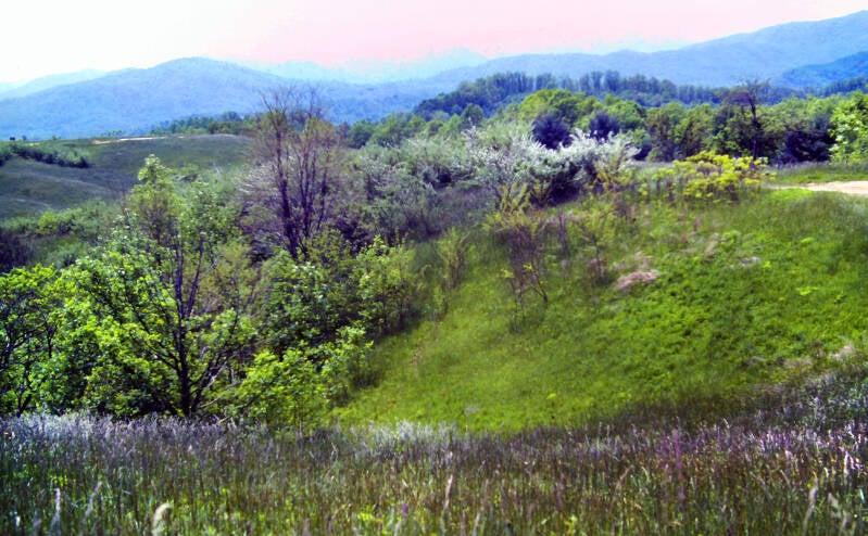
After Lovers Leap came some easy woodland hiking before the Appalachian Trail followed a gravel road for a short stretch through some very scenic meadows in a place called Mill Ridge. Years ago, those meadows used to be tobacco fields.
My backpack was very heavy, but I did not mind. I had time. I had lots of extra food in my pack.
Still May 26, 1983 and Chapter 5.
Weighing myself my last night in the Inn, I discovered I had lost more than fifteen pounds during my first three weeks on the trail. I still needed to lose more weight, but the present rate of loss was a little fast considering the physical demands of my journey.

Due to the Memorial Day holiday, I could not pick up my supply package until Tuesday morning. After Erwin, it would be time for me to pick up my daily mileage. This was also why I had felt free to have a rest day in Hot Springs.
There was no point in arriving in Erwin, Tennessee, the next trail town, before Monday night.
I was enjoying the day, and Mill Ridge was a lovely green place with buzzing bees and nice views. Halfway through your fourth week in the woods, it feels good to walk around in the open for a while.
Still May 26, 1983. Still Chapter 5.

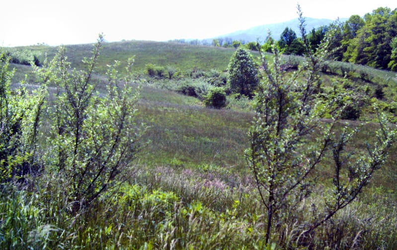
It seemed very apparent to me that a lot of care had gone into the concept of Mill Ridge in 1983. There were mown fields of short grass, fields of tall grass and breaks in the fields where trees and shrubs of varied heights grew.
This created a variety of habitats where different birds and animals could thrive. A USFS sign I passed noted these fields were important brood areas for turkey and grouse, providing food an protection for many other species as well.
Another stretch of easy woodland trail was followed by a moderate-to-easy two-mile climb up Rich Mountain.
Still May 26, 1983. Still Chapter 5.
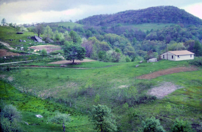
There were excellent views from a fire tower just off of the Appalachian Trail on a side path, and a spring near the summit boasted some of the best water I had tasted on the trail. It was clear and cold. Most of the water I had encountered in these southern mountains had been cloudy and somewhat stagnant.

A short, sharp descent from Rich Mountain led to an easy, graded climb up Spring Mountain and the shelter perched high up near the summit. I stopped for the night, even though it was not yet 5:00, and I had covered less than eleven miles. I still had four full days in which to hike the remaining fifty-five miles to Erwin and arrive by Monday night. Still May 26, 1983. Still Chapter 5.
It was 9:30 a.m. before I started hiking May 27. Tired of instant oatmeal, I had made up a batch of pancakes from some mix I had purchased in Hot Springs. They came out alright, but it was a lot of trouble to clean up. Maybe I won't bother again.

The first part of the hike was a breeze -- several miles of gentle downhill trail with one quick, mild climb. The next five miles were a constant, though well graded, uphill, mostly through evergreen forests. I stopped at Little Laurel Shelter, which was spotless and well-maintained, and a great spot for today's lunch.
Still May 27, 1983. Still Chapter 5.
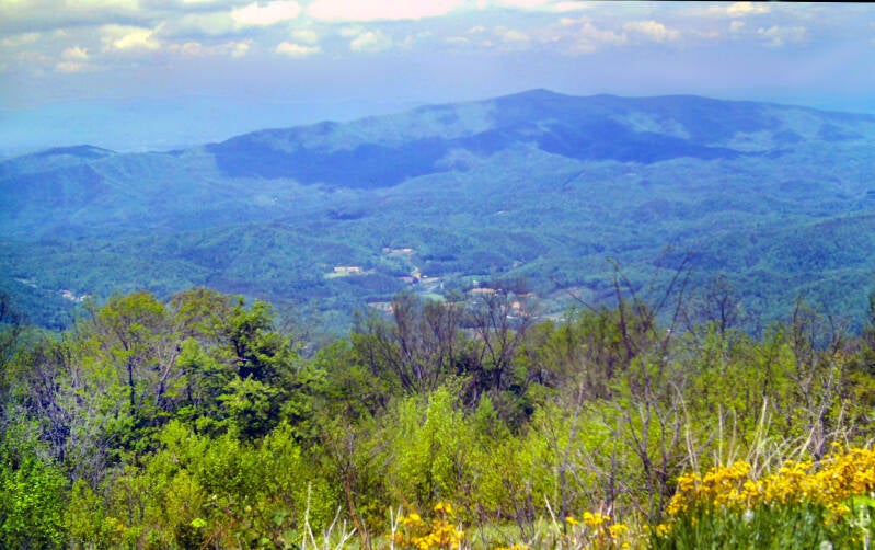
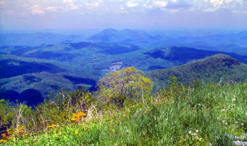
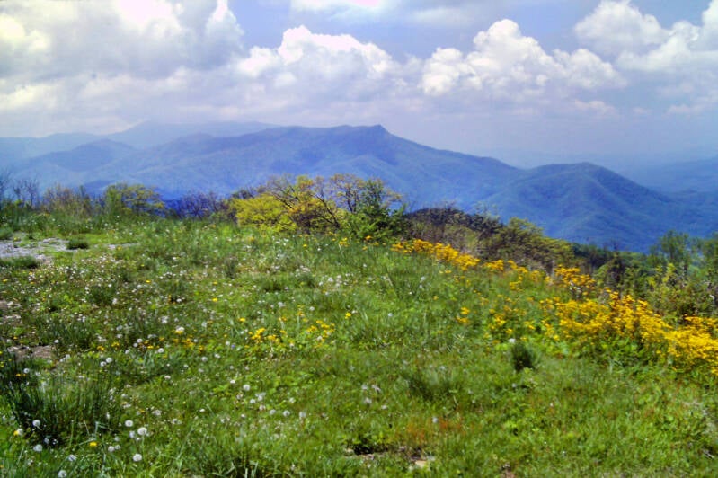
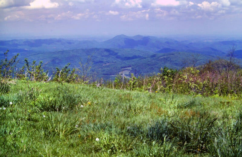
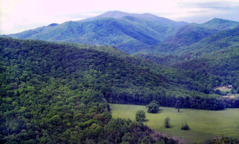
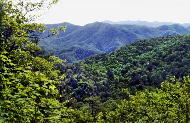
Following my long break, I finally started to hit my stride after a morning of mediocre progress. It was 1:30, and the day was still idyllic. A fairly steep jaunt up Camp Creek Bald began the afternoon's hike. I made it without a stop.
I made my way up to a fire tower with views every bit as excellent as those from Rich Mountain. The sky was as clear of haze as any I have seen in these misty southern mountains. I took my camera out of my backpack and started firing away.
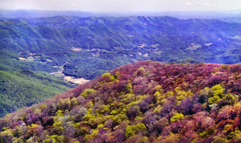
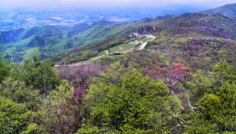
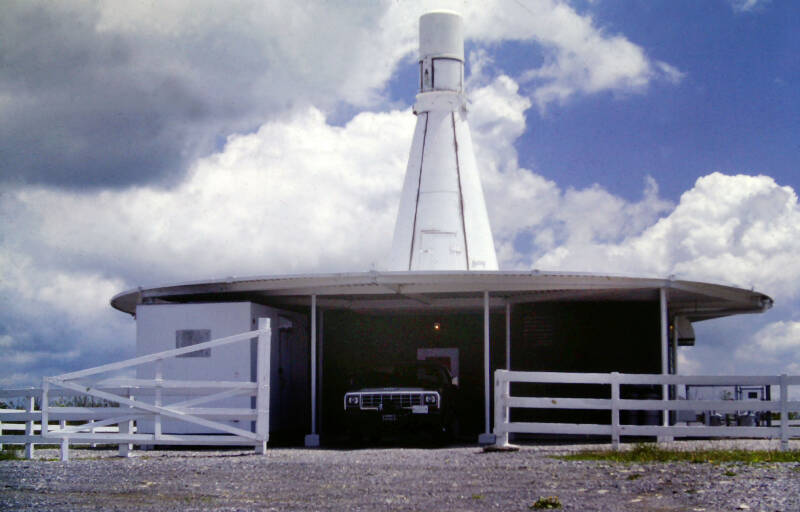
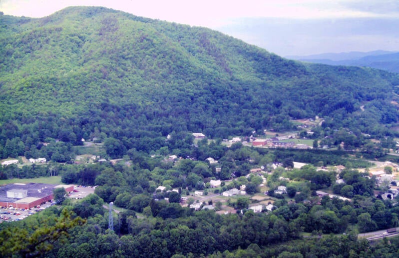
I later learned that the collection of odd-looking buildings sitting at the end of a dirt road that came up from that wide Tennessee valley below were the remains of an abandoned ski resort known as Viking Mountain. They included a cluster of A-frames and those round structures.
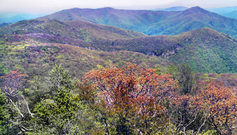
The forests around the fire tower were bursting into perhaps the most massive and colorful display of budding trees I had ever seen in one place.

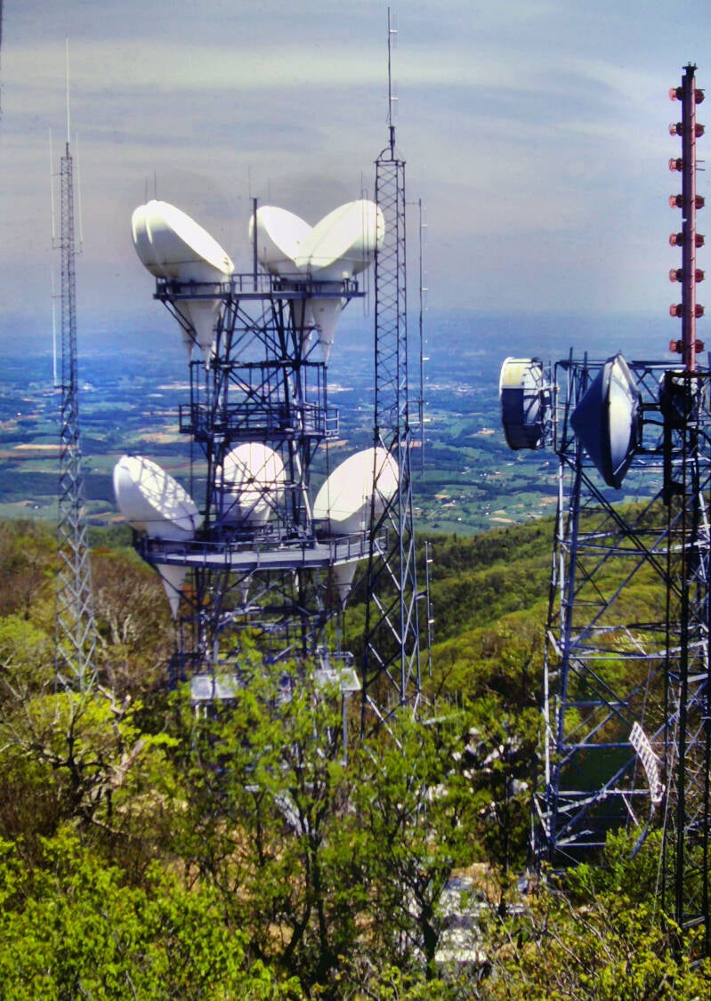
Some very futuristic-looking towers (for 1983) only partially obscuring the wide valley beyond. Looking west into Tennessee also from Camp Creek Bald.
Also from Chapter 5 and from May 27, 1983.
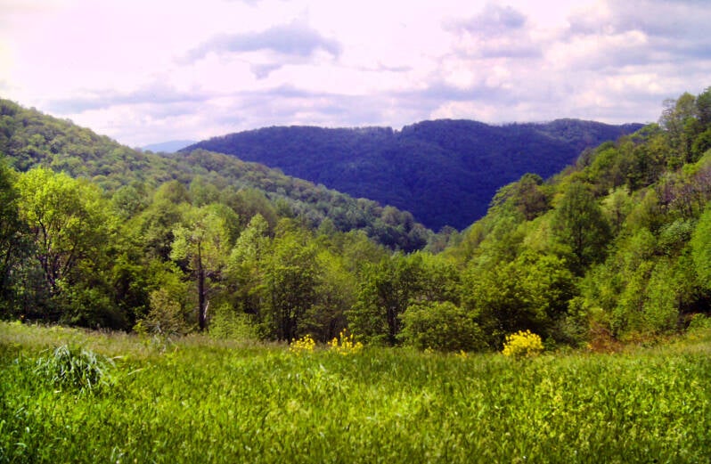
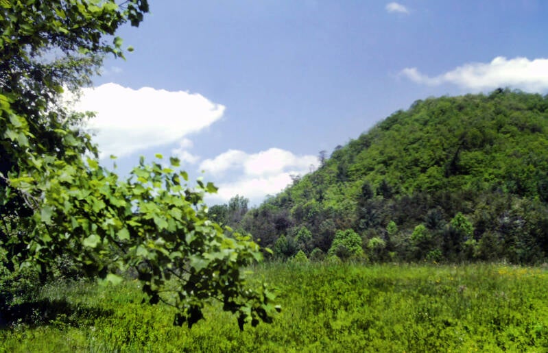
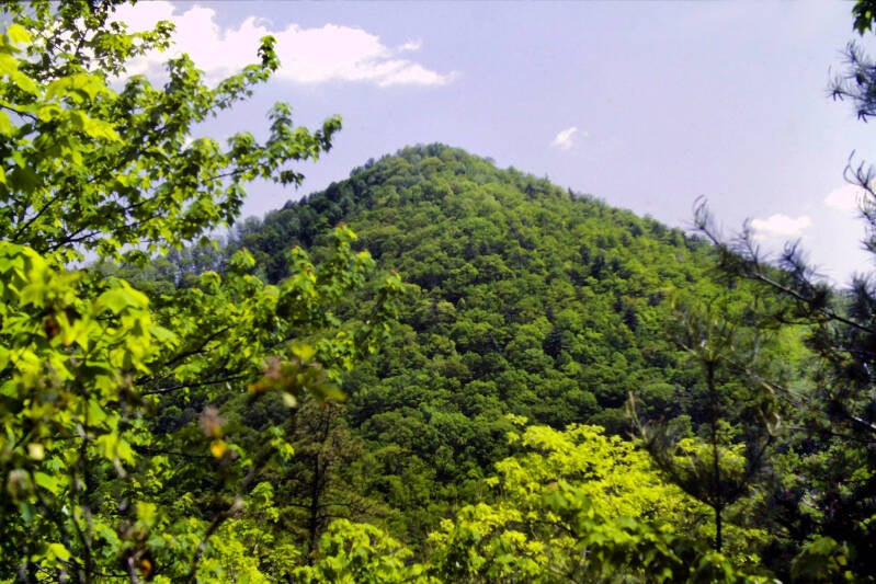
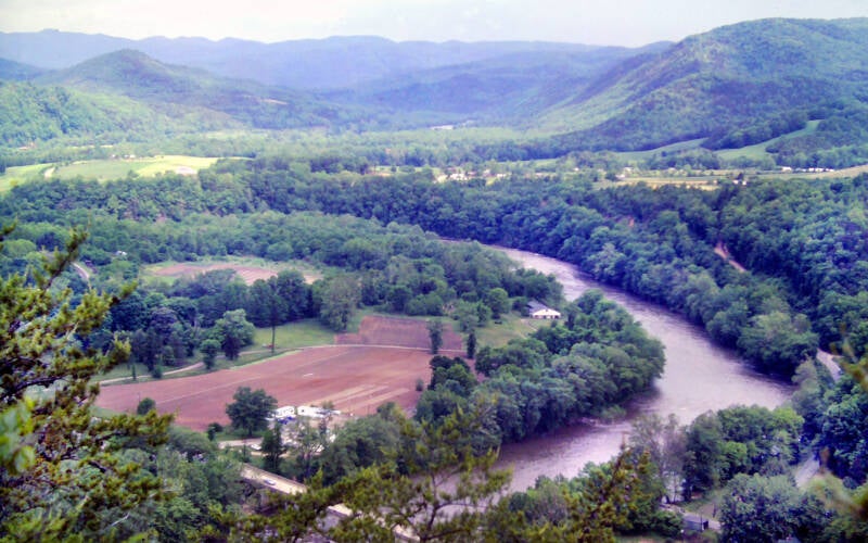
There were especially nice vistas into Tennessee: views of a wide, gentle plain with a couple of solitary mountains rising in the distance from the valley floor.


This day was one of the nicest of my entire life: cool and sunny, without a cloud in the sky until late afternoon. The sky above was an incredibly deep robin's egg blue. Even along the horizons I could clearly see details on mountains that were many miles away.
Still May 27, 1983. Still Chapter 5.
I'm not done. More AT pics here.