My 1983 Appalachian Trail Hike in Photos
I wrote a ton in words in my journal as I hiked the Appalachian Trail. I also shot a ton of Kodachrome slides in that pre-digital age. I've scanned all my old AT slides and posted them with short text blurbs connecting them to their parts of the story. I'd never tried to connect all these slides with all these words before. It helped me remember details of that long-ago hike in new ways. These pages are a chronological visual journal of the hike. Probably one of the oldest thru-hikes on the Internet to get one.
More pics from my 1983 Appalachian Trail hike. Table of Contents is here.
Taconic Range, MA - Danby-Landgrove Road, VT
Still Chapter 18. August 16, 1983.
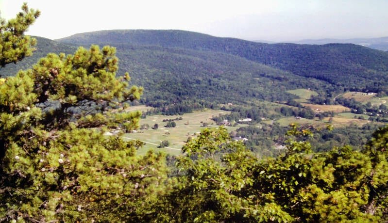
Today began with the final three-and-a-half miles of the eastern fork of the Taconic Range, starting with Mount Bushnell and its excellent views.
Then came Jug End.
Just as Lions Head stands sentinel over the southern flank of the ridge, Jug End is its northern outpost. Near its summit, the ridge crest abruptly ends, the ground plunging steeply towards the valley on both the north and east flanks, providing northward vistas unsurpassed on the range. I could see for miles up the Housatonic valley to the north, the line of the Berkshires to the northeast, and the western fork of the Taconics to the northwest.

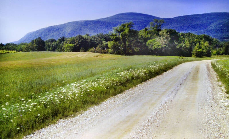
The trail down Jug End had just been relocated. Gone was the killer descent I remembered from my previous trips. In no time, I was on the dirt-surfaced Jug End Road, beginning the five-and-a-half mile Housatonic Valley roadwalk, crossing over from the Taconics to the Berkshires. An excellent little piped spring was located just a quarter mile into the roadwalk, an opportunity to chug water and fill my canteen.
Still Chapter 18. Still August 16, 1983.
Today was considerably hotter and more humid than yesterday, the return to the dog days of August. The Appalachian Trail followed dirt roads for most of the roadwalk, but the final mile or so was on a paved road. The AT crossed the Housatonic River just before reentering the woods to climb into the Berkshire Mountains. The shade was welcome.
There was a lot of ups and downs along the trail, a few decent views. I crossed several brooks -- all dry.


The rest of August 16, and all of August 17 and 18 combined I took no more pics. I shot this interesting old shack on a tiny pond near the summit of Mount Greylock on August 19. I spent all of this time period in the Berkshires and high mountain ponds were a pleasant recurring feature of the Berkshires, so this pic can stand in for Benedict Pond, Upper Goose Pond, Finerty Pond, Anthony Pond and Gore Pond.
We stayed at Mount Wilcox South Shelter the night of August 16 after a 20-mile day. The shelter's resident porcupine gnawed away at the shelter and my sleep constantly all night. We camped for the night next to Finerty Pond on August 17. That followed a 16-mile day featuring another big Massachusetts roadwalk far less pleasant than the Housatonic Valley crossing.
August 18, it rained. Sometimes it drizzled, the rest of the time it came down steady. It rained all day; it never stopped. I plowed through more than 15 miles that day in less than six hours, two sprints sandwiched around a 45-minute break at a shelter, the one place I could get out of the rain all day. We spent that evening enjoying the amenities of a town's community center, which included a TV, hot showers, a sauna, a pool, and some padded wrestling mats on which we could sleep. This thoughtful generosity was abused by some over the years, so no one gets to stay there anymore. Still Chapter 18.
I left the center at 8:00 the morning of August 19. 1983. From there it was a mile of road walking back to the Appalachian Trail. Thick fog and patches of mist lingered in the woods throughout the morning, complimenting the lush forests through which I walked. It hung stationary over the bogs and ponds I passed. I hiked the first nine AT miles with one 15-minute stop at Anthony Pond. The fog was burning off when I hiked the roadwalk through downtown Cheshire, Mass and made the long climb up Massachusetts' and the Berkshires' tallest mountain.


It never completely cleared, as you can see from the two pics above at that pond near the summit. My mom picked me up at the summit of Mount Greylock at the end of a 17-mile day. I was hoping for better visibility when I resumed my hike here the next day. As you can see, I got it.
Now August 20, 1983. Still Chapter 18.
My mom was on vacation and wanted to see some of the mountains she'd been reading about in my journal all summer. I was skeptical at first, but I have to admit she had a great vacation. Turns out if you have a car, there's a lot of stuff to see and do relatively near the trail. She met more people the hours I hiked than I met mosquitos... almost.


There weren't a lot of options to let her see the tops of mountains, but Mount Greylock, with its paved auto road to the summit, was a good one. So, I had her meet me there for the first night, which gave me a second chance at the summit ridge views if August 20 was a better day. It was.
I needed road crossing at both ends for day hiking. Road crossings were far less common up here, especially paved roads.
This gave me some tricky hike planning. On August 20 I was able to wait until a day of slow clearing culminated in crystal clear skies around 3:30. My day was only around 6.5 miles long because I wanted to end it on a paved road. I shot a few pics around the summit and headed down the north side.
Still August 20, 1983. Still Chapter 18.


I carried my backpack today, but it weighed in at a mere ten pounds. I had a warm shirt, a canteen containing about a cup of water, my camera, guidebook, and trail map. That light weight was a big plus, particularly since the trail down the north side of Greylock was much more rugged than yesterday's ascent, with many steep and eroded sections.
Still August 20, 1983. Still Chapter 18.
There were a couple of great views along the descent, from the tops of two knobs. They overlooked the college-town city of Williamstown to the north, with the Green Mountains of Vermont in the background. Otherwise, the hike was an agreeable, uneventful trip through forests of spruce, ferns, and northern hardwoods -- a fitting conclusion to the Berkshires and to Chapter 18.


August 21, 1983. Beginning of Chapter 19. Picking up where the previous day's hike left off, Route 2 in the middle of the bustling college town of North Adams, Massachusetts. The climb out of the Hoosic valley was long, but on a nice section of trail.
The first mile-and-a-half ascended alongside a stream past a variety of cascades and small waterfalls. Next, an old woods road led me away from the brook, climbing along a ridge to the top of East Mountain. There was one steep scramble up a rockslide before the trail broke out of the forest into an open area on the ridge crest with great views southward across the valley. The neighboring large towns of North Adams And Williamstown spread out below, covering a broad, relatively flat section of the river valley.
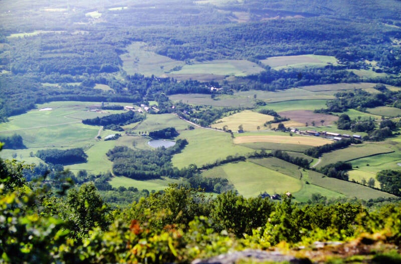
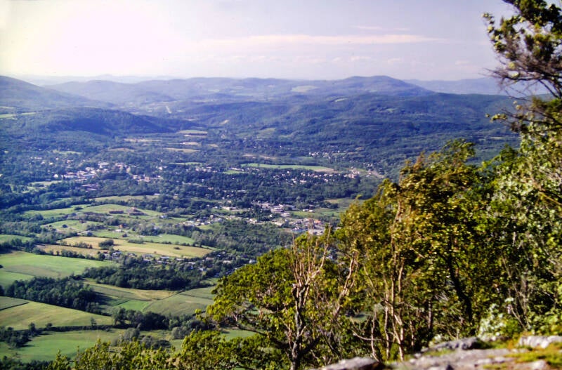
Mount Greylock rose massively as a backdrop to the south, and westward I could make out a northern spur of the Taconics. A short while later, another climb brought me to a spot called Eph's Lookout with similar views. After the second lookout, the Appalachian Trail leveled off as it followed the ridge crest. About a mile later, I arrived at a Green Mountain Club trail register. I was at the Vermont state line and the southern terminus of their Long Trail.
Still Chapter 19.
The initial miles of the Appalachian Trail in Vermont passed through beautiful forests of northern hardwoods, spruce and fir with an abundance of birch trees.
Thanks to the spruce, the fir, the white birch, the sugar maples, and all of the varieties of moss and ferns spreading over the forest floor, today felt like a homecoming for me. The mountains of northern New England were my first love as a backpacker, and many elements of those boreal forests were present here.
This day's hike worked out to almost nineteen miles -- the section of the Appalachian Trail between Massachusetts 2 and Vermont 9, so I wanted a reasonably early start. . . Yeah. I hit the trail at 12:15. This was to be a typical day hiking experience for me.
Still August 21, 1983. Still Chapter 19.

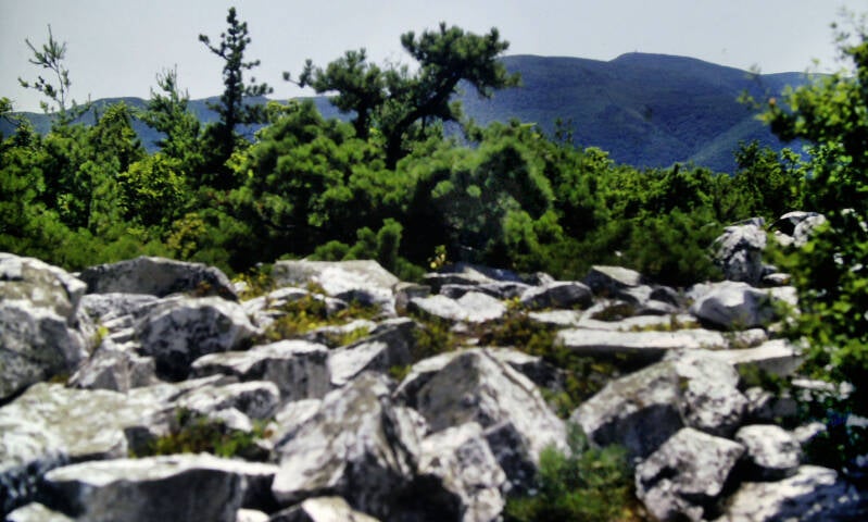
The downside of day hiking with my mother shuttling me to and from the trailheads is she was not a morning person. In spite of the almost weightless backpack I was carrying, every day seemed to be a race against darkness.
I made tracks along the ridge today, racing the sunset.
Near the middle of the hike I crossed the high point of a nameless ridge that was my second 3000-foot summit since Shenandoah National Park. Mount Greylock had been the first.
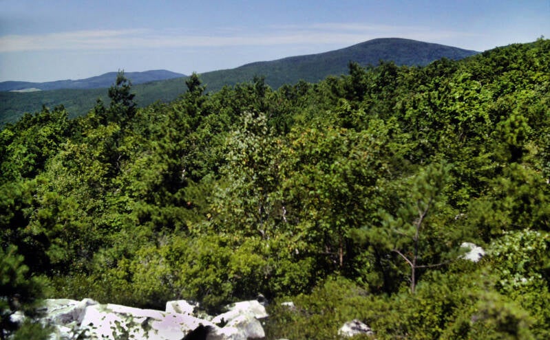

There were a few nice views from this ridge. The brilliant sunshine and brilliant blue sky were just a little more intense due to the altitude and slightly thinner atmosphere. Greater heights lay ahead not very far down the road.
Still August 21, 1983. Still Chapter 19.
Most of my hike today was in Vermont. The Appalachian Trail traverses the southernmost hundred miles of Vermont's Long Trail before turning east near Sherburne Pass to strike out towards the White Mountains of New Hampshire. With more than 1500 miles and about three-and-a-half months of walking behind me, I was in northern New England at last.

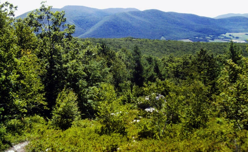
I crossed County Road along the ridge crest seven miles into the hike. My original intention had been to hike the 13.5 miles from Greylock’s summit to this road yesterday, until I noticed that would leave me with a short day today as a result of the lack of road crossings along the trail in Vermont. My guidebook called this a gravel road passable by car. It was in fact a one-lane, rutted dirt track. My mother would have needed to drive her sedan solo over this road yesterday evening to pick me up. Bullet dodged.
A scenic little beaver pond, tiny whitecaps ruffling in the breeze, sat beside the trail just after the descent from that ridge. The AT continued through the woods, passing over a series of small knobs along the ridge crest and skirting the shores of a couple more small, secluded ponds formed by beaver dams in little mountain brooks.
Still August 21, 1983. Still Chapter 19.


Near the end of the nineteen-mile day, I came upon the grassy, scrub-grown summit of Harmon Hill, with the finest views of the day. To the west, the small city of Bennington, Vermont lay cradled in a long green valley surrounded by mountains.
The sun sets on August 21, 1983. Still Chapter 19.
I didn't shoot any pics August 22, so here's another beaver pond from the 21st.
I passed below a power line about two miles into the hike. That is where the first raindrops of the day began to spatter against my face. Soon, I was wearing my rain gear and the rain was coming down steadily. It never completely stopped during the remainder of the hike.


There were a few good lookouts along the wooded ridge crest, and none were totally obscured by clouds. Rather than the usual solid, low overcast, this rainy day in the mountains was marked by a higher, mid-level overcast, with scattered small clouds drifting past at my altitude. The trail elevation hovered in the 3000- to 3500-foot range all day, while the ceiling was at about 5000 feet.
About halfway through the hike, I spent a few minutes at the Glastenbury Mountain fire tower. I walked in a continuous downpour from just past Glastenbury Mountain to the end of today's trail, journeying along boggy ridges speckled with beaver ponds. I came out on the Arlington-West Wardsboro Road at 7:15 -- a half-hour late, but my ride was not there. My mother drove up as I was walking a few minutes later. She had become lost, as the beginning of this road was somewhat difficult to locate. I drove back to the motel. It was a slow ride through all of that fog. I had earned my twenty miles today, and the long, hot shower afterwards.
Night falls on August 22, 1983. Still Chapter 19.
August 23, 1983. A dazzlingly fine day, a beautiful section of trail, another late start. I did not begin hiking until 1:00 P.M. -- partially due to the fact that, as my mother had last night, I missed the very obscure turn-off onto the Arlington Road. Four miles in, I came out of the woods at Stratton Pond, a large mountain lake in a shallow hollow encircled by low ridges. It was a lovely spot, particularly on a crystal-clear day.

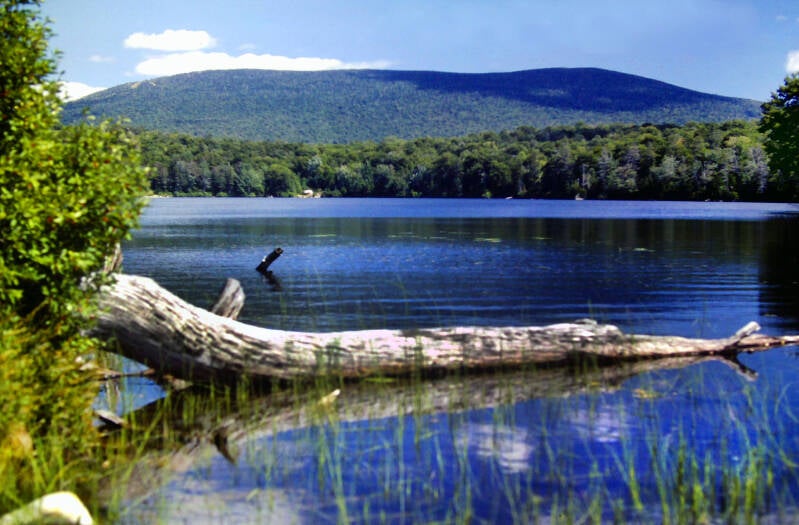
The pond's hollow was a slight depression in a wide plateau which nestled against the western slope of 3900-foot Stratton Mountain. The western shore of the lake gave a picturesque view of that famous mountain.
Still August 23, 1983. Still Chapter 19.
The next six miles of my hike passed through a region recently designated by Congress as the Lye Brook Wilderness Area. It was the old AT route, two miles longer than the current route, but way more scenic, so I took it. This made my official fifteen-mile day seventeen miles long.
The former AT was very rough and poorly blazed compared to the present trail, but it was worth the extra effort and mileage.
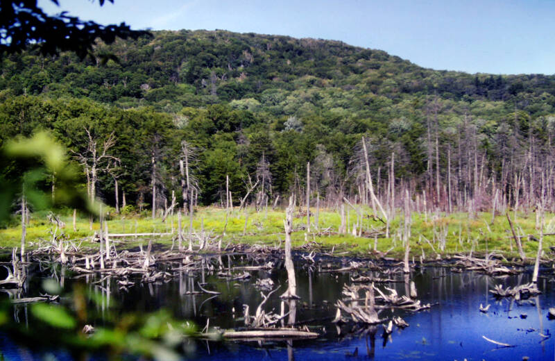
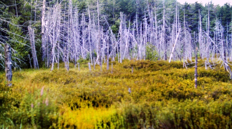
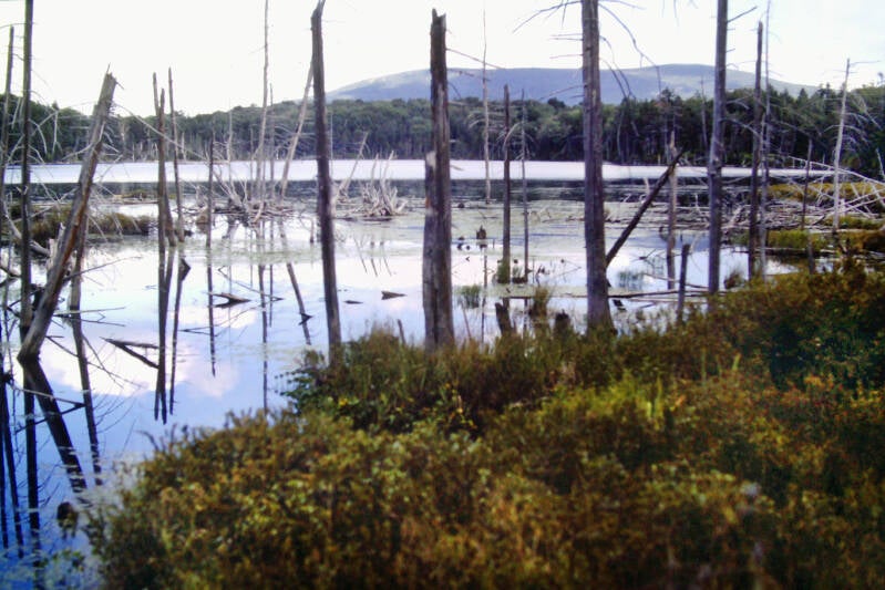
Initially, it skirted the south shore of Stratton Pond, a sparkling cobalt through the trees. After brushing the western shore, with that view of Stratton Mountain, the trail passed through a number of mossy bogs, crossing them on wooden bridging and steppingstones.
I emerged from the woods at Bourne Pond, which the trail skirted with more gorgeous views of Stratton Mountain across the water. Bourne Pond was almost as large as Stratton Pond, and just as lovely.
Still August 23, 1983. Still Chapter 19.

Late in the day, an outcrop called Prospect Rock and a side trip to Spruce Peak each provided sweeping panoramic views of the town of Manchester, Vermont, its green valley, and the surrounding mountains.
I arrived at Vermont 30 at 8:00, a full half-hour late and drove back to the motel beneath an enormous Vermont moon. This was a very different way of seeing the country than backpacking. Then, I saw a long, narrow corridor. Now, I was getting a much broader picture of the surrounding area as well.
August 24, 1983. Still Chapter 19. A 12:45 start. Oh, well. I had four major mountains to climb. I would need to average two-and-a-half miles per hour, rest stops included, in order to complete this section by dark. I kept managing to make day hiking a greater challenge than backpacking.
My first climb featured the largest elevation gain of the day. The trail ascended about 1400 feet in two-and-a-half miles to the summit of Bromley Mountain. The climb was well graded with the exception of a bit of a steep scramble near the top, and I hiked it in about an hour. That took care of the first big climb and still kept me on the pace I would need to maintain all day. It was an encouraging start.
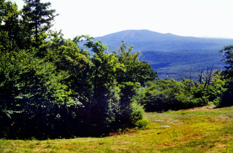

To be specific, I did not quite need to average two-and-a-half miles per hour that day. I had a twenty-minute cushion. So, naturally, I blew fifteen minutes of that cushion atop Bromley's 3260-foot summit.
Still August 24, 1983. Still Chapter 19.
Bromley's summit featured a wooden observation deck, part of the extensive ski development on the mountain, which gave 360-degree views.


Thanks to a mass of dry, crystal-clear air entrenched over New England today, I gazed out upon an expanse of country covering hundreds of square miles, from the Adirondack Mountains of New York in the west to the White Mountains of New Hampshire to the east.
A short, sharp drop into a col, and a brief stiff climb up to the north summit of Bromley. A nice view south across the ridge crest to the main summit.
Still August 24, 1983. Still Chapter 19.

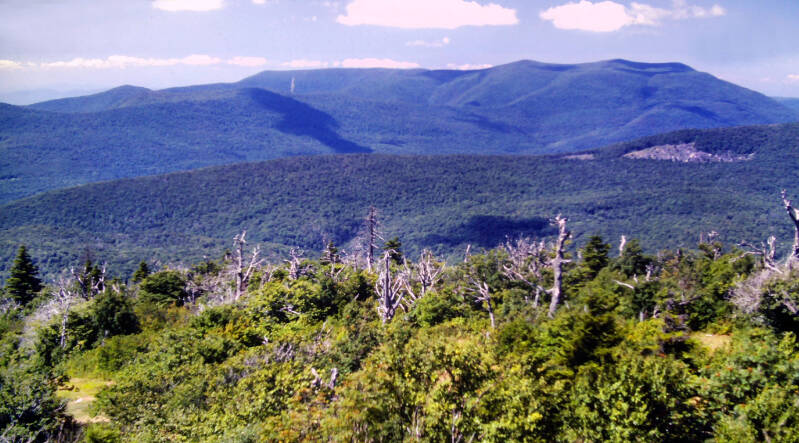
The Appalachian Trail descended very gradually along the north ridge, through a beautiful forest of balsam fir and red spruce. Then I was descending into Mad Tom Notch.
As a backpacker with some New England experience, seeing the word notch in your guidebook could really get the blood pumping and the sweat glands going.
Happily, this notch was nothing like its cousins in New Hampshire's White Mountains. The descent was rather moderate. The climb back out was steep for most of the distance, but not excessively so. The AT climbed about a thousand feet in a bit over a mile from the floor of Mad Tom Notch to the summit of Styles Peak, the second of my four major summits today.
Still August 24, 1983. Still Chapter 19.

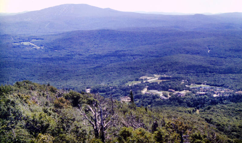
The top of Styles Peak was 3394 feet above sea level -- about 270 feet higher than Bromley's. The views were almost as nice, almost another 360-degree panorama, although not quite as unobstructed. I had to spend a few minutes taking it all in. On almost any other day, this mountain would have been the main highlight of the hike.
It was difficult to tear myself away after just five minutes, but it was 3:45 and I still had eleven more miles to cover. At this time of year, it is almost completely dark at 8:00.
Still August 24, 1983. Still Chapter 19.


The Appalachian Trail continued along a somewhat muddy ridge crest sprinkled liberally with small bogs. The lush spruce-fir forest testified to a damp climate similar in some respects to the southern Appalachians, but this woodland had a completely different feel.
Harsher temperatures and cold north winds here create a starker, more barren-looking rain forest than those down south. There was less undergrowth, no vines and creepers, and none of that riotous, concentrated crush of growth so characteristic of the jungle-like forests of North Carolina and Tennessee. The trees here were slightly more dispersed.
Still August 24, 1983. Still Chapter 19.


I crossed over several knobs along the crest to Peru Peak. This summit, at 3429 feet, was the highest I crossed that day, but the peak was heavily wooded. A side trail led off a few yards from the AT to a viewpoint which was barely a peephole. Nevertheless, I enjoyed this mountain also.
When I was a kid, coniferous forests always seemed to hold a special magic for me, and that feeling never completely went away. Besides, I was in a wonderful mood.
I descended along a rocky trail to a low, boggy area on the ridge, flying over long stretches of log walkways.


The trail followed the eastern shore of Griffith Lake for a while. It was another lovely spot, one of the many large mountain lakes I have passed in New England. I stopped for a couple of minutes on the shore to listen to the rippling of the waters and to savor the views of the surrounding mountains before I went on.
Still August 24, 1983. Still Chapter 19.
The final summit of the day was 2850-foot Baker Peak, to which the Appalachian Trail ascended after leaving the lake. This was the lowest summit of the day, so I was not expecting much.


The Valley of Vermont below to my west dominated the view, tiny villages dispersed among the green pastures and forests of rural New England. U.S. Route 7, as usual, was a rural two-lane winding along the valley floor. Across the valley, the Taconic Range was several winding strands of lower mountains stretching to the north and south horizons. Valley and mountains were backlit by the soft golden light of the westering sun. It was another late day on the trail.
The end of the climb scaled straight up some open rock ledges. A broad expanse of the mountains and valleys to the west, as well as a large chunk of the Green Mountain chain to the north and south were visible. Up ahead were Pico and Killington, the two highest mountains on the Appalachian Trail in Vermont.
Still August 24, 1983. Still Chapter 19.


Because Baker Peak lacked the commercial development of Bromley, this became my favorite vista of the day and a fitting climax to a perfect hike.
That vast mountain view and the rocky crag on which I was standing was reminiscent to me of New Hampshire's White Mountains, the Green Mountains' more spectacular cousins to the east.
Still August 24, 1983. Still Chapter 19.


The final five miles were quietly pretty. The trail passed a succession of scenic little ravines and streams.
I had used up my entire cushion and then some on all of those wonderful peaks and at Griffith Lake and needed to make up some time at the end.
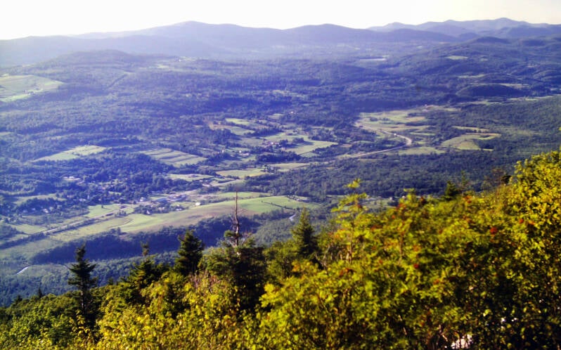

Night was falling like a rock as I cruised the last mile to the Danby-Landgrove Road. I made it to the road at 8:03, having wrung every drop of usable twilight from the waning day. Five minutes later, it was pitch dark.
This brings us to the end of August 24, 1983. Still Chapter 19.
I'm still not done. More AT pics here.