My 1983 Appalachian Trail Hike in Photos
I wrote a ton in words in my journal as I hiked the Appalachian Trail. I also shot a ton of Kodachrome slides in that pre-digital age. I've scanned all my old AT slides and posted them with short text blurbs connecting them to their parts of the story. I'd never tried to connect all these slides with all these words before. It helped me remember details of that long-ago hike in new ways. These pages are a chronological visual journal of the hike. Probably one of the oldest thru-hikes on the Internet to get one.
More pics from my 1983 Appalachian Trail hike. Table of Contents is here.
Harriman State Park, NY - Taconic Range, MA
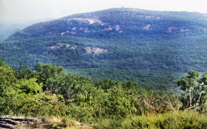
The first climb August 8, 1983 was a bear, even when compared to the rest of the trail in this park. I had hoped that one or two days of hiking would restore all my lost conditioning. By the time I reached the ridge crest, I was exhausted, and I had only come little more than a mile. Fortunately, West Mountain had a lot going for it. The views from up top were the best in the park to that point, and a nice breeze rapidly dried out my sweat-soaked clothes. Still Chapter 16.
There was a place only 11.5 miles up the Appalachian Trail from my campsite the previous night called Graymoor Monastery. The order was formed in Europe during the Middle Ages with a special mission to aid travelers. Learning that the Appalachian Trail passed near their property here, it seemed like a logical extension of that original mission to do something special for the hikers. For no charge, they provided us a cell with a bed for the night, shower and laundry facilities, dinner, and breakfast.
I needed to get there by 4:00 to be accepted. That seemed doable at the start of the day, but thanks to the tough trail and my lost conditioning, that goal was slipping away.
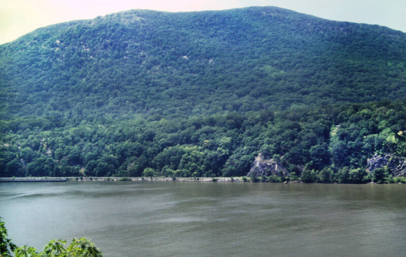
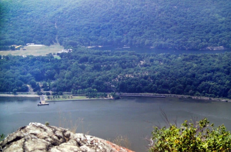
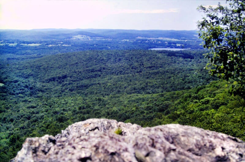
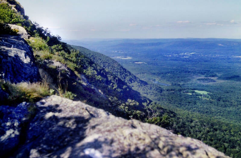
Bear Mountain at 1284 feet is the highest mountain in Harriman State Park. The view is impressive because the mountain rises directly adjacent to the Hudson River, which at this point is only a few feet above sea level. This view along the descent from Bear is of the also impressive heights across the river.
On top of the summit stands a monument. The summit, the views, and the monument can be reached by an auto road. As a result, a lot of cars and a lot of people were up there when I arrived. I took a quick ten-minute break and got started again, even though I was dead tired. The clock was ruthlessly working against me. My last-ditch effort to make it to Graymoor by 4:00 actually had begun on the one-and-a-half-mile climb up Bear Mountain, which I forced myself to do without stopping for any rests -- a major undertaking at this early point in my reconditioning.
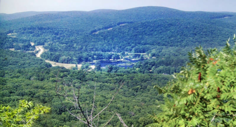
The trail down Bear Mountain was far worse than the trail up. Eventually, the descent came to an end. I emerged from the woods onto some paved paths, skirting a large body of water called Hessian Lake. Dozens of rowboats were out on the lake, which was surrounded by beaches with hordes of people. I passed park benches also swarming with humanity, most of whom seemed to be staring at me, wondering what the hell I was doing walking through that park with a backpack on. I did not do much to reassure them. I could see that most of them thought I was a psycho and that had me constantly breaking out in fits of laughter, which no doubt convinced them.
The trail grew even weirder. It passed under New York Route 9W through a tunnel, a concept which seemed so totally New York that it was perfect.
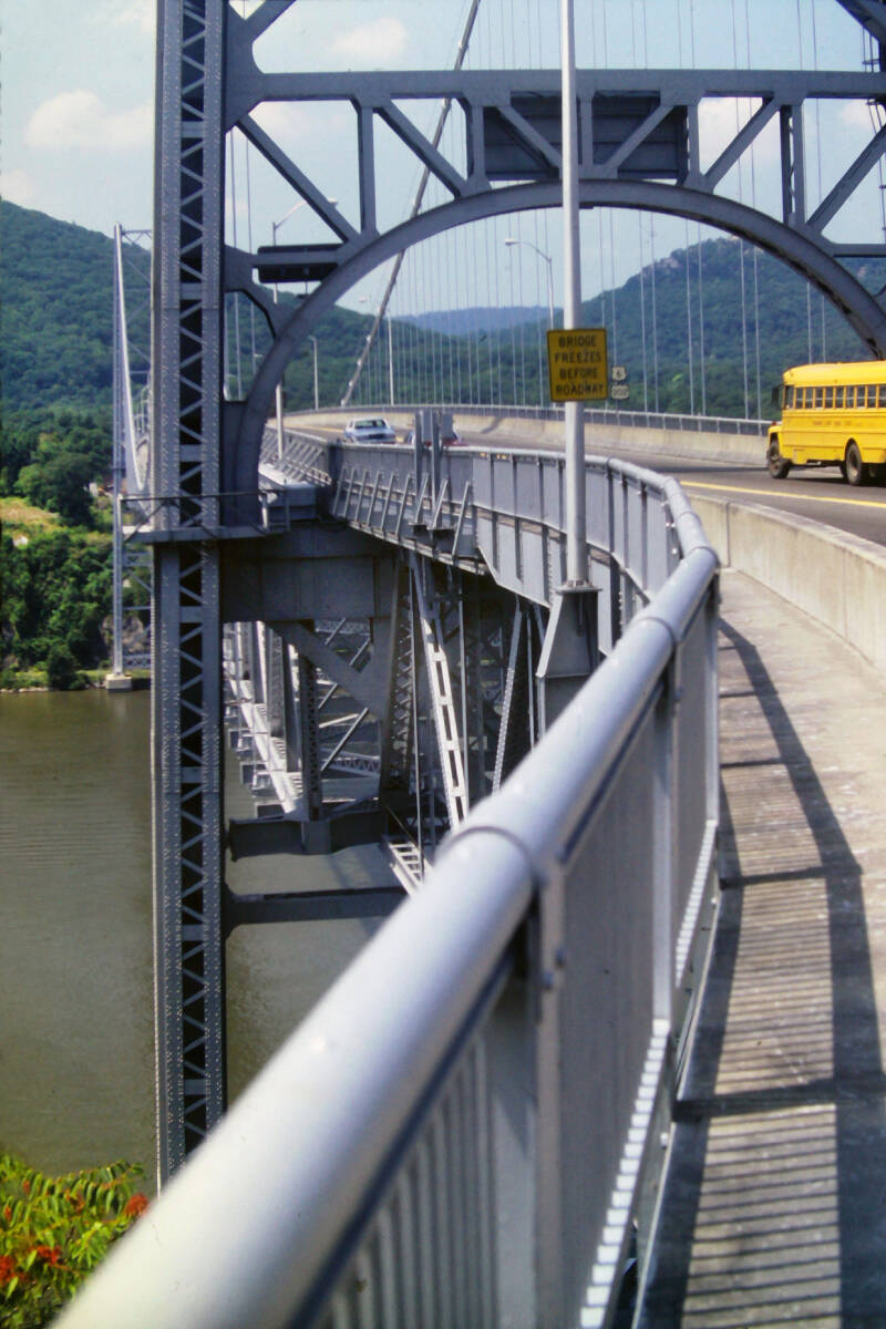

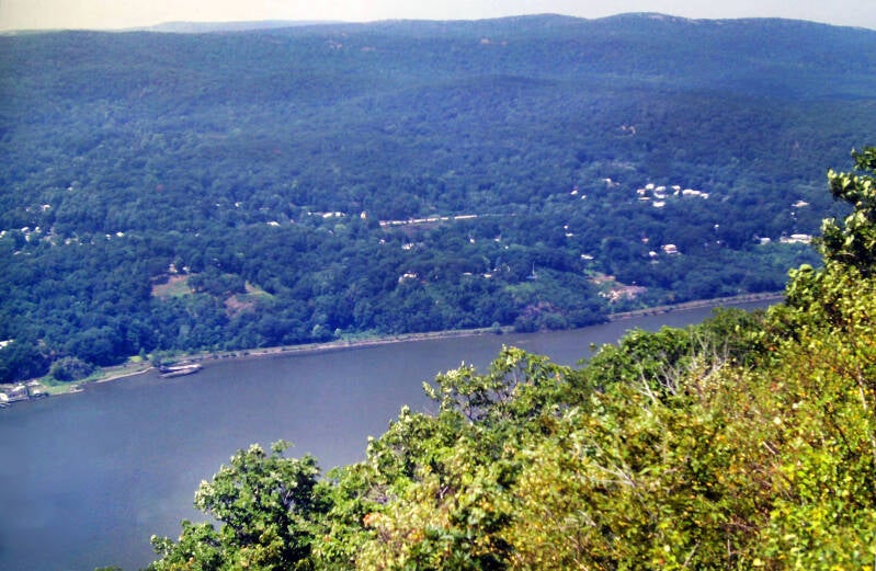
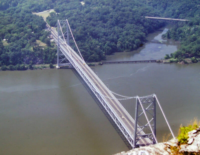
I emerged from the tunnel at a snack bar next to a huge swimming pool filled with screaming kids. I just cannot get enough of these wilderness experiences. I bought a coke at the snack bar and drank it as I walked; I did not have the time to take any breaks. After the pool, the Appalachian Trail followed concrete paths through a nature zoo also packed with people who were gawking at me. I finally reached the pedestrian walkway of the Bear Mountain Bridge, on which the Appalachian Trail crossed the Hudson River. As I was walking across, I saw a kid in the back seat of a passing car taking my picture. I smiled and waved, trying to look deranged. It was a relief to be back in the woods once I reached the other side, but a killer climb tempered that somewhat.
I had hiked the preceding four miles without stopping, in one-and-a-half hours. I now possessed a half-hour cushion with which to work in my attempt to reach the monastery. I stumbled to the top of the ridge, where the Appalachian Trail came out onto an old dirt road. Now, I faced a dilemma: the views from a cliff called Anthony's Nose were reputed to be spectacular, but they were a one-mile round trip off of the Appalachian Trail. If I went for it, I would blow the entire cushion I had just worked so hard to acquire. Did I really want to push myself to the limit just as I was finally starting to find my good hiking pace again?
I dropped my pack, grabbed my camera, and headed down the road towards Anthony's Nose. It was one of the best views since Shenandoah. Nevertheless, I definitely needed to haul butt by the time I got back to the Appalachian Trail. It was 2:30, and I now had one-and-a-half hours in which to hike the final three-and-a-half miles.
I arrived at Graymoor at 3:50, thinking I was ten minutes early. I climbed the long driveway up the hill to the place and found out that the monastery does not accept hikers until 4:30. I was actually forty minutes early. My all-day sprint had not really been necessary, but I didn't regret the experience. My layover had left me flabbier mentally than physically. And that night I had a shower and clean clothes between trail towns.
Still August 8, 1983. Still Chapter 16.
Since I worked so hard to get there, here's another view of the Hudson from Anthony's nose on August 8.
On August 9, 1983, I woke up in time to catch the earliest serving of breakfast at 7:00. This morning's portion of the Appalachian Trail was a number of brief roadwalks connected by short stretches of woodland path. One of the dirt roads it followed was a portion of the old post road between Albany and New York City, dating back before the Revolutionary War.
One last pic of the Bear Mountain Bridge from Anthony's nose on August 8.
Part of the woodland hiking today included a stretch on an old mine railroad bed from the Civil War era. Although spectacular scenery was lacking there was a lot of history along the trail today, and I enjoyed it.
I was hiking with two other guys, a thru-hiker from New Jersey I had just met at Graymoor the previous night and the thru-hiker of sorts I had met my first day back on the trail. At about 12:30, we reached the end of the third and longest roadwalk of the day: a two-and-three-quarter mile stretch along paved and dirt roads.
A state park campsite was just up the road from the point where the Appalachian Trail turned into the woods. We decided to have lunch there. It was a good decision. The site featured a hand-cranked pump which poured out cool, delicious water.
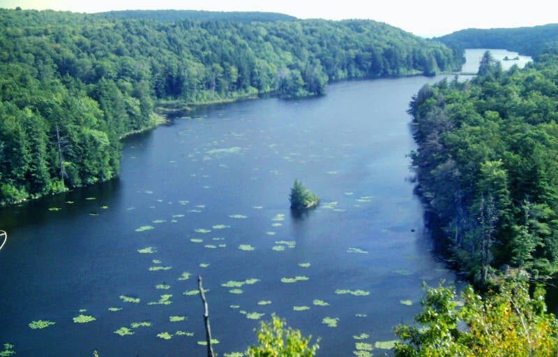
The next few miles were an easy walk through pleasant forests. The Appalachian Trail then crossed New York Route 301 and ascended a very rocky trail alongside Canopus Lake.
Still August 9, 1983. Still Chapter 16.
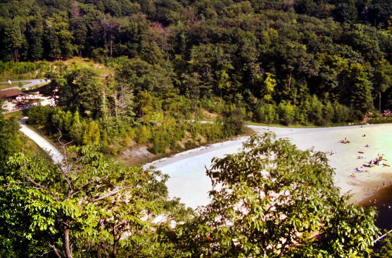
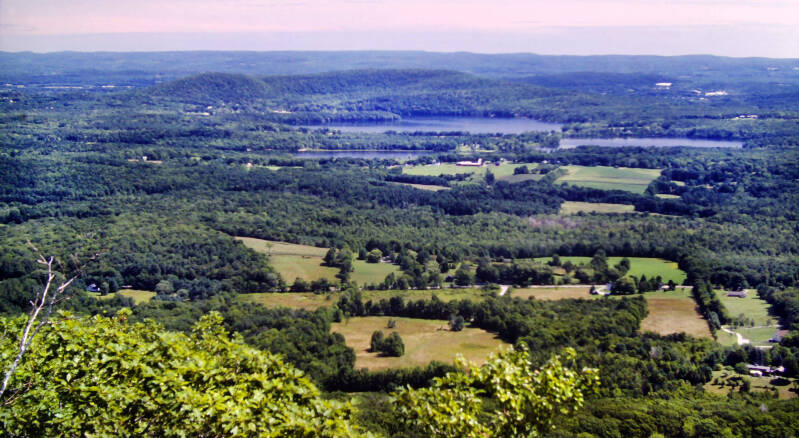
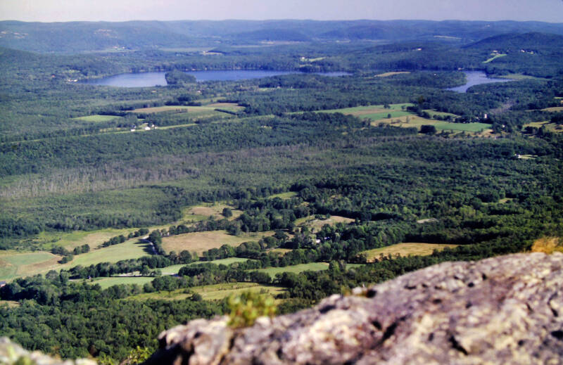
After a couple more miles, we stood on a rock outcrop at the north end of that lake which almost seemed to overlook two different lakes. Looking south, the pristine lake pictured above. Looking down, the massive manmade beach on the lake's north end pictured right and below. A very steep side trail -- virtually a rock climb, led down towards the beach. We dropped our packs and headed down off the mountain. Our objective was a snack bar adjacent to the beach. Sadly, we arrived at 4:30, just after the grill had closed. I had to content myself with nothing more than a huge, icy coke, three ice cream sandwiches, and bag of potato chips.

The trail up to the summit of Shenandoah Mountain was a breeze. The open summit (pictured below) featured the first real views of the entire day. We sat up there for a half-hour, enjoying the sunshine, cool breezes, and some rare haze-free vistas. I was the last to leave, heading down the mountain at 6:00 with three miles remaining to tonight's destination.
Still August 9, 1983. Still Chapter 16.
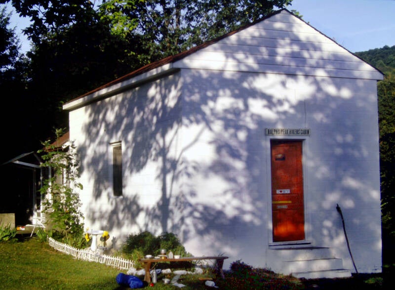
The path down was the best maintained trail I had yet seen in New York or New Jersey. I made tracks. It was the best hiking I have managed since my layoff. I arrived at the Ralph's Peak Hikers Cabin at 7:00. It felt great to move like that again, especially at the end of a long day. I had walked 19 miles on August 9, finally feeling almost my old self again.


Ralph's Peak Hikers, the local AT maintenance club, had restored an old farmhouse and furnished it with beds, a kitchen table, and various other amenities. It was a delight.
I took a pic of it the next morning.
Still Chapter 16.
August 10, 1983. The initial six miles were almost all on forest paths, climbing over a couple of mountains. The trail was well laid out, and even contained the first real switchbacks I can remember seeing since Virginia. I had an enjoyable time on the climbs. I hiked them at my good old pace without any rest stops. The next section of trail was a twelve-mile roadwalk.
Finally: a day with a high only in the seventies and low humidity for one of my long roadwalks. Hell, it felt downright chilly waking up that morning. It was the first real break in the long heat wave since early June.
It was a quiet, rural stroll, mostly on small, shady lanes through attractive forests and quiet residential neighborhoods. I had two other hikers for company. August 10 was the first real break in the long heat wave since early June. Five miles into the roadwalk, I bought a mess of snacks for first lunch. Five miles further and slightly more than an hour later, we stopped at a little town park in Pawling, New York, that contained a small lake with a tiny beach, a snack bar, and a picnic area.
My second lunch was two burgers, two orders of fries, and two cokes from the snack bar. For some reason a nice older lady who must have thought we looked hungry brought us some coke and potato salad that were left over from the picnic. As thru-hikers, our stomachs would never have forgiven us tomorrow if we turned down food today, so....
We also accepted her invitation to stop by her house, which was a mile ahead, directly on our roadwalk, and have a cold drink.


We did not leave her house until 6:00, with more than eight additional miles to the shelter. About two hours of daylight remained. At the house, we learned that it was supposed to rain tonight, so we were determined to make it. I arrived at the shelter at 8:30, walking the last mile was in the dark. For some reason, nobody felt much like eating dinner.
August 11 was even cooler, featuring the first all-day rain I have encountered since the Blue Ridge south of Shenandoah, so here's one more pic from August 10. A few miles into the day, the AT climbed up Schagticoke Mountain into the rain clouds, and I was back in Connecticut and New England at last. A few miles later we were in the village of Kent. My mother met us and gave us a ride to a nearby motel. It was a short 9-mile day, bringing August 11 and Chapter 16 to a close.

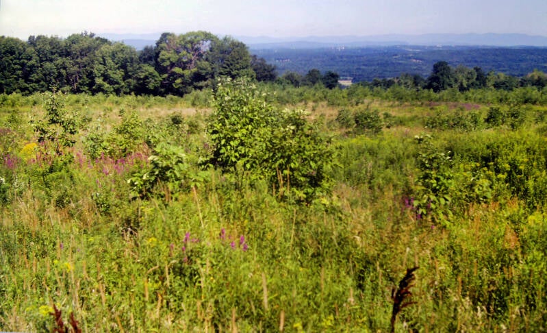
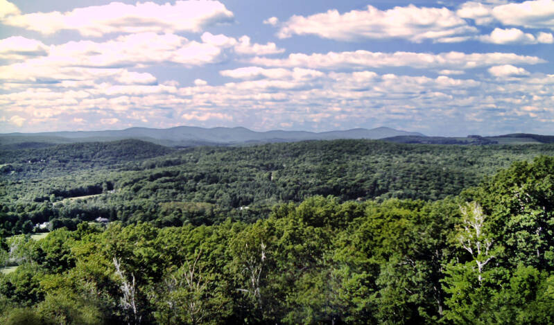
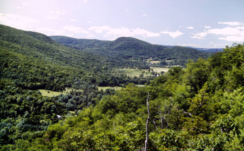
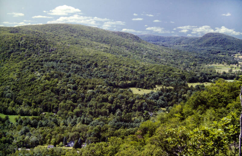
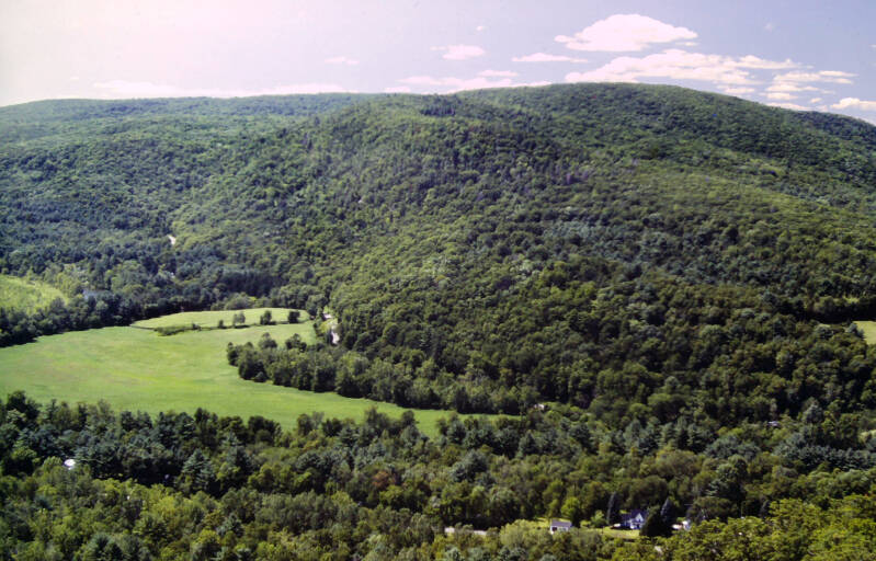
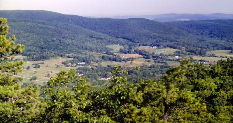
Chapter 17, August 12. The rain had tapered to a fine mist when we reached the AT. The first couple of miles were on rural paved roads. We entered the woods for the passage through Macedonia Brook State Park. The entire state park, no longer on the AT, was beautiful, one of the nicest stretches on the Appalachian Trail since Shenandoah National Park in Virginia. Encircling the summit of Cobble Mountain was a sprawling, rocky meadow with extensive views to the north and west, overlooking a lush, green valley filled with forests and pastures in the foothills of eastern New York State.
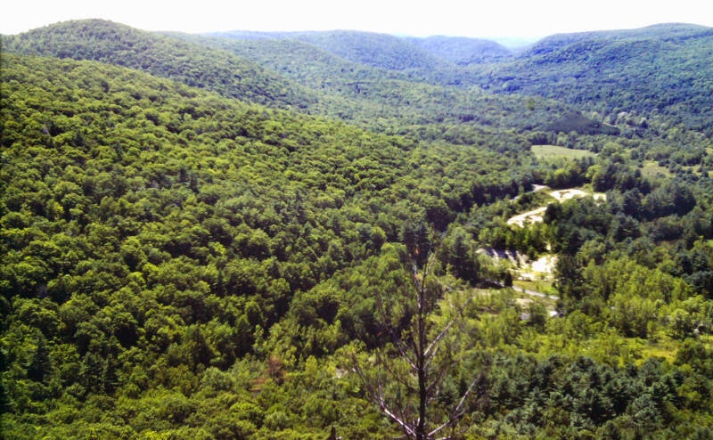
In Four Corners Campground, still in the state park, there was a pump for drinking water. We had dinner there. With dinner out of the way and full water bottles in our packs, we were free to camp wherever we could pitch our tents. Several miles later, the trail climbed up to a summit called Calebs Peak covered by a pleasant, open forest with partial views over the Housatonic River Valley below. We pitched our tents on a little patch of grass beneath the trees and made our camp for tonight, having come nine miles on this short day.
Still August 12, 1983. Chapter 17.

August 13, 1983 was still cloudy and even chillier when I woke up. The first nice view of the day was a mile up the trail, from St. Johns Ledges -- a hundred-yard stretch of open ledges perched atop high, steep granite cliffs overlooking the Housatonic River Valley. I reached it just as the morning clouds were drifting off over the eastern horizon and the day was turning fine.
The Appalachian Trail then clawed straight down the face of the cliffs. It was quickly over, though, and I was soon walking River Road. River Road was a gravel road running along the western bank of the Housatonic. After a mile, the road was gated and closed to vehicle traffic.
Another St. Johns Ledges pic.
Since 1938, the Appalachian Trail had continued to follow the road north from here along the river past the old washed-out bridge site. The road continued through several plantations of towering white pines. The one tricky stretch of hiking was along the mile or so after the Appalachian Trail left the road and passed through dense concentrations of tall weeds in a riverside marsh. At the end of River Road was a cold and excellent spring. Still August 13.
The trail passed through several magnificent groves of hemlock and pine as it wandered over some low hills and through a small, dark ravine on its way to US 7 at Cornwall Bridge. I crossed the river and arrived in that little New England village at 10:30 this morning, with eight miles already under my belt. A free 25-oz. beer and a large lunch purchased at the deli tempered those expectations. After a mile of roadwalking, the Appalachian Trail went into Dark Entry Ravine, ascending through the perpetual twilight silence of an old hemlock forest. Above the ravine were some excellent views into Cornwall Valley.
Next up was an awesome forest of towering, ancient hemlock known as Cathedral Pines a couple of miles later. In between was an attractive roadwalk through a high farming valley filled with fields of corn and encircled by mountains. Mohawk Mountain had some superb viewpoints from the ski area, but we could not find water, and the spring at the shelter was bone dry. We finally found a nice, running stream alongside US 4 about a mile later, where we sat down and made our dinners.
Once again, we were going to have to make camp before we reached the next water, so we took care of dinner when water was at hand. There was a quick two-mile roadwalk before the Appalachian Trail climbed gradually up a ridge on an old dirt road which followed the route of an even older Indian trail. We pitched our tents at the edge of a farmer's field at 8:00. Even with the beer and all in town, I managed to hike twenty miles and have fun. August 13, 1983 was a good day. Still Chapter 17.
On the morning of August 14, about four miles from the previous night's campsite, I came to a grove of beautiful old pine trees. In the middle of the grove, next to a small rushing stream, was a solitary picnic bench, where I took my first break. The day was cool, breezy, and sunny. A bit later, Dean Ravine was a pretty chain of small waterfalls and cascades in a deep, narrow valley filled with pine and hemlock. The trail turned into a virtual rock climb straight up the face of a cliff to the top of Barrack Mountain.
Barrack Mountain was a rather sadistic climb for a backpacking trail, but some open ledges near the summit offered great views to the north and to the south -- some of the nicest since Shenandoah National Park. Another excellent vista looking westward from a point just beyond the summit immediately proceeded an almost-vertical plunge down cliffs to US 7. After that tough traverse of Barrack Mountain, the Village Diner was a welcome sight. It was directly on the Appalachian Trail, at the crossing of US 7. I called home about 2:00 and made arrangements with my brother for him and some other friends and relatives to meet me at 5:00 in the village of Salisbury, Connecticut.
The spot was almost nine miles up the trail. I am not and never will be a super-fast hiker. Even while struggling to reach a shelter at the end of a long day, I am constantly distracted by views, possible photographs, etc. I probably must work harder to average two-and-a-half miles per hour over a given stretch of trail than most thru-hikers need to work in order to average three miles per hour. Yet here I was, promising to meet people nine miles up the trail in less than three hours. I paid for my meal and started making tracks. Still Chapter 17. August 14, 1983.
There was a three-and-a-half mile roadwalk as the AT crossed the Housatonic one last time. The final half of the roadwalk was a steady climb back out of the valley. The trail reentered the forest and followed a stream up the lower slopes of Prospect Mountain. Despite a short, steep pitch on the climb up alongside Prospect Falls on rock steps and iron ladders, I continued without stopping. I kept walking, telling myself I would take a break in a little while and pretending to believe me.
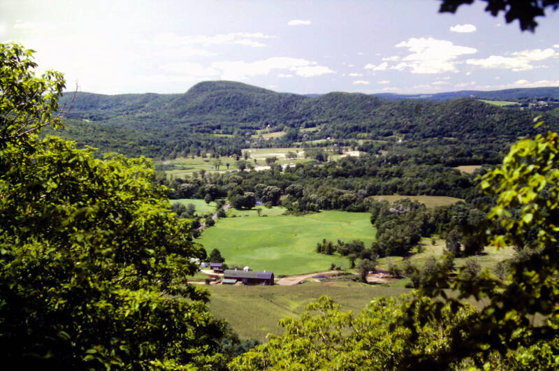
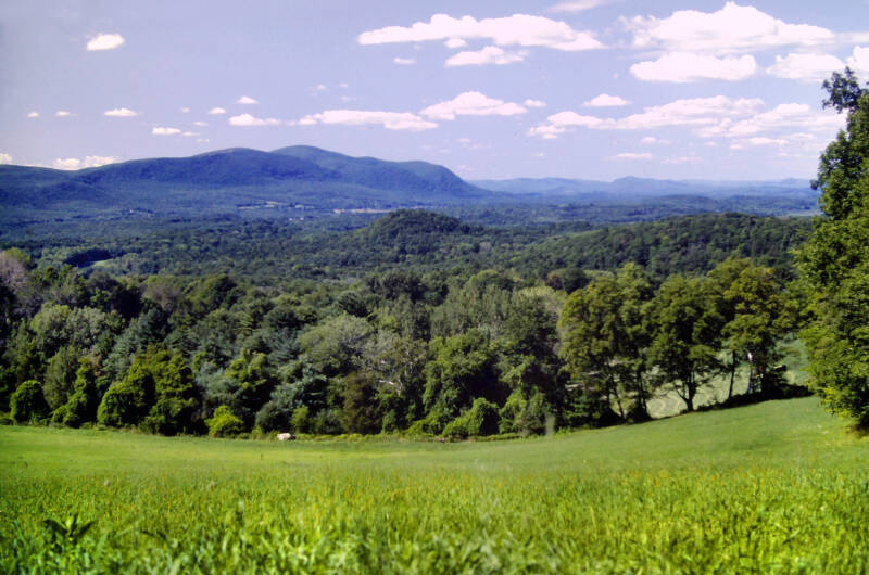
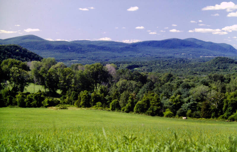
After another half-mile, I dropped my backpack and carried my camera five hundred feet down a side trail to Rands View (pictured above, right and below), a spot at the top of a high, sloping pasture where a remarkable view northward revealed the Taconic Range from Lions Head to Mount Everett. It was such a nice spot I had to sit down for a couple of minutes to take in the views and shoot a few photographs before continuing my dash to the rendezvous.

Near the beginning of the descent to Connecticut 44, a skunk stood in my path, showing no immediate inclination to move aside. I did not feel like pressing the issue, so I sat down and took my second break. He moved on a couple of minutes later, and so did I. The descent was steep, but not sadistically so. I soon reached Connecticut 44 and began the final half-mile, all roadwalk, to the rendezvous. I actually managed to arrive before 5:00. I sat down to wait for my guests. They had brought with them cases of beer, and they held me down, twisted my arm, poured beer into my mouth, and forced me to swallow the vile brew. It was awful.
I fell asleep sometime around 2:00 in the morning. I awoke at 7:00 August 15 and lay there for about an hour. I had a healthy breakfast of beer and Pop-Tarts. It took us about an hour to collect all of our garbage and return the area to its pristine condition. At 11:00, everybody said good-bye and headed down the trail to my cousin's van. A thru-hiker friend showed up at about that time. Together, we headed up the mountain. Still Chapter 17.
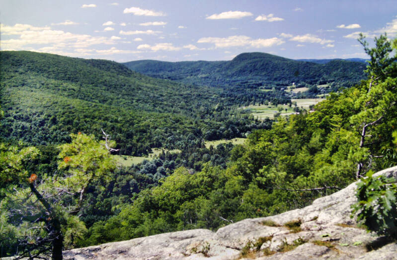
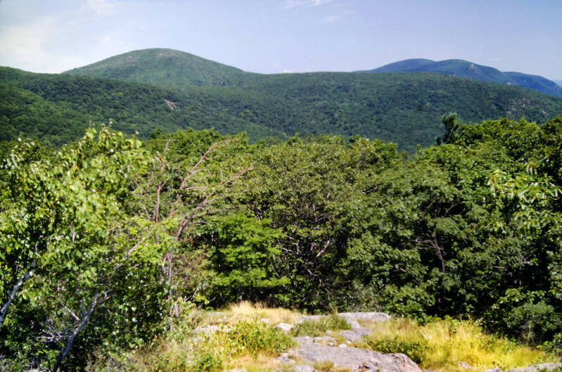
The ensuing stretch of trail, from Route 41 to Jug End, was the second of the three small segments of the Appalachian Trail in Connecticut on which I had already hiked prior to this trip. Tired and hung-over, somehow, I made it up the two-mile climb to Lions Head. The southern portion of the Taconic Mountain chain is basically two parallel ranges separated by a high central valley. The Appalachian Trail follows the eastern range. In Connecticut, this range consists of a high, wooded plateau called Mount Riga, with the rocky crag of Lions Head rising from its southernmost tip. This location provides the peak with spectacular views to the south and east, across the Housatonic Valley, of a rugged, hilly country of forests, lakes, and small farms. These were easily the best views since Shenandoah, and I knew from previous hikes that the views only improve as you head north.
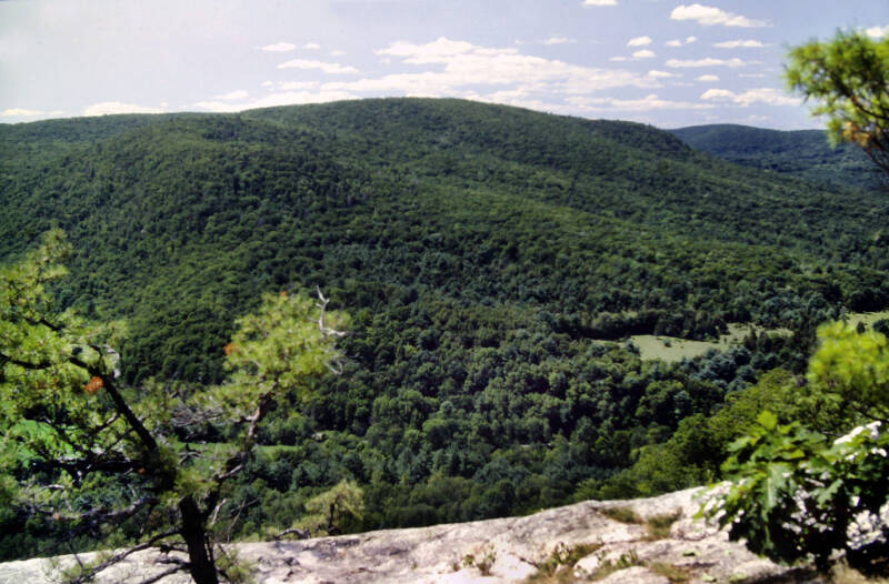
I took a long break on Lions Head. Just past the summit was another great outlook, to the north this time, of the high plateau, with Bear Mountain rising above its northern end.
Still Chapter 17. Still August 15, 1983.
I took another lengthy break two miles later at the new Bond Shelter. I read the register and gulped down about a half-gallon of water from the nearby brook in order to combat a severe case of cotton mouth.
After the shelter, the Appalachian Trail ascended Bear Mountain, the first 2000-foot summit over which the trail actually passed since Shenandoah National Park. The climb was very rugged, but the trail ascended through low, scrubby pines past naked rock ledges with constant views to the south, east, and west. Nice views always make a difficult climb seem easier.
The summit was crowned by the ruins of a stone monument built in 1885. The monument now consisted of a large, disorderly pile of rocks, and the cement platform which used to sit on top now rests near the bottom. The panorama from atop the rock pile is still spectacular, with legitimate 360-degree views.
The Appalachian Trail descended steeply down the cliffs which constitute the northern face of Bear Mountain into a deep, narrow, densely wooded ravine.
As I entered Sages Ravine, I crossed the Massachusetts border. Ten states down and four to go.
A wide, roaring brook teeming with cascades, small waterfalls, and deep, quiet pools, knifed a deep cleft through the ridge. In many sections, steep cliffs towered over the banks of the brook.

I sat down by the south bank of the brook to take my third long break in less than seven miles of desultory hiking, once again guzzling large quantities of cold water to relieve my cotton mouth.
Chapter 17 of my Appalachian Trail story was over. Now began Chapter 18 of my story.
Still August 15, 1983.
From Sages Ravine, the Appalachian Trail climbed steeply to another wooded plateau. In the middle of a cool dark hemlock forest, it crossed Bear Rock Stream near the eastern rim of the plateau.

I took a short side trip to one of my favorite places on earth, following the stream east off the trail for about fifty yards, where the flat ground ends with an abrupt stroke of a giant axe and a high cliff towers above the upper Housatonic Valley.
The southern tip of the Berkshires seemed to spring just as suddenly from the flattish valley floor a few miles away on the eastern edge. A few feet behind me the stream plunged over the edge of the plateau, the beginning of a long series of cascades. I took another fifteen-minute break there.
Still August 15, 1983. Still Chapter 18.

From Bear Rock Stream, the next mile-and-a-half of the Appalachian Trail ascended Race Mountain, picking its way up a boulder-strewn slope softened by a carpet of fallen needles from the hemlock. The last half-mile threaded a narrow perch atop a series of massive naked rock cliffs.
Then the Appalachian Trail crossed another rocky, scrubby summit area. Hawks drifted lazily on the smooth thermals of a mid-August afternoon, soaring high above the valley below.
Still August 15, 1983. Still Chapter 18.


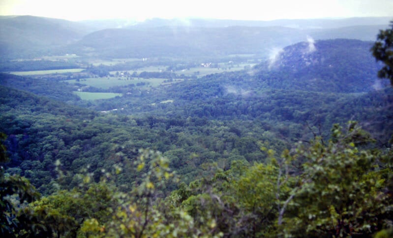
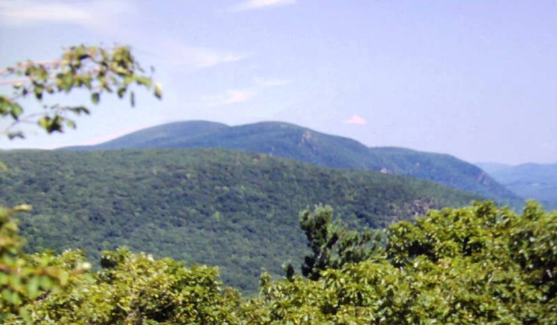
From Race Mountain's summit we had a clear close-up view of Mount Everett, the highest peak in the Taconics at 2602 feet, and its fire tower. There was a deep sag in the ridge between Race and Everett.
A long, steep descent into that sag was followed by the longer, steeper climb up Mount Everett. The fire tower, which was closed to the public (wink, wink), gave sprawling 360-degree views over miles of mountains, hills, lakes, and valleys.

Although it was warmer and more humid than recent days, the visibility was fairly unobstructed.
Still August 15, 1983. Still Chapter 18.
The Appalachian Trail descended from the summit to a state picnic area near Guilder Pond. The wind-rippled surface of only the second-highest pond in Massachusetts lies 2042 feet above sea level -- a greater altitude than on any mountaintop the AT had climbed since Virginia - before today.


We obtained water at a stream crossing just past the picnic area and walked on a little further to a flat piece of ground on the southern slopes of Mount Undine, where we set up camp for the night.
One more pic from Race Mountain.
Twelve-and-a-half miles over terrain like this was enough of an accomplishment for a day during which I was nursing the Godzilla of hangovers.
One more pic from Mount Everett.
Still August 15, 1983. Still Chapter 18.

I'm still not done. More AT pics here.