My 1983 Appalachian Trail Hike in Photos
I wrote a ton in words in my journal as I hiked the Appalachian Trail. I also shot a ton of Kodachrome slides in that pre-digital age. I've scanned all my old AT slides and posted them with short text blurbs connecting them to their parts of the story. I'd never tried to connect all these slides with all these words before. It helped me remember details of that long-ago hike in new ways. These pages are a chronological visual journal of the hike. Probably one of the oldest thru-hikes on the Internet to get one.
More pics from my 1983 Appalachian Trail hike. Table of Contents is here.
Baldpate Mountain, ME - Jerome Brook Lean-to, ME

Still September 15, 1983. Still Chapter 22.
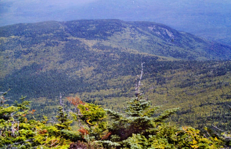
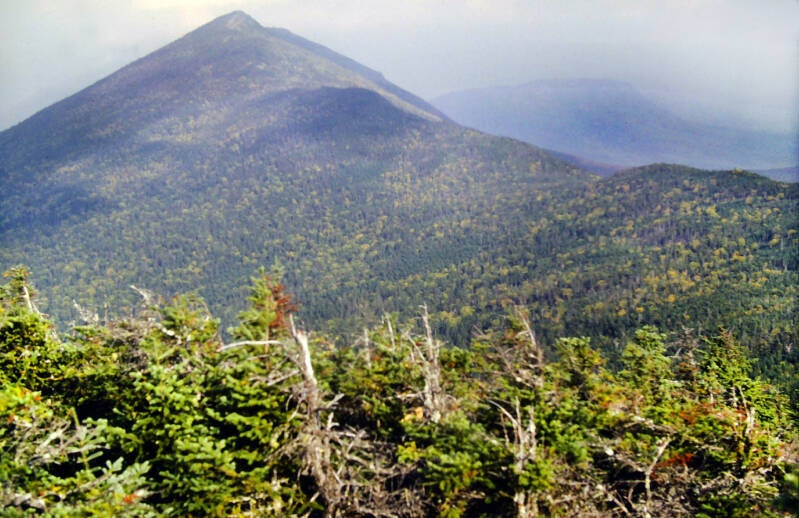
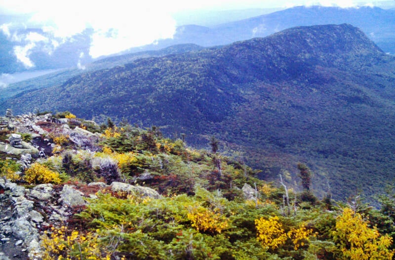
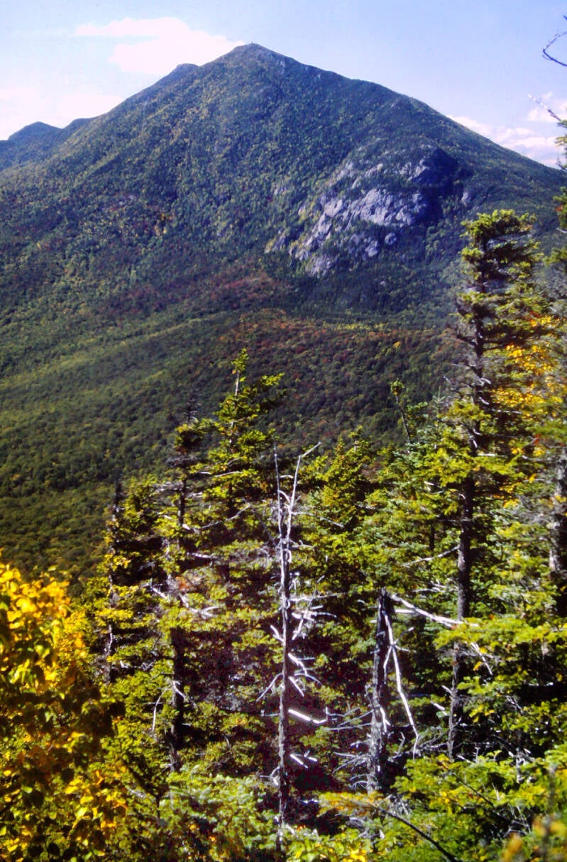
Looking back at Baldpate's west peak as I climb the east peak to the main summit.
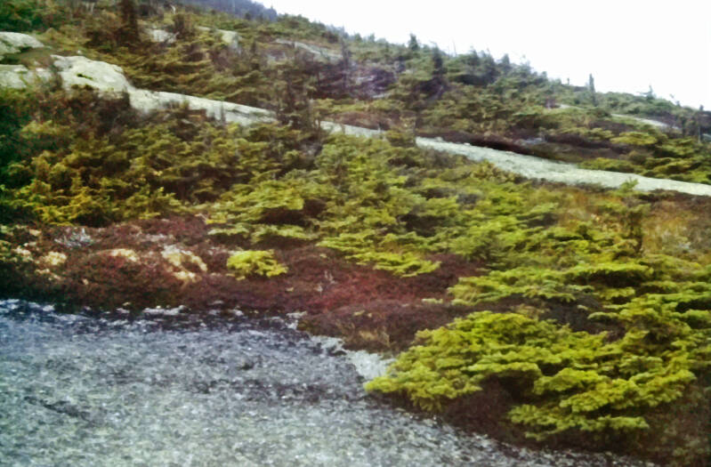
A stiff wind was blowing up there on the west peak to augment the cold. I did not linger long. Another steep trail dropped from the west peak down into a sag. The crest was partially open to the views and covered with stunted conifers and some alpine vegetation.
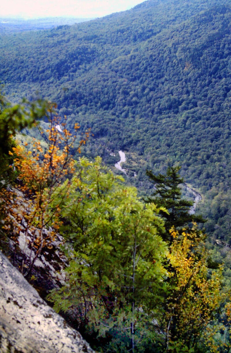
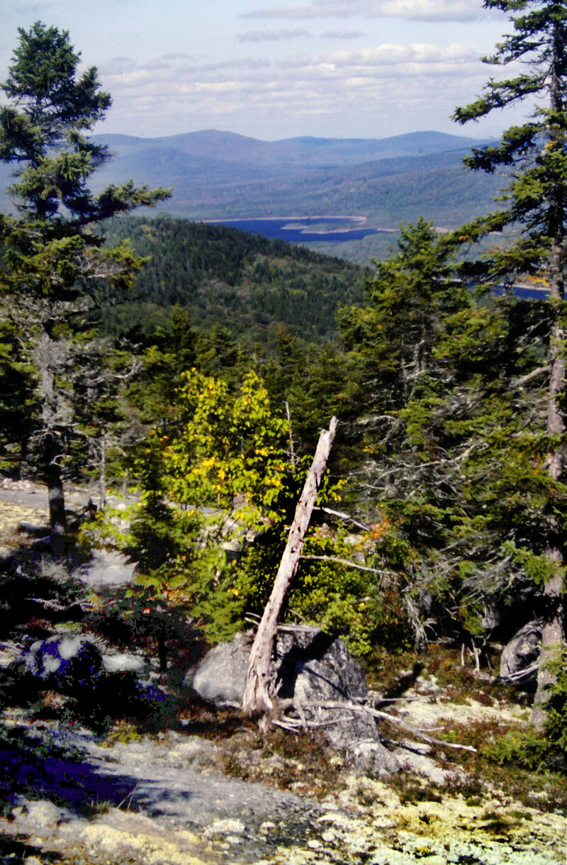
After a brief leveling-off, the Appalachian Trail scaled the steep stone wall of the south face of Baldpate's main summit. It was a grueling climb coming so soon after that initial ascent to the ridge, but worthwhile in every respect. All the way up, I had outstanding views like this one of the west peak, with Grafton Notch and Old Speck in the background.
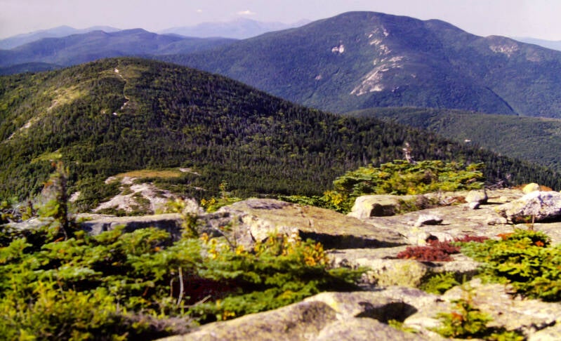
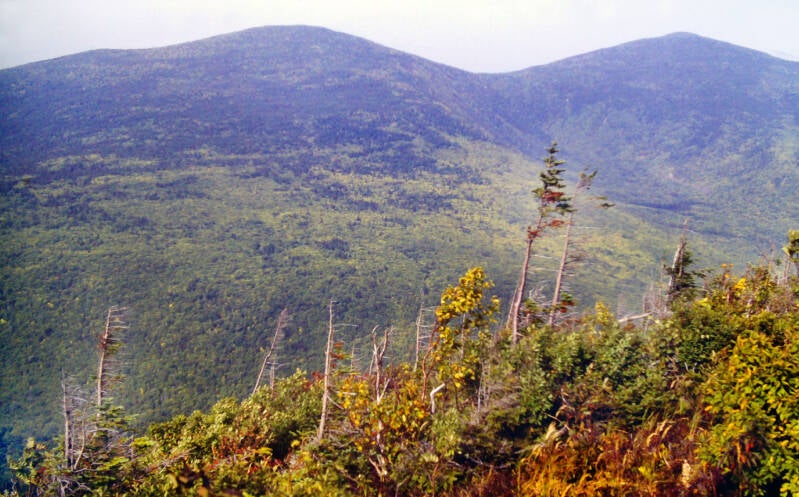
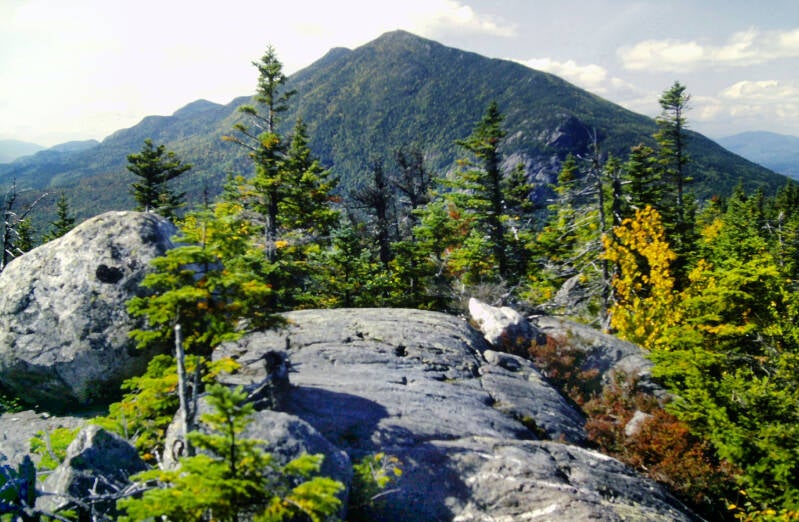
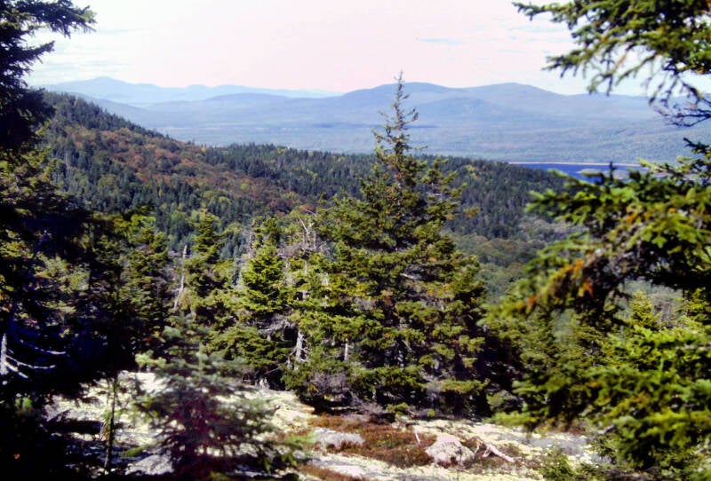
From the rocky, alpine summit, there was a panorama which included a large portion of the Mahoosuc Range. In many respects, Baldpate's long ridge crest was like an instant replay of the Mahoosucs.
The vast majority of the morning's hike thus far lays out in this pic of the west peak and the ridge beyond.
Still September 15, 1983. Still Chapter 22.

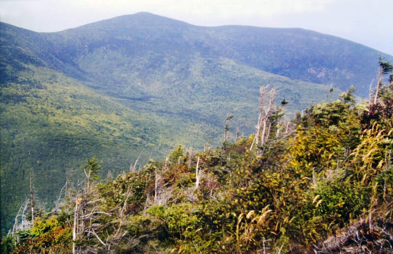
The ridge remained open for more than an additional half-mile, as I descended sharply over rocks into a steep little gap and ascended the small, rocky crag of Little Baldpate, which had excellent views north across a deep valley towards Wyman Mountain, Hall Mountain, and their surrounding foothills. Shortly after crossing that summit, the Appalachian Trail finally dropped below tree line at the beginning of another long, steep descent into Frye Notch.
Not far past the notch, the character of the trail suddenly changed. The remaining miles of the day were the easiest hiking I had seen in weeks, although views were a lot sparser. The Appalachian Trail crossed the West Branch of the Ellis River at the top of a sixty-foot-high cascade. I eventually arrived at the Hall Mountain Lean-to at 4:45, having completed a respectable sixteen-mile day despite the very slow start.

The shelter was located in a shallow sag between two knobs of Hall Mountain. The spring was not running strongly when I got there, but I scraped the scum off the surface and collected my water for dinner and breakfast. More than a pint of good drinking water remained in my canteen, so any water I used from the spring would go into something boiled. The next day, I had a one-mile descent to the next good, running water in Sawyer Notch.
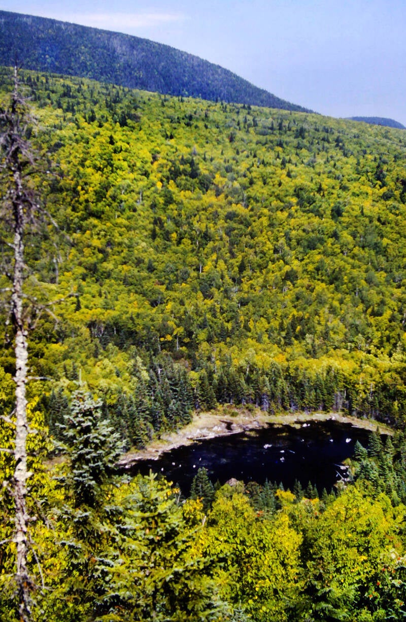
A side trail from the shelter is a five-minute walk to the top of some cliffs with another great viewpoint of the Appalachian Trail route northbound, extending all of the way to the Saddleback Range in the distance. I sat there for about a half-hour in the twilight after dinner, sipping hot chocolate and savoring my dessert Pop-Tart. It was an extremely civilized conclusion to a day which had everything: an alpine ridge walk, a long cascade in a scenic notch, another nice mountain pond, and an extended stretch of decent hiking at the end.
Bringing us to the end of September 15, 1983. Still Chapter 22.
I settled for nine big miles September 16, 1983, calling it quits at 2:30. A series of small and large problems put a premature end to my hike.
I awoke at 6:15 and was on the trail by 7:45. I felt reasonably well, but a couple of minor ailments which have been plaguing me lately were acting up: a partially torn-off right big toenail and a sore tendon behind my right knee. Annoying, but nothing I couldn't handle. What did slow me down today was the absolute ruggedness of the Appalachian Trail over the initial six miles.
The descent into Sawyer Notch from Hall Mountain was long and steep, threading along a crumbling footway. The trail crossed a gravel lumber road and Sawyer Brook in that narrow, wooded valley, and the real mess began.
Moody Mountain goes down beside Pond Mountain in Tennessee at the top of my list of the mountains from Hell on the Appalachian Trail. The climb up from Sawyer Brook was unrelenting torture. Towards the top, the AT scaled up the face of some steep cliffs. At one point, because it looked identical to the rest of the trail, I strayed off the trail and followed a shallow, rocky gully straight up the cliffs to a dead end at a sheer rock face.
There were nice views back down into Sawyer Notch and across to Hall Mountain from the top of the cliffs, but no sweeping vistas. Nevertheless, some erosion control and perhaps a few switchbacks were all that was required to make Moody Mountain a worthwhile trip.
The trail down the other side of Moody was a slight improvement over the ascent, until a dizzying half-mile, 800-foot drop at the end into Black Brook Notch. The Appalachian Trail forded the knee-deep waters of Black Brook just before crossing Maine 5.
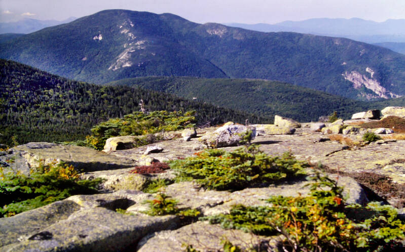
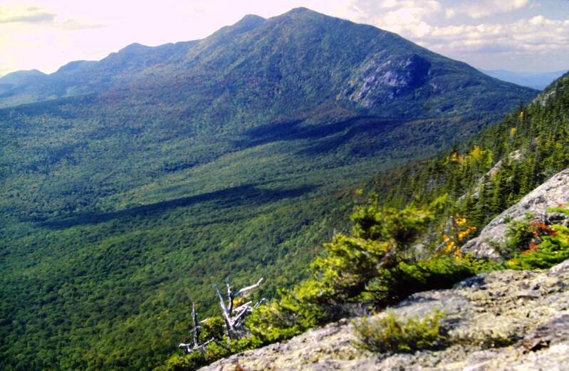
Old Blue Mountain was an instant replay of the ascent of Moody, mirroring it even to the point where I again missed a turning of the path and followed a steep, shallow gully a couple hundred feet up the face of the cliffs. Near the top of Old Blue, the AT leveled off to a steep, but sane, climb over some knobs to the open 3600-foot summit, where there were partially obstructed 360-degree views.
The best vista was looking southward, where Moody Mountain sneered at me across the notch as Baldpate glowered in the distance.
I made much better time over the final three miles to the shelter, but I set no world records. Rain was coming, and the next shelter was almost twelve miles away.
Bringing us to the end of September 16, 1983. Still Chapter 22.
I reglued the flopping sole of my boot that night at the shelter. Within 15 minutes of walking September 17, 1983 morning, the rough, uneven, rain-soaked ground undid the glue job and tore the front several inches of sole completely off my left boot. I had to hike for the remainder of the day without it, which soon wore a hole all of the way through the bottom of the shoe, keeping my toes wet and numb all day, and spelling the end of my second pair of hiking boots on this journey.
Eight miles in, I came out of the woods and onto Maine Highway 17 at 11:30. I decided to hitchhike into Rangeley from that spot, although it was a much longer hitch than from Maine Highway 4, thirteen miles ahead on the Appalachian Trail. My boots were finished and so was I.
In Rangeley, I arranged for the work boots I had bought as a temporary fix after the first hiking boot blowout in Virginia to be mailed to me in Monson. Until then, I would be backpacking in the running shoes I carried to take a break from the hiking boots when I was not backpacking.
I did not shoot on September 17 and 18. Pic below is from the 19th, climbing Saddleback.
After a promising dawn, September 18 had remained cloudy and hazy all day. In spite of a 1:45 late start after hitchhiking all the way back to the AT, I decided not to settle for anything less than the fourteen miles to Piazza Rock Lean-to, even though, as expected, I wound up finishing my hike in darkness. I needed to pick up the pace after days of mostly disappointing hiking. Still Chapter 22.
September 19, 1983. Leaving the shelter that morning at 8:00, I was not up for what I had to do that day, but I needed to make up for lost time. There was a lot of mud along the trail. Rain had fallen briefly and sporadically several times as I was preparing to leave but had stopped by the time I set out. It was again very warm for mid-September in western Maine, on the muggy side, foggy, and quite breezy -- a so-so day.
As I walked a thin, sullen drizzle began to fall. Everything was slick with damp and treacherous; I never could break into an actual stride.
The trail up Saddleback was steep, but with few hazardous sections, for a change. I made the ascent in good shape. A surprise awaited me at tree line: a wind was blowing up there stronger than any I had yet encountered on the Appalachian Trail, with the exception of that one night on Mount Washington.
The trail became very steep at that point. I had to fight my way up against a gale lashing at me from my left. It was cloudy, clammy, and generally miserable -- just the type of weather for which I had been hoping on the greatest expanse of above-tree line walking on the Appalachian Trail in Maine (three miles).
My tee shirt was sweat-soaked from the climb, and the force of that wind against the damp was bone-chilling, despite the relative warmth of the actual temperature.
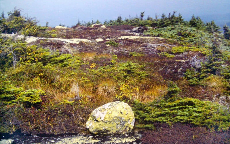
I was compelled to put on my chamois shirt and even a ski cap to protect my left ear, which was continually blasted by the full brunt of that biting wind. It was a day of strange contrasts. Most of the final mile to the summit was a series of gradually ascending terraces. Dark, soggy tundra was interspersed with ledges of naked rock dabbed with lichen. Masses of ground-hugging plants spread out like thick carpets while scrub spruce shivered in the gale above them.
The whole way, I was submerged in wind-blasted cloud which roared past me like a raging ghost river. Although the views were wiped out, it was still rather spectacular. It remained like this over Saddleback's main summit and a peak known as The Horn.
In a high saddle along the ridge line, I caught a brief glimpse of sun. The clouds began to slowly break apart, although the peaks on either side were still cloaked. I finally passed below tree line once more for the first time in three miles as I descended into the sag between The Horn and Saddleback Junior. The sun again broke through the clouds during my descent from The Horn. It stuck around for the remainder of the day.
Still September 19, 1983. Still Chapter 22.
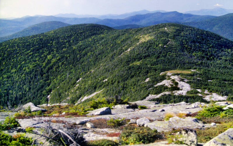
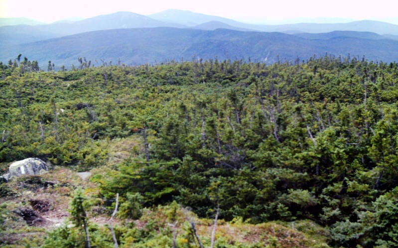
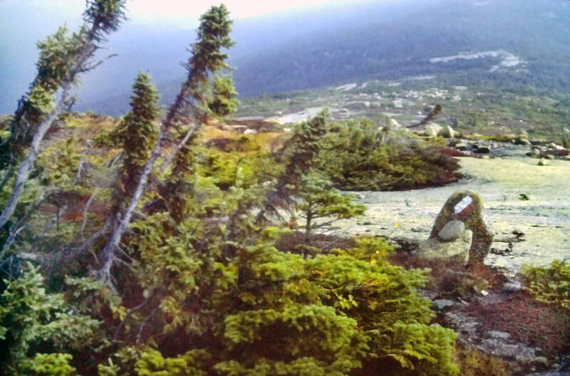
The long sag between The Horn and Junior huddled beneath a dawn forest of spruce and fir thickly underlaid with moss everywhere, huge swathes of clover, and occasional patches of gently swaying ferns. The ascent over inclined ledges was steep and hazardous, as was the descent on the other side, but I enjoyed my first views of the day from the open, rocky summit.
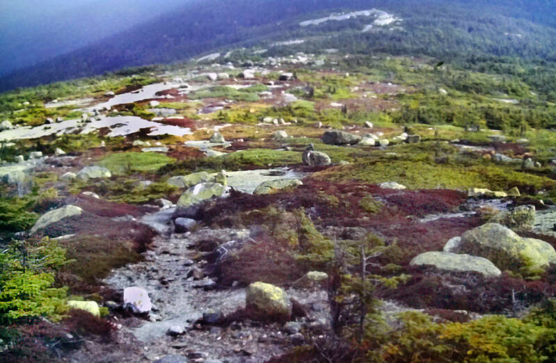
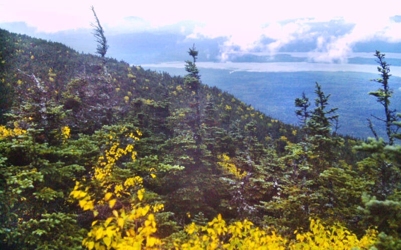
Even the clouds over Saddleback and The Horn had lifted, although the sky remained hazy, and visibility was limited. To the north, I could see all of the rugged peaks ahead on the Appalachian Trail the next: Spaulding, Sugarloaf, and the infamous Crockers.
After 16 miles, I arrived at Spaulding Mountain Lean-to at 6:00, much earlier than I expected considering the major climbs and after my 14-mile sprint the previous afternoon.
The next day, September 20, 1983, I had 13 tough miles to backpack over Spaulding, Sugarloaf, North Crocker and South Crocker Mountains. After that, I needed to hitchhike to Stratton and make the Post Office before closing. I awoke at 6:15 and was on the trail at 7:15.
The initial mile from the shelter was a fairly steep climb covering the remainder of the ridgeline to Spaulding Mountain's summit. I made some good time over it in spite of a tangled footway of rocks and roots.
I sat down for a moment at the junction with the short side trail up to the summit for a snack before going up. Feeling a gentle rustling in my lap (which I had not experienced much recently in my lonely thru-hiker existence), I looked down to find a fat brown mouse snuggling up to me. Gosh, Maine was a friendly state! I named her Judy.
The last official day of summer in western Maine was the warmest day I had encountered in the state. A slowly burning-off haze was in the air, and the thermometer must have climbed well up into the seventies. I know I sweated out a few gallons as the afternoon progressed.
There were some views through the haze along the ridgeline and the three high summits I crossed. I had also intended to take the half-mile, 700-foot rock climb side trail to the summit of Sugarloaf. At a lookout just before the trail junction, I peered out over a world of vague forms barely visible through the steam. The second-highest summit in Maine was supposed to have fantastic views, but I did not feel it would be worth the climb today, particularly when time was of the essence.
Not far beyond the side trail junction, coming around a bend, I found myself virtually face-to-face with a large bull moose standing astride the Appalachian Trail, drinking from a small stream which ran across it. We stared at each other, both stunned, for a few moments before he crashed off through the woods.
When I reached Maine 27, I had hiked the entire rugged thirteen miles with only two short breaks, and I had two hours before the Post Office closed to procure a ride to Stratton. For once I got a ride in 10 minutes. End of September 20, 1983. End of Chapter 22.
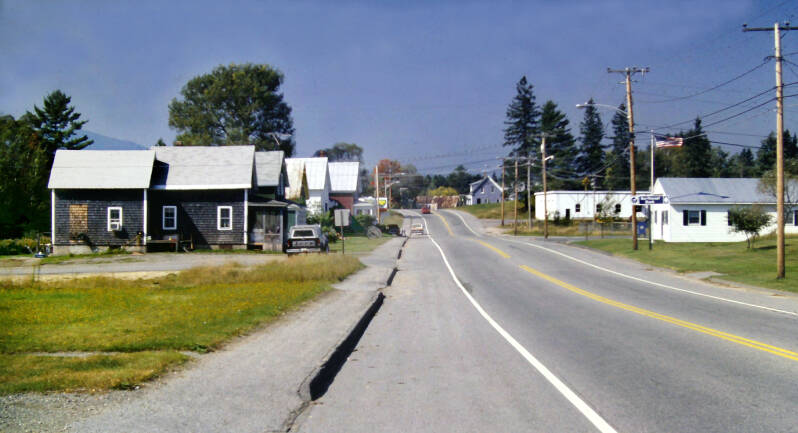
September 21, 1983. Chapter 23. My thumb was out as I walked the outskirts of the village. After ten minutes, I paused to take a picture. In the resulting shot, the only car driving on the road was a small red compact. Coincidentally, that turned out to be my ride.

My benefactors were two attractive young German women. One hopped into the back seat, and I crammed into the front passenger seat with my backpack. We flew down the winding, narrow two-lane highway like it was the autobahn, screaming past big logging trucks on blind curves as they chattered blithely away in German. For some reason, the excellent chance that I was going to perish in a flaming wreck on Maine 27, less than two weeks' hike from Katahdin, struck my trail-warped mind as hysterical, and I could not stop laughing. They seemed to approve of my adventurous attitude.
The initial two miles of the Appalachian Trail crossed a number of low ridges and small streams as it wound through level forests towards the base of the Bigelow Range.
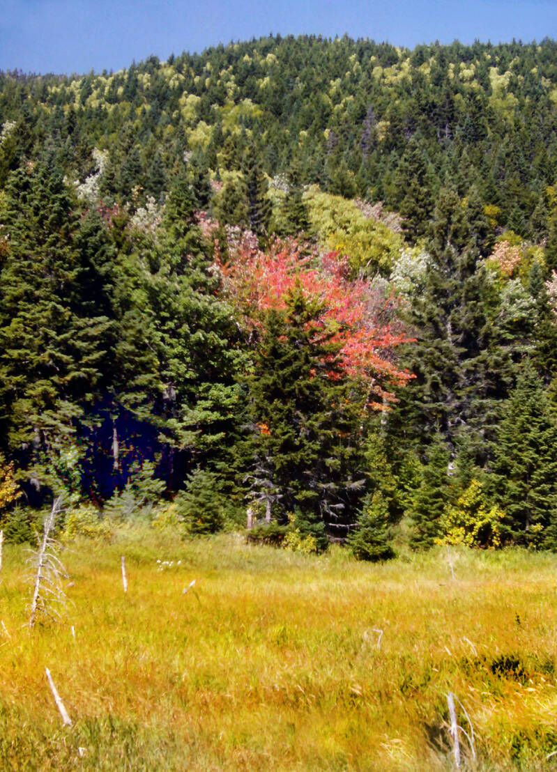
Even at the lower elevations now there were frequent signs that Autumn was here, although fewer than you would expect to see that far north in a normal year.
The next one-and-a-quarter miles followed an old, abandoned logging road up the side of the ridge to a junction with the Bigelow Range Trail. It was a very reasonable climb for Maine, but that was on the old road.
At the junction, the road became the Bigelow Range Trail and the Appalachian Trail turned off, straight uphill. It climbed steeply over huge boulders and tilted rock slabs for a half-mile to the ridgeline and then immediately assaulted a steep knob.
Still September 21, 1983. Still Chapter 23.

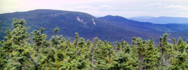
A couple of short side trails led to lookouts. Summer was attempting to linger into autumn. The air was very hazy and humid, and north-south perspectives were a complete white-out. The only real views were those east and west along the ridge itself.
On very clear days Bigelow was reported to provide vistas extending to Katahdin. This was not such a day.
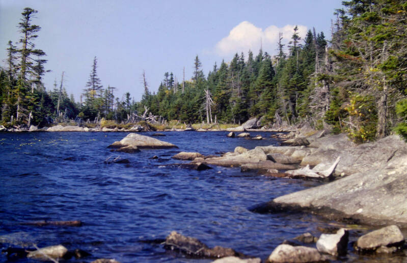
After the first knob, the trail passed over a couple of lesser bumps before descending a very short, very steep ravine to Horns Pond, located high up on the ridge crest. I took a forty-five-minute break at one of a pair of six-man shelters situated on the shore of the pond. I read the register, filled my water bottle at the nearby spring, took some pictures and had lunch.
Still September 21, 1983. Still Chapter 23.
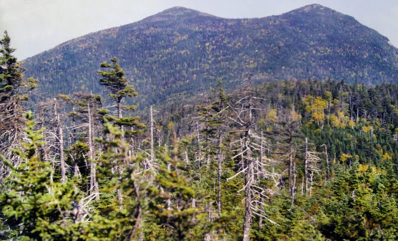
The Appalachian Trail climbed a very steep half-mile to the summit of the South Horn, one of a pair of open, rocky crags rising above the north shore of the pond (not surprisingly, the other is called North Horn). Angry winds were shrieking past South Horn's summit, and the haze was thickening. In the distance, a sullen line of black clouds was moving in fast from the northwestern horizon. Hello. The cold front was coming on like a runaway train.
One intense thunderstorm experienced atop a high ridge crest (Pearis Mountain, Virginia) is plenty for any one lifetime. I put my head down and started cruising along the two miles of ridgeline between South Horn and West Peak, the main summit of Bigelow. I negotiated the narrow, razorback summit ridge through the teeth of howling winds and scrambled recklessly back down below tree line in the narrow pass between West and Avery Peak. On the floor of Bigelow Col, I gratefully reached tonight's shelter. End of September 21, 1983. Still Chapter 23.
The clouds burst late that night. It poured like I had not seen since Virginia. Immense forks of lightning, massive explosions of thunder, roaring winds, and torrents of rain.
September 22, 1983. Morning emerged reluctantly from the murk, leaking a cold, bleak light through the persisting deluge. By 8:30, the rain had tapered off to a fine drizzle. It was chilly and dank as I made my breakfast, but the storm clouds were gradually dissipating. A good, steady breeze was blowing, rapidly drying out the leaves and brush. I did not even need my rain gear when I left the shelter at 10:15.
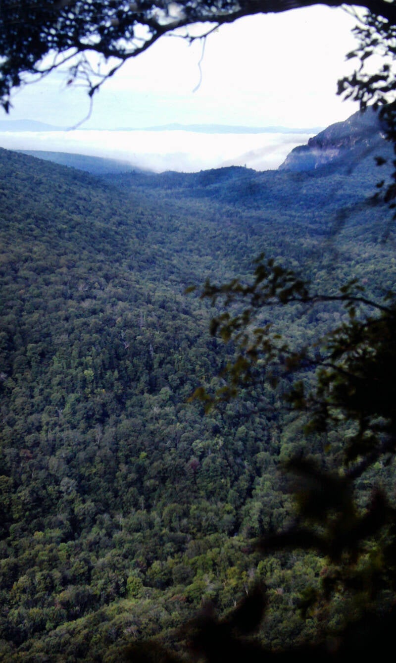
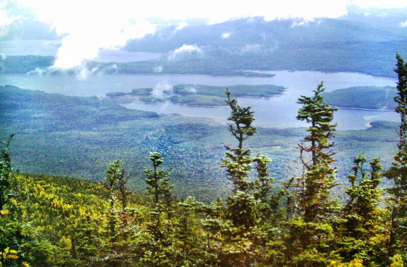
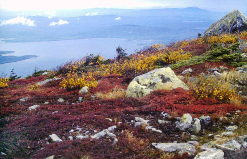
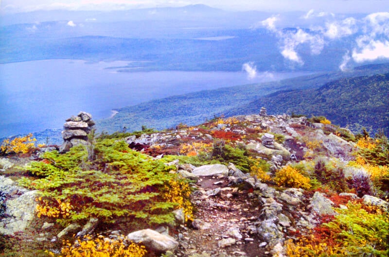
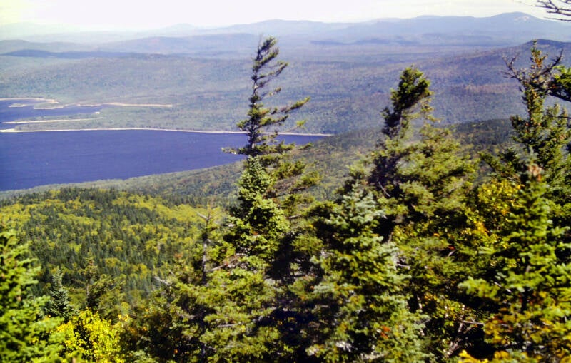
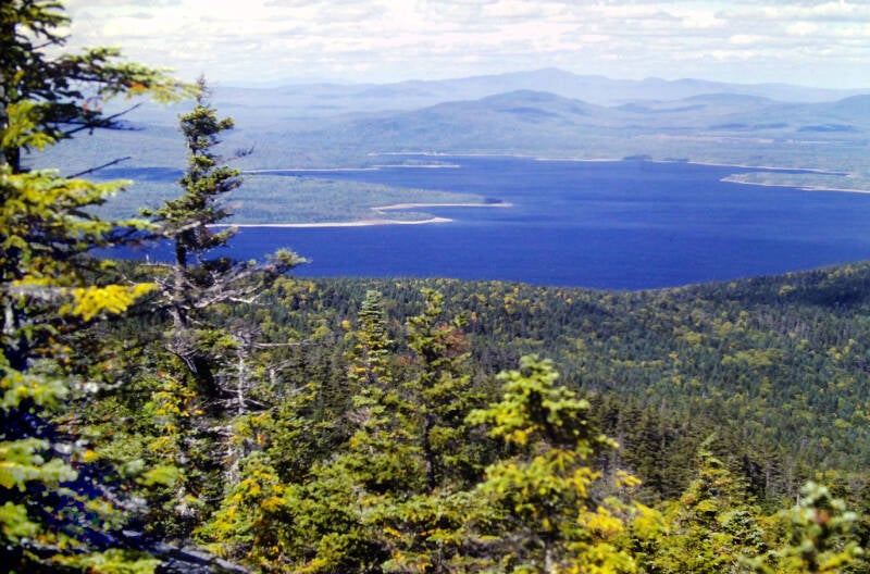
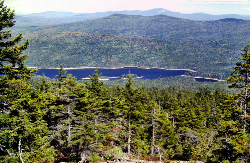
It remained overcast, but the ceiling had lifted well above the mountain. The air was dry and comfortable, and the sun was even trying to burn through the overcast. I did have a breathtaking view of Flagstaff Lake, an enormous, sprawling, eleven-mile-long expanse of water in the valley below.

Avery Peak sported an extensive alpine area on and around the summit and a spectacular panoramic view. Like the West Peak of Bigelow from the previous day, on extremely clear days, Katahdin could be seen in the distance, but today was another missed chance on Mount Bigelow. That was disappointing, but forecasts had called for an all-day rain, so I was not complaining.
There was an old wooden fire tower on Avery Peak's summit, which I understand is no longer standing in 2022, other than that stone foundation.
Those small touches of Autumnn far below were far outpaced by the scrubby alpine vegetation up on Bigelow. The long hot summer of 1983 had seemed endless, even reaching up into central Maine mountains in the last third of September. But change was in the air.
A new trail relocation covered the descent from Bigelow and the climb up Little Bigelow. The footway was deadly after last night's heavy rains. It had not yet become compacted from hiking traffic; pieces kept breaking off and sliding away, taking my feet with them. I took another Maine back flip on the way down. Actually, the relo was a fairly good trail, and should be a pleasure to walk once the ground has settled.
Still September 22, 1983. Still Chapter 23.
The sky was still mostly overcast from a night and early morning of heavy rains. Very dry air had moved in after the rain, causing some breaks in the heavy overcast and dazzling sunlight wherever it broke through. The combination caused some spectacular contrasts. My $200 late 70s Fujica did its best to capture them.
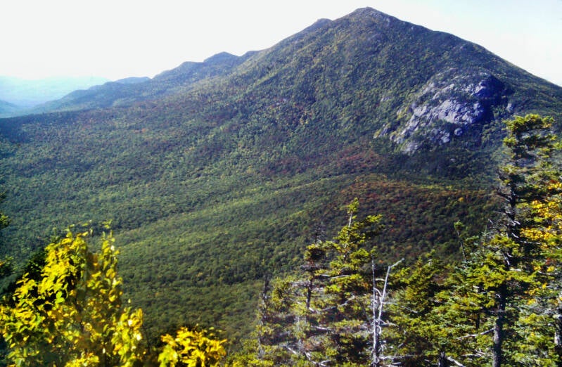
Looking ahead to Little Bigelow on the way down from Avery Peak.
In the sag between Bigelow and Little Bigelow, I passed the Safford Brook Trail, which had once been part of the Appalachian Trail. In the 1930's and 40's, the AT had passed through a farming valley along the banks of the Dead River, past the villages of Flagstaff and Dead River.
The Safford Brook Trail now dead ends less than two miles from its junction with the present Appalachian Trail at the shore of Flagstaff Lake. This enormous man-made body of water is a storage lake for the hydroelectric dam built by a Maine power company in 1949. Elements of AT history now lie slumbering beneath the long, rippling swells.
The AT reached the ridgeline of Little Bigelow Mountain and traversed a series of rocky knobs, several of which had open ledges. The sun had finally broken through, and the day had turned clear and beautiful. The haze was gone from the air, replaced by a crisp hint of chill. An arc of mountains stretching from Bigelow to Saddleback coiled behind me.
Still September 22, 1983. Still Chapter 23.
Ahead and to my right and left unfolded miles of relatively flat lake country.
A different kind of pretty countryside lay ahead on the Appalachian Trail, a change of pace from the mountain landscapes. A chance to pick up the pace after the rugged peaks and arduous trails of southwest Maine.
But before that I had one last great mountain to traverse. It had turned into a perfect autumn day, and there were constant viewpoints along the crest of Little Bigelow.
Just below 3000 feet at its summit, Little Bigelow was much smaller than the lofty peaks of the preceding few days. But it still had fantastic views.
Time and again I was able to in a single view see all the magnificent mountains I had climbed today and over the previous three days. And think back to the impressive variety of weather conditions they had delivered.
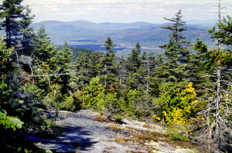
There were also constantly evolving views of the lowlands ahead, with enormous lakes reflecting the autumn sky and lots of relatively flat country and much lower ridges.
Still September 22, 1983. Still Chapter 23.

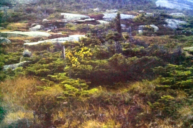
In addition to the nice views, the ridge crest of Little Bigelow was interesting in itself. Lots of fascinating rock formations and trees built to withstand the wind and cold.
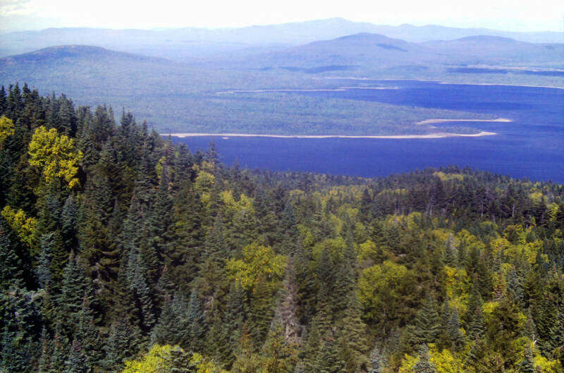
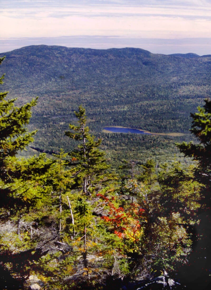
Another view of Flagstaff Lake. The summit of Little Bigelow had been almost three thousand feet. As I walked along, the ridge gradually diminished, its crest reaching towards the low country.

Eventually this long, narrow finger of Flagstaff Lake began to dominate the view ahead as I descended towards it.
Still September 22, 1983. Still Chapter 23.
There had been a lot of autumn color in the scrubby alpine vegetation up on Bigelow. There were touches of color along the ridgeline of Little Bigelow. In the valleys and along the lower ridges below there was almost nothing. The long, hot summer of 1983 was just not letting go. It was late September, and I was deep into northern New England.
The section of trail coming down off of Little Bigelow was as hazardous as any on the entire Appalachian Trail -- a tortuous climb down huge boulders in a steep ravine.
Still September 22, 1983. Still Chapter 23.
Long drops isolated each rock from the next, and the stream cascading over them was swollen from last night's rain, often obliterating the path.
Negotiating this mess took a great deal of slow, painstaking effort. For once, I actually had to keep my mind on the trail, or else. Nevertheless, it took me more than a half-hour to safely cover that deadly quarter mile.
After that, it was smooth sailing. I came to the beginning of the lowlands through which I will be traveling all of the way to Monson.
Still September 22, 1983. Still Chapter 23.
On flat ground covered with wild profusions of moss and ferns and broken by the muddy brown channels of sluggish streams, the trail traveled through the dark beauty of a hemlock forest. There was plenty of deep mud and slime through which to slog, and skirt around when I could, but at least it was walking trail rather than a crawl down mossy, dripping sheer rock faces.
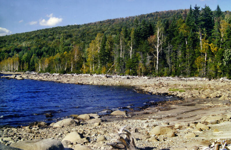
I came to one very memorable spot. The Appalachian Trail brushed the tip of a long arm of Flagstaff Lake at a lonely gravel shore strewn with piles of bleached white driftwood resembling heaps of old bones.
Facing the lake, the drowned outlet of Bog Brook was a long, narrow finger of the bay to my left. Beyond that lay two small coves with Little Bigelow rising above them, lingering wisps of cloud clinging to its ravines.
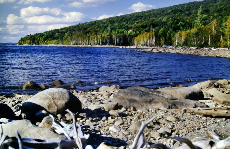
Ahead of me, a long way off, two wooded, rock-tipped peninsulas formed the mouth of my secluded bay. In the distance, a low, dome-shaped mountain rose above the far shore of the lake with small, low clouds scudding across its summit. It was a scene immense in scope, yet intimate in its solitude. A fresh breeze was blowing, sending choppy waves breaking upon the rocks at the shoreline.

I arrived at Jerome Brook Lean-to at 5:15: a 1938-vintage shelter less than a tenth mile beyond the Appalachian Trail crossing of Long Falls Dam Road, a lonesome stretch of pavement along which the nearest village was twenty miles away.
I woke up in the middle of the night to find myself in the sedate stare of a wild white rabbit sitting a few feet away, untroubled by the presence of a human. "What's up, Doc?" A fitting conclusion to September 22, 1983. Still Chapter 23.
I'm still not done. More AT pics here.