My 1983 Appalachian Trail Hike in Photos
I wrote a ton in words in my journal as I hiked the Appalachian Trail. I also shot a ton of Kodachrome slides in that pre-digital age. I've scanned all my old AT slides and posted them with short text blurbs connecting them to their parts of the story. I'd never tried to connect all these slides with all these words before. It helped me remember details of that long-ago hike in new ways. These pages are a chronological visual journal of the hike. Probably one of the oldest thru-hikes on the Internet to get one.
Pics from my 1983 Appalachian Trail hike. Table of Contents is here.
Amicalola Falls State Park, GA - Start of Nantahala Range, NC
Begin at the beginning. At 4:20 p.m. on the afternoon of May 2, 1983 -- a very warm day for early May -- I was at the Visitor's Center in Amicalola Falls State Park in north-central Georgia. I strapped on my heavy backpack and started wheezing my way up the first rugged mile of the Amicalola Falls feeder trail. An early stretch climbed steeply up this dirt fire road with some nice views.
From the Prologue of my story.
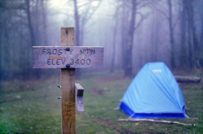
May 3, 1983. Not yet on the AT. A foggy morning on the summit of Frosty Mountain, Georgia, where I spent my first night on the trail, about five miles into the 8.7-mile feeder trail that led to the actual southern terminus of the AT.
Chapter 1 of my story.
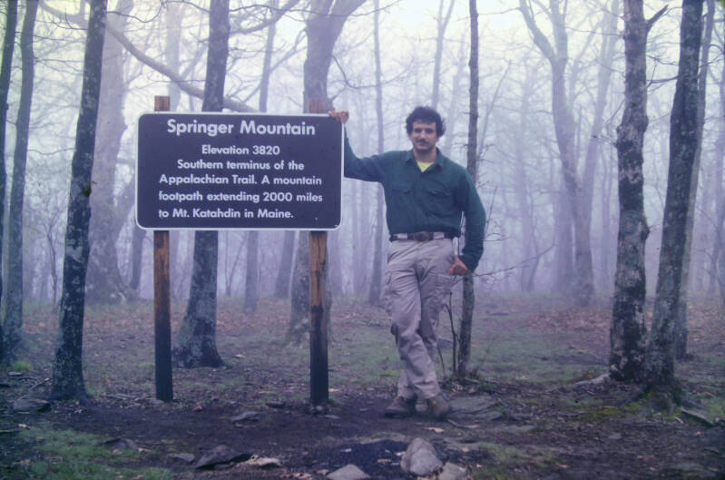
Just before noon on May 3, 1983. Summit of Springer Mountain, Georgia. Wearing a pair of new hiking boots and carrying a bunch of extra pounds, neither of which made it past central Virginia. Chapter 1, of course.
May 3, 1983. My first day was emblematic of much of my first month on the Appalachian Trail in which it rained a lot. A chill drizzle began to fall not long after I had left Frosty Mountain's summit. It hung on strong as I crossed the summit of Springer Mountain and began the official AT hike. Rain and drizzle stuck around all day, occasionally intensifying into major downpours.
This led me to a few surreal watery visions, none of which I was able to capture on film because waterproof cameras in 1983 were only for extremely well-funded individuals, not for the guy pictured above.


On May 4 I only hiked nine miles and shot no photos. The terrain was heavily wooded with no real views, although there were some steep climbs. In Georgia, I hadn't yet started writing the long journal entries that formed the basis for my book and I didn't shoot a lot of pictures. I wish now I did more of both then. May 5, 1983 was an exception as far as pics.
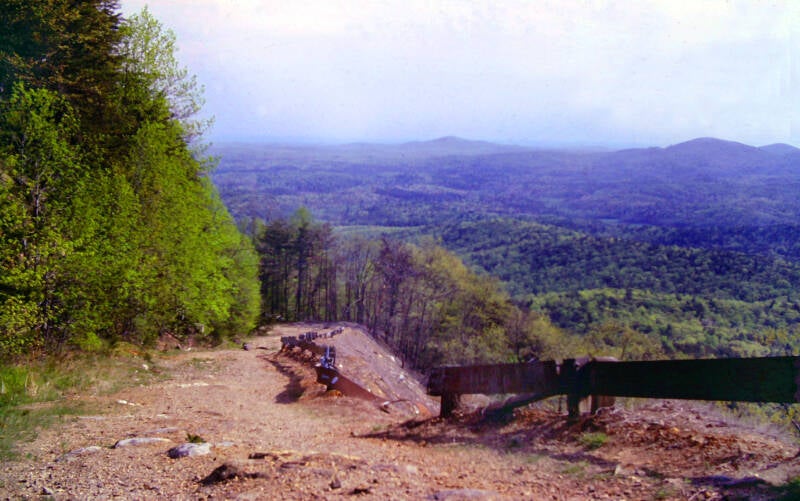
There was a pretty nice view along the way from Ramrock Mountain's ridge crest.
It was still early Spring at those elevations in Georgia, so there was not a lot of foliage to block the views. A bit farther down the mountainsides bright green leaves were just beginning to sprout on some of the trees.
Still Chapter 1.


Along the ridge of Big Cedar Mountain.
There was plenty of green in the valley below, but trees were just beginning to bud up here.
Still May 5, 1983.
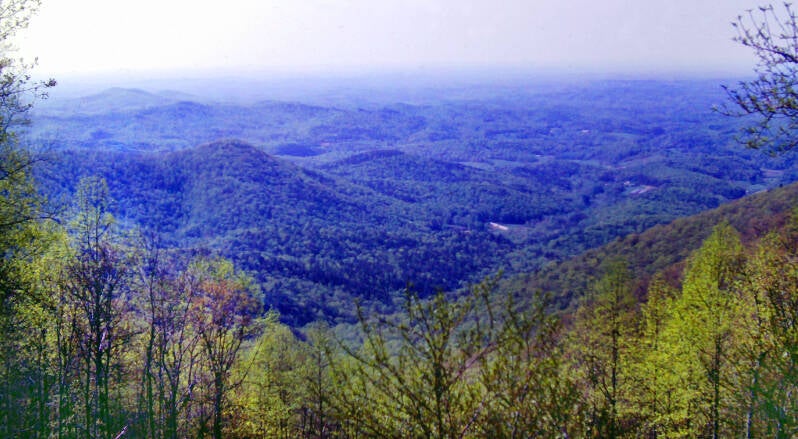
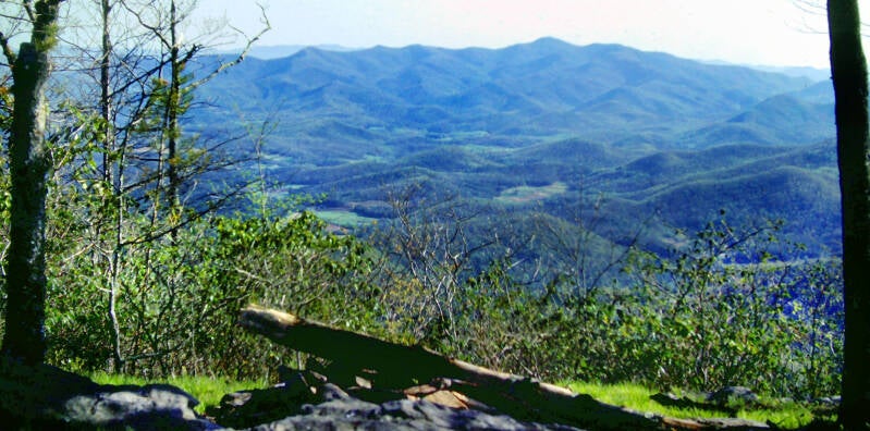
There were some excellent vistas from the summit of Big Cedar Mountain.
Still Chapter 1.
I took in the best views thus far along the Appalachian Trail in Georgia and started the descent.
After seven miles of ups and downs, including those traverses of Ramrock Mountain and Big Cedar Mountain, I hit a stretch of continuous climbing for the next six miles.
Still Chapter 1. Still May 5, 1983.
It was a comparatively gentle climb for the most part, but I had a long way to go before my body was truly ready for this adventure. The day was sunny and hot, and I ran out of water about halfway through the climb.
The heavy backpack I was carrying, and the extra pounds of my overweight body had taken their toll on the soles of my feet, which felt torn and bleeding by the time I reached the end of that climb on the open summit of Blood Mountain. The new best views thus far on the trail in Georgia picked up my spirits a bit.
Still May 5, 1983, and Chapter 1.
At 4,458 feet in elevation, Blood Mountain is the highest peak on the Appalachian Trail in Georgia, making it of course the highest peak thus far of my hike.

I wanted to stop for the night at the stone shelter on top of Blood Mountain, but I was extremely dehydrated and there was no water up there. I was left with no choice but to push on.
In Neels Gap, two miles from the summit of Blood Mountain, a place called the Walasiyi Inn offered limited groceries and lodging in 1983. Only the vision of a cold coke and a hot shower carried my body limping down that final descent to the Inn. Still May 5, 1983, and Chapter 1.
May 6, 1983 was another exceptional picture-taking day for me in Georgia.
I traversed another group of scenic ridges with equally picturesque names: Corbin Horse Stamp, Wolf Laurel Top and Cowrock Mountain.

The ridge crest and summits of Corbin Horse Stamp and Wolf Laurel Top were rather wooded, but the lack of foliage at the higher elevations and some nearby cliffs brought my camera out.
Still May 5, 1983. Still Chapter 1.
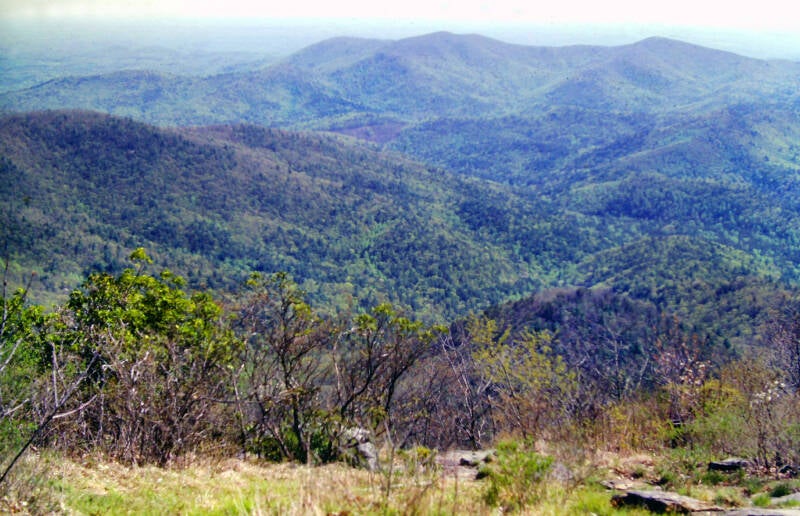
Cowrock Mountain was the star of the show on May 6, with many views from the open, rocky areas around the summit.

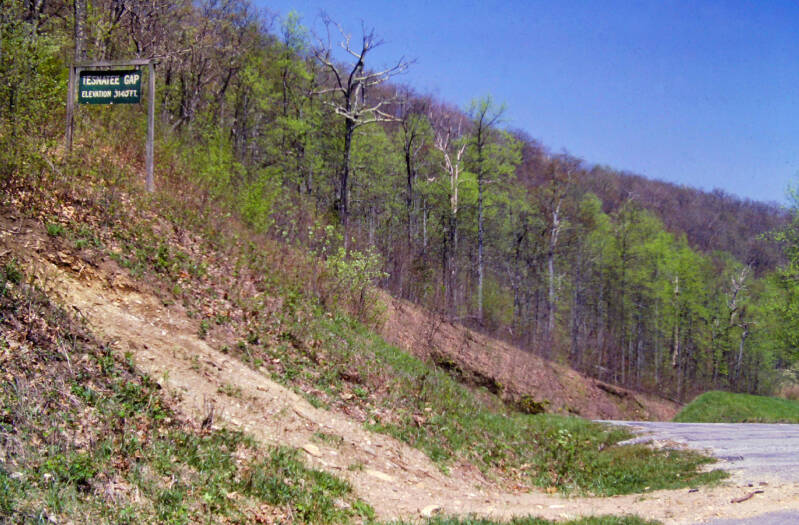
After Cowrock, the day went downhill. My friend Dave and I, who had been more or less hiking together since my second night on the AT, had been told there was water ahead at Whitley Gap Shelter. When Dave and I reached Tesnatee Gap after hiking those first six miles, I double-checked the guidebook and discovered that both water and shelter were on a side trail involving a three-mile round trip off the AT.
A U.S. Forest Service sign on the floor of Tesnatee Gap informed us that water was available on a trail down the side of the ridge. Dave and I elected to go for that. The sign said it was 2/10-of-a-mile. The sign lied. We had crawl and slide down an extremely steep slope for about a half-mile before we found the spring: a slow, muddy, shallow trickle. I was only able to coax about a pint of dirty water into my bottle, and then faced a daunting climb back up.
Still May 6, 1983. Still Chapter 1.

On the night of May 6, 1983, my fourth night on the Appalachian Trail, I attempted to hang my fifty-pound backpack from a nail in a shelter to keep it and my food away from some ravaging mice: "The nail spun around just as I let go of my pack, sending the whole thing crashing down several feet onto the little toe of my shoeless right foot. Blood instantly began gushing out and I knew right away I was screwed. It was very dark, and I was very tired, so I merely wrapped the toe up with gauze, hung my pack on another nail, and left the wound to be attended to in the morning. ...In the morning, I cleaned the toe with an alcohol prep pad, treated the wound with antibacterial ointment, and wrapped it in a Band-Aid and adhesive tape. About a square half-inch of flesh was missing from the toe, cut almost down to the bone. Every step I took today in those leather hiking boots was another adventure in pain."
Backpacking miles every day in 80s era hard leather hiking boots kept the wound open and throbbing. The pic on the right was from approximately two weeks later. By this time, I had also lost the nail from that toe. As you can probably tell from their color, I was incidentally on the way to eventually losing the other four toenails from this foot (and most of the nails on my left foot.)
I was reconciled to living with this open wound for the entire five months, but by June 3: "Another hard callus has formed directly over that scab on my little toe, and the wound that could never possibly heal while I was hiking is somehow beginning to heal beneath it. I no longer need to swathe it in Band-Aids and adhesive tape." - excerpt from Chapter 6.
On the morning of May 7, I rode those adventures in pain thirteen miles to a campsite high on a ridge well up the slopes of Tray Mountain. I was trying to hike fifteen miles that day, but it wasn't happening.
Those additional two miles of my planned hike would have brought me to a shelter, with walls and a roof I wouldn't need to pack up and take with me the next morning. Instead, I pitched my tent in a campsite located on the site where an old "cheese factory" once stood high up Tray Mountain.

Although it was a beautiful day, and Tray Mountain had fine views, the night brought change.
Awakening in my tent just after midnight, I instantly felt a vague sense of uneasiness rippling through the dark forest. Outside, the air seemed leaden and dead. The evening breeze had died, and the gorgeous starry canopy beneath which I had gone to bed had faded to dark grays and black. Standing in the murky stillness on Tray Mountain, I turned to the west and watched as the distant sky was briefly lit by a flash of lightning many, many miles away, beyond that horizon. Dead silence. A somewhat eerie beauty, with ominous undercurrents. It appeared that I had picked a bad night to pitch a tent.
My two Tray Mountain pics from May 7 were my last in Georgia. I awoke to a deluge of biblical proportions in the morning on May 8, 1983. There is nothing like trying to pack up everything you own in a downpour. My sleeping bag was soaked, my tent was hopeless; everything was drenched. Adding insult to injury, the rain came to a dead stop about five minutes after I had finished, although it returned a few times as the day went on.
I managed to drag my wet gear and mangled toe another thirteen miles and pitched my tent in the woods just past Dicks Creek Gap, less than nine miles from the North Carolina border. May 8 would be my last night in Georgia on this hike.
May 9, 1983. I awoke that morning at first light. The temperature had dropped to near freezing and the breeze had died. A heavy, gelid mist hung suspended in the still, frosty air.
It turned into a gorgeous afternoon: warm breezes and gauzy fair-weather clouds streaking across a soft blue sky.
Dave and I had lunch in Bly Gap, just across the state line into North Carolina. One state down and eleven to go.

A large meadow ran down the side of the ridge from the crest at Bly Gap, with an excellent view of the valley far below. I just lay in the sunshine and enjoyed it for a while. My shoes, socks, tent, sleeping bag, and towel were all spread out on the grass next to me, finally beginning to dry out from all of that rain. Soon enough, Dave and I would go to find the water that the guidebook told us is located here, and tank up for the afternoon portion of the day's adventure.
There was no water to be found in Bly Gap, and Dave and I were counting on it. One of the two springs mentioned in the guidebook was dry, and we could not find the other one. The guidebook's directions to this second spring were fairly vague. We gave up after wandering for more than a half-hour on unmarked herd paths.
On leaving Bly Gap, we were compelled to make the steep, one mile climb up Courthouse Bald beneath a blazing sun with absolutely no water on a muggy, subtropical afternoon.
One last look at Bly Gap. May 9, 1983. Still early Spring up there. Lots of budding trees.
My body was still "water soft" and vulnerable. By mid-June I would be walking much greater distances on hotter days with significantly less water. But those days lay down the road. We hiked twelve miles May 9, with only three of them coming after our lunch break at Bly Gap.

I felt unbelievably run-down and sore when I awoke May 10. One of the large blisters between my toes now had a smaller blister growing directly out of it, and that smaller blister had an even smaller blister growing up out of it. The deep wound on my little toe was becoming severely infected. I was one sorry specimen. I could not imagine how I could go on even one more day.
Five minutes after beginning my hike, it was obvious that this was finally going to be my breakthrough hike. For some reason, after I started moving, I felt wonderful. All of the injuries still hurt like hell but did not seem to matter. I could feel the reserves full of power. The air was cool and fresh; the scenery was an attractive mixture of rhododendron thickets, ferns, moss, and leafy woods. The trail sides were covered with legions of tiny, brilliant blue flowers called bluets which have brightened the Appalachian Trail from the start back in Georgia.
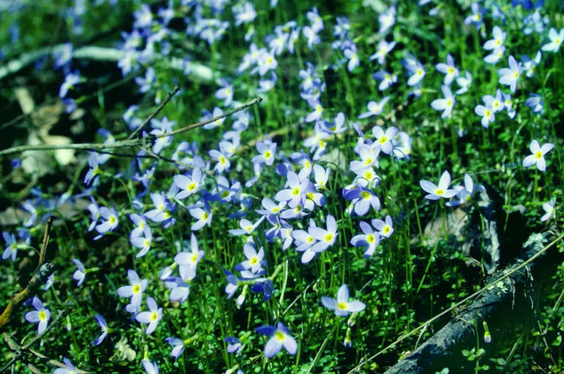

Deep blue sky above, thick carpet of bluets below. Bluets are an early Spring flower. In places where they were blooming like this, the trees were still waking up from winter. This far south and this far along into May, lots of bluets indicated higher elevations.
May 10, 1983. Chapter 1.
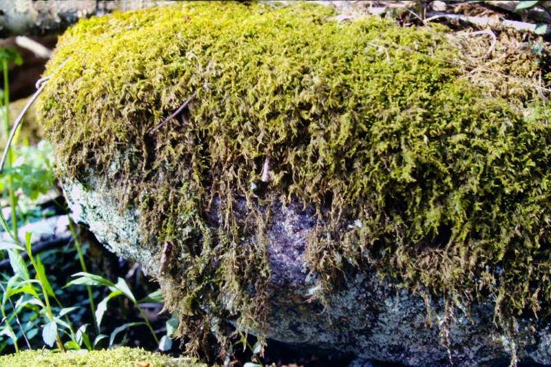
These were among the mossiest woods I've ever seen. In many places every rock and fallen branch sported a thick, green carpet.

The trail was a piece of cake, well laid out and excellently graded. The forests were varied and attractive. The trail up to the top of Standing Indian was so well graded that I was able to cover the entire two-mile climb in less than an hour, without stopping for breaks.
Still May 10, 1983. Chapter 1.
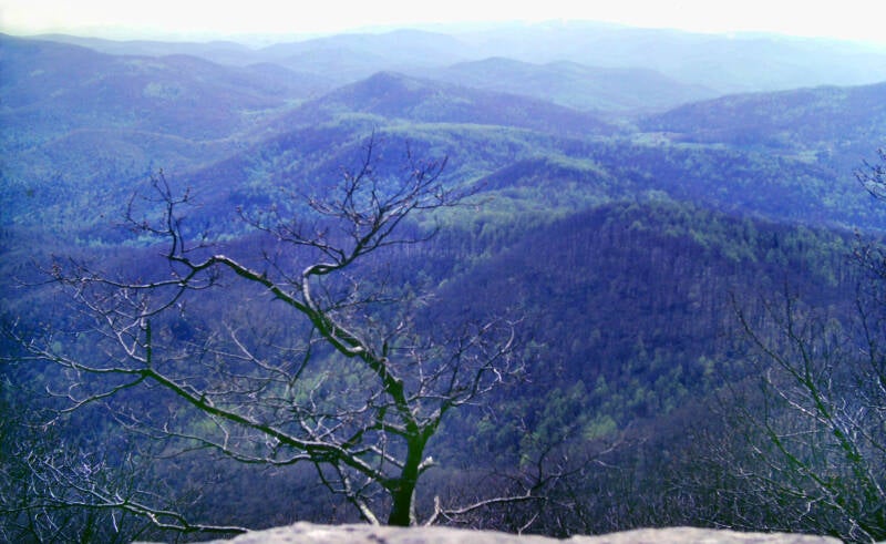
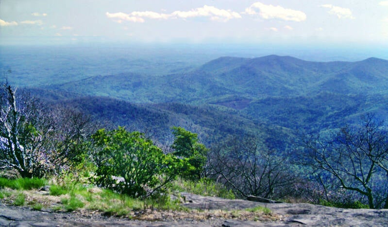
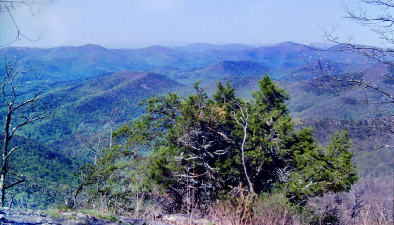
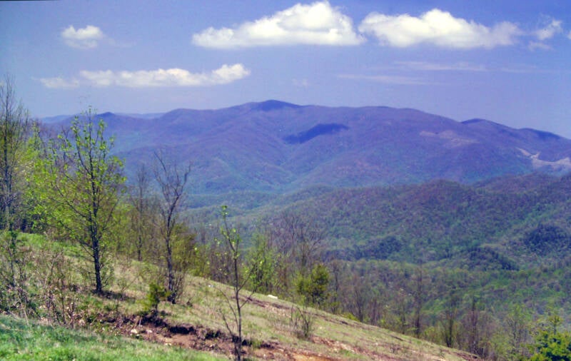
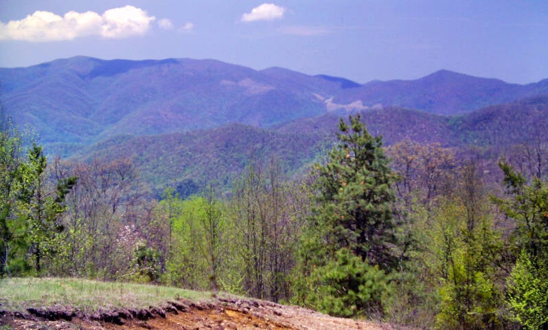
More than 5500 feet in height, Standing Indian is by far the highest summit yet for a northbound Appalachian Trail hiker. There would be no higher summits ahead until the Great Smoky Mountains.

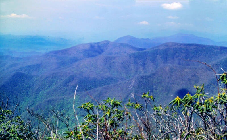
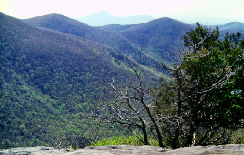
The summit was partially open, with a 360-degree view -- the best yet on the trail. Standing Indian was known as the "Grandstand of the Southern Appalachians" because of its central location in that intricate maze of mountain ranges.
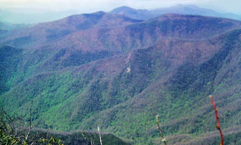
You could still see the traces of the old fire tower that was removed in the 1950s. Rhododendron, saplings and other vegetation were growing up around the edges of the clearing. This raised an interesting question to which I don't have the answer. What was preventing the summit from being overgrown almost 3 decades later?

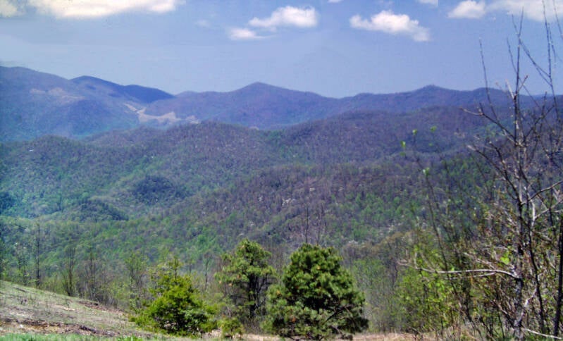
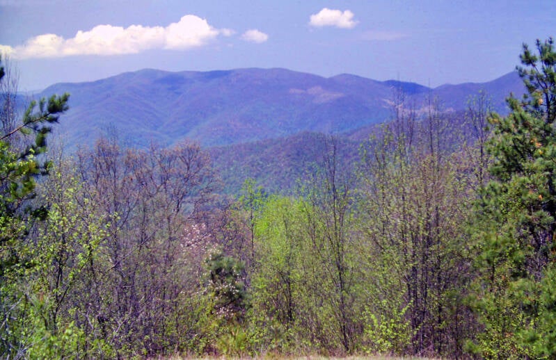
Towering heights carved by green valleys stretched as far as the eye could see in every direction.
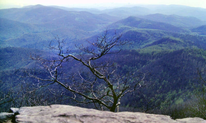
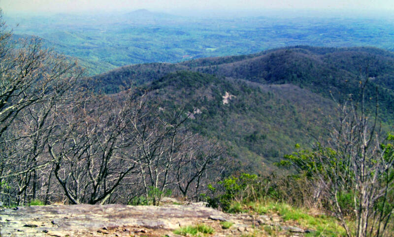
Still May 10, 1983, still Chapter 1.
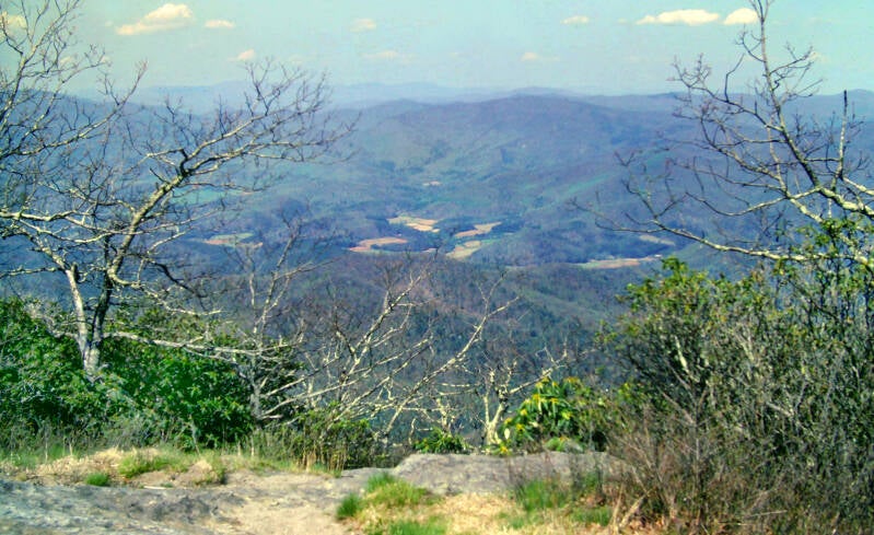
There were still plenty of views to be had above the trees in 1983. I hear there are far fewer views now, especially in summer, which brings me back to my earlier question. I wonder what changed between 1983 and now that hadn't changed in the preceding 3 decades?

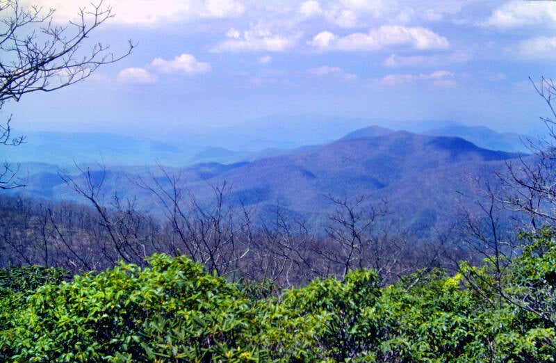
On a long hike like this one, you don't always get the perfect day for a great mountain. On May 10, 1983, I did.
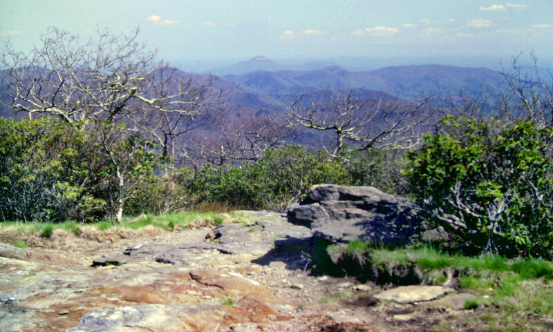
I have been told that the summit of Standing Indian is now completely wooded and has been for a while. A good reminder that 40+ years is a long time.
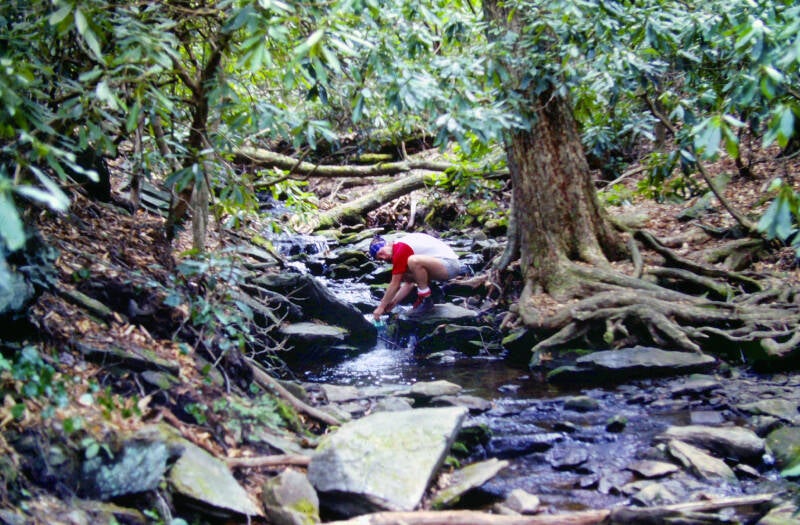
The next portion of the hike was every bit as scenic as the morning's had been. It was mostly sidehill trail, well down from the ridge crest. The Appalachian Trail journeyed through a landscape of twisted masses of rhododendron jungles breached by small, rocky streams bordered by profusions of growth, even wilder and more densely entangled. My friend Dave fills his water bottle as we cross a mountain stream beneath a dense rhododendron forest. Still May 10.
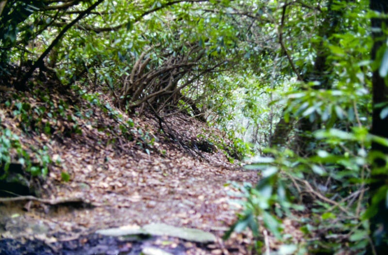
At times, the trail was a tunnel, completely encircled by rhododendron, their thickly interwoven branches forming walls and a roof. These rhododendron jungles were also quite common in the Nantahala Range ahead.
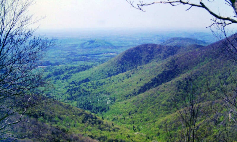
In Carter Gap, the Appalachian Trail left the Blue Ridge, which it had been following from the beginning of the hike, and swung around the bases of a couple of mountains to the beginning of the Nantahalas, an east-west cross range which it would follow westward towards the Great Smoky Mountains.
I'm not done. More AT pics here.